Table of Contents
- 1. Overview
- 2. Geography of Hiking in Rwanda
- 3. History and Culture: The Land of a Thousand Hills
- 4. Gorilla Trekking in Rwanda
- 5. Best Time for Hiking Rwanda
- 6. Best Trails for Hiking in Rwanda
- 7. Food and Drink in Rwanda
- 8. Accommodation for Hiking in Rwanda
- 9. Planning and Logistics
- 10. Frequently Asked Questions About Hiking in Rwanda
Overview
Hiking Rwanda is not what most people picture when they think of Africa. There are no flat plains here, no wide-open savannah, no horizon stretching to infinity. Rwanda is a country of ridges, valleys, and volcano peaks pushing through rainforest and cloud, and the experience of hiking in Rwanda is inseparable from this vertical landscape. It is also the only place on Earth where you can trek on foot through forest and end the morning sitting a few metres from a mountain gorilla family going about its day.
The country's trail network divides across three distinct hiking environments. In the northwest, Volcanoes National Park protects five of the Virunga chain's volcanoes and the majority of the world's remaining mountain gorillas. The trails here climb from bamboo forest through giant hagenia trees and subalpine meadows to crater lakes and summit ridges with views into three countries. In the southwest, Nyungwe Forest National Park preserves the largest high-altitude montane rainforest in central Africa, with over 130 km (81 mi) of trails, 13 primate species, and a canopy walkway suspended 70 m (230 ft) above the forest floor. In the east, Akagera National Park offers an entirely different landscape: savannah, wetland, and lake-edge walking in the only Big Five reserve in Rwanda.
Gorilla trekking is the centrepiece of hiking Rwanda for most visitors, and rightly so. Permits cost $1,500 per person as of 2026, issued by the Rwanda Development Board, and are limited to eight visitors per gorilla family per day. This is not a cheap experience, but the combination of the physical trek through mountain forest and the hour spent with one of the 12 habituated families in Volcanoes National Park is unlike any other hike on the planet. The gorilla population in the Virunga massif currently stands at approximately 604 individuals, and it is growing, the result of decades of conservation work that began with Dian Fossey in 1967 and continues under the Rwandan government and international NGO partnerships today.
Rwanda is also one of Africa's most logistically accessible hiking destinations. Kigali International Airport connects to major European hubs, and Volcanoes National Park is a 2.5-hour drive from the city. Nyungwe is five to six hours by road. No long internal flights, no multi-day overland transfers, and no visa complications for most nationalities: Rwanda operates an e-visa system that processes applications within 72 hours. The infrastructure for hiking tourism here is organised, well-maintained, and increasingly well-staffed.
This guide covers the geography, history, gorilla trekking system, trail network, food culture, accommodation, and logistics for hiking in Rwanda, with the information needed to plan a first or return trip from scratch.
DREAMING OF HIKING RWANDA?
Explore our amazing hiking tours in Rwanda now !
Geography of Hiking in Rwanda
Rwanda is one of Africa's smallest countries, roughly 26,338 sq km (10,169 sq mi), approximately the size of Wales or the state of Maryland. It is also, by some measures, the most densely populated country on the African continent. Yet within that small area it contains an extraordinary concentration of biological diversity, volcanic terrain, and high-altitude forest, all of it shaped by its position on the Albertine Rift, the western arm of the East African Rift System.
The country's topography is defined by its elevation. Rwanda sits on a high plateau averaging 1,500 m (4,921 ft) above sea level, with the Virunga volcanoes in the northwest rising significantly higher. The Congo-Nile divide, the long ridge running north to south through the western third of the country, separates rivers draining west into the Congo basin from those draining east into the Nile system. This ridge is one of the great hydrological and ecological boundaries in Africa. Nyungwe Forest, which straddles the divide, is the source of the Nile's most distant headwater stream. Hiking the Congo Nile trail through Nyungwe is, in a literal sense, walking the watershed of two of the world's great river systems.
The Virunga mountains in the northwest form the most dramatic hiking landscape in the country. The eight volcanoes of the Virunga chain, five of which fall within Rwanda's Volcanoes National Park, include Mount Karisimbi at 4,507 m (14,787 ft), Rwanda's highest point and the tallest peak in the Virunga range. Mount Bisoke at 3,711 m (12,175 ft) is the most frequently climbed, with a summit crater lake; Mount Sabyinyo at 3,634 m (11,922 ft) marks the triple border of Rwanda, Uganda, and the Democratic Republic of Congo. These are dormant volcanoes; the geologically active members of the Virunga chain, Nyiragongo and Nyamuragira, lie across the border in the DRC. The geology here is young and rich: the volcanic soils support exceptional biodiversity at every elevation.
Vegetation zones in Volcanoes National Park change with altitude in a pattern that is at once predictable and dramatic. Between 1,800 m and 2,500 m (5,906 and 8,202 ft), mixed forest and open grassland dominate the lower slopes. The bamboo zone occupies the band between approximately 2,500 m and 2,800 m (8,202 and 9,186 ft), and this is where mountain gorillas spend much of their time, feeding on bamboo shoots in season. Above the bamboo, hagenia-hypericum woodland takes over, a landscape of gnarled, moss-draped trees with an understorey of flowering herbs and ferns. Above 3,600 m (11,811 ft), the vegetation opens into afroalpine moorland with giant lobelias, dendrosenecio, and helichrysum dominating the high ridges all the way to the summit zones.
In the southwest, Nyungwe Forest National Park covers 1,020 sq km (394 sq mi) and is the largest block of high-altitude montane rainforest in East and Central Africa. It sits at elevations between 1,600 m and 2,950 m (5,249 and 9,678 ft), with the highest point at Bigugu Peak, 2,950 m (9,678 ft). The forest is ancient, and the biodiversity figures reflect this: over 1,000 plant species, 300 bird species (29 endemic to the Albertine Rift), 13 primate species, and more than 85 mammal species. Nyungwe provides an estimated 70% of Rwanda's freshwater. The hiking trails here move through dense, green, humid forest, almost always within earshot of birdsong and primate calls.
History and Culture: The Land of a Thousand Hills
Rwanda's earliest inhabitants were the Twa, a forest-dwelling people whose ancestors have occupied the central African rainforest for tens of thousands of years. The Twa, today less than 1% of the population, were the original hunters and gatherers of the forests that now form Nyungwe National Park. Their displacement from Nyungwe following the park's establishment in 2004 remains a contested and painful chapter in Rwanda's conservation history, and advocacy groups continue to work on land rights and community integration on their behalf.
By the 11th century, Bantu-speaking Hutu farming communities were established across the hills, and by the 15th century, a Tutsi royal dynasty had consolidated power across the region into a unified Kingdom of Rwanda. The mwami, or king, held authority over both Hutu farmers and the cattle-owning Tutsi aristocracy in a tiered but fluid social structure. Ethnicity was not the rigid biological category it would later be made to appear: movement between social groups was possible, intermarriage was common, and all groups shared the same language, Kinyarwanda, the same religious traditions, and the same cultural practices.
Colonial rule sharpened and hardened these distinctions in ways that would have catastrophic consequences. Germany colonised Rwanda in 1897, incorporating it into German East Africa, and Belgium took control after World War I. Both colonial powers applied a policy of indirect rule that explicitly favoured the Tutsi minority, distributing ID cards that classified every Rwandan by ethnicity and cementing what had been a flexible social hierarchy into a fixed racial taxonomy. The Belgians codified a theory, now thoroughly discredited, that the Tutsi were racially distinct from and superior to the Hutu, a fabrication that was used to justify their preferential treatment. The consequences of this colonial project took 50 years to fully manifest.
In 1959, a Hutu uprising toppled the Tutsi monarchy and triggered a series of massacres and mass displacements. Rwanda gained independence from Belgium in 1962 as a Hutu-led republic. The decades that followed were marked by periodic anti-Tutsi violence and the exile of hundreds of thousands of Tutsis to neighbouring Uganda, Burundi, and Congo. In 1990, exiled Tutsi fighters organised as the Rwandan Patriotic Front (RPF) invaded from Uganda, beginning a civil war. A peace process collapsed in April 1994 when President Habyarimana's plane was shot down over Kigali. In the 100 days that followed, between 500,000 and 800,000 people, overwhelmingly Tutsi civilians, were killed in a genocide organised by Hutu extremists. The RPF halted the genocide in July 1994 by taking military control of the country.
What Rwanda has built since 1994 is one of the most remarkable national reconstruction stories in modern history. The government abolished ethnic classifications on identity documents and in public discourse. Economic growth has averaged over 7% per year for two decades. Kigali is now consistently rated one of the cleanest and safest cities in Africa. The Umuganda tradition, a monthly day of national community service, has been reinstituted as a civic practice. In 2008, Rwanda became the first country in the world to ban plastic bags nationally. The National Genocide Memorial in Kigali, where 250,000 victims are buried, operates as both a site of mourning and a centre for reconciliation education. Visiting it is not obligatory for hikers, but for anyone spending time in Rwanda, it is a significant act of acknowledgement.
The cultural landscape along the hiking trails carries traces of this layered history. The communities around Volcanoes National Park, particularly the villages of Kinigi and Bisate, include families of former poachers who were converted into conservation stakeholders through community benefit-sharing programmes. A portion of every gorilla permit fee flows directly to local community development: schools, health centres, and infrastructure. The Gorilla Guardians Village near the park entrance, run by former poachers, offers cultural performances and a direct conversation about what changed and why. The Kinyarwanda term for the gorilla naming ceremony, Kwita Izina, which takes place annually in June, means 'to give a name,' and it is a public celebration of conservation as national identity.
Gorilla Trekking in Rwanda
Mountain gorillas exist in only one place on Earth: the Virunga volcanic massif spanning Rwanda, Uganda, and the Democratic Republic of Congo, and a separate population in Uganda's Bwindi Impenetrable Forest. The global wild population is approximately 1,000 individuals, making the mountain gorilla among the most critically endangered great apes on the planet. Rwanda's Volcanoes National Park holds around half the Virunga population, currently estimated at 604 individuals, distributed across 12 habituated families accessible to visitors and a further group habituated solely for scientific research.
The word 'trekking' is accurate. Gorilla trekking in Rwanda is a full physical undertaking through montane rainforest and volcanic terrain, not a viewing platform experience or a vehicle-based encounter. Trekkers begin at Kinigi Park Headquarters at 7 a.m. for briefing and group assignment, then drive by vehicle to the trailhead corresponding to their assigned gorilla family. From there, the hike begins: through bamboo, across steep ridges, sometimes cutting through dense undergrowth with a ranger's machete. The duration depends entirely on where the gorillas spent the previous night and how far they have moved since dawn. Trackers who monitor each family daily communicate their location by radio to the trek leader. Some treks last 30 minutes. Others take four to six hours. Most fall in the two to three-hour range. Trekkers move at altitude between 2,500 m and 4,000 m (8,202 and 13,123 ft).
When the gorillas are found, the rules are strict and non-negotiable. The group stops at a minimum distance of 7 m (23 ft) from any gorilla. Visitors spend exactly one hour in the gorillas' presence, regardless of whether the family is a three-minute walk from the trailhead or a four-hour climb away. Masks must be worn within the exclusion zone: gorillas are highly susceptible to human respiratory diseases, and disease transmission is a genuine threat to a population this small. No flash photography. No eating or drinking in the gorillas' presence. If a gorilla charges or approaches, the protocol is to crouch and look down: submissive posture, no eye contact, no noise. The trackers and lead ranger manage the encounter throughout.
Groups are capped at eight visitors per family per day. The Rwanda Development Board (RDB) assigns families to groups at the morning briefing, taking account of fitness levels and the family's current location. Families vary significantly in character and the nature of the trekking experience: Umubano and Amahoro are known as calm, accessible families suited to moderate trekkers; Susa, the largest group with around 28 members including multiple silverbacks, requires more demanding terrain and is assigned to fit, experienced hikers. The briefing rangers ask about fitness and medical conditions directly: be honest.
Gorilla Trekking Etiquette: What to Know
Maintain 7 m (23 ft) minimum distance at all times, even when gorillas approach you Wear a face mask within the exclusion zone: carry a high-quality mask from home, not a surgical one No flash photography under any circumstances Keep voices low throughout the trek and silent during the hour with the gorillas If charged by a silverback: crouch, look down, do not run Porters are available for hire at the trailhead; strongly recommended for those with limited mountain fitness Altitude sickness is a genuine concern above 3,000 m (9,843 ft): acclimatise in Kigali or Musanze for at least one night before trekking
Permits and Booking
Gorilla permits cost $1,500 per person as of 2026. They are issued by the Rwanda Development Board and must be booked through the RDB website or an accredited tour operator. No independent permit purchase is available at the park gate. Permits sell out months in advance for peak season months of June to September and December to February. In the shoulder season of March to May and October to November, a 30% discount on permit fees applies for visitors who meet the condition of spending at least two consecutive nights in one of Rwanda's other national parks (Akagera or Nyungwe) before the Volcanoes trek. Book as early as possible regardless of season: availability is genuinely limited, and last-minute permits are rare.
The Dian Fossey Hike
A separate and deeply significant trail within Volcanoes National Park leads to the Karisoke Research Center and Dian Fossey's grave. From the park trailhead, the hike climbs approximately 3 km (1.9 mi) through hagenia forest to an elevation around 3,000 m (9,843 ft), taking two to three hours each way. Fossey established Karisoke on 24 September 1967, naming it by combining the names of the two volcanoes between which it sits: Karisimbi and Bisoke. She was murdered in her cabin in December 1985. She is buried in the gorilla graveyard she created, next to Digit, the silverback who was killed by poachers in 1977 and whose death prompted her to found the Digit Fund, now the Dian Fossey Gorilla Fund International.
The site retains fragments of the original research structures. Around 500 people make the pilgrimage each year. The hike is operated as a separate permit from gorilla trekking and can be booked through the RDB.
PLANNING A HIKING HOLIDAY IN RWANDA?
Dive into our curated Rwanda hiking adventures today!
Best Time for Hiking Rwanda
June to September: Peak Dry Season
The primary dry season runs from June through September and is consistently the most popular period for gorilla trekking and volcano hiking in Rwanda. Trails are firm and less muddy, visibility on summit climbs is at its best, and afternoon rainfall, while never entirely absent at altitude, is significantly reduced. Daytime temperatures in Volcanoes National Park typically reach 20 to 25°C (68 to 77°F) at lower elevations, dropping to 7 to 13°C (45 to 55°F) at night. On the summit of Karisimbi, temperatures can fall below 0°C (32°F) on clear nights, and frost is possible. This is peak booking season: gorilla permits sell out earliest in July and August. Book three to six months in advance.
December to February: Short Dry Season
The shorter dry season offers comparable trekking conditions to June through September, with slightly cooler temperatures and fewer visitors. December to February is an excellent window for those who cannot travel in summer. The period around Christmas and New Year attracts higher numbers of visitors, particularly for gorilla trekking, so book early for those dates. January and February are among the quietest months of the year on the volcano trails, and some hikers prefer the softer light and cleaner air of this season over the peak summer months.
March to May: Long Rainy Season
The long rains fall from March through May. The trails in Volcanoes National Park become significantly more demanding: bamboo forest paths turn to deep mud, volcanic slopes are slippery, and the ascent to Karisimbi and Bisoke crests takes longer and requires more physical effort. Gorilla trekking continues year-round, as the gorillas remain in the forest regardless of weather, and permits are available at a 30% discount for qualifying visitors. For those whose priority is cost over trail conditions, this is the most economical window. Nyungwe is worth visiting during the rains, as the chimps stay closer to the forest trails when fruit is plentiful. Waterproof gear is essential at any time of year, but particularly so in this season.
October to November: Short Rainy Season
October and November bring a shorter rainy period. Trail conditions are similar to March through May: muddy, atmospheric, and perfectly manageable with the right preparation. Birdwatching in both Volcanoes and Nyungwe is excellent as migratory species arrive. The 30% gorilla permit discount applies in this window under the same qualifying conditions as the long rains.
Year-Round Practical Note
Rwanda is a high-altitude tropical country, and rain can fall at any time in any season. 'Dry season' means fewer and less sustained rains, not guaranteed dry weather. Pack waterproof layers, waterproof boot covers (gaiters are useful in bamboo zones), and a reliable rain jacket for every trip regardless of season. Temperature fluctuations between lower elevations and volcano summits are significant: a 15°C (27°F) temperature difference between the park headquarters and the Karisimbi summit is common.
Best Trails for Hiking in Rwanda
Mount Bisoke: Crater Lake Summit
Mount Bisoke is the most popular volcano hike in Rwanda and the most straightforward introduction to the high-altitude terrain of Volcanoes National Park. At 3,711 m (12,175 ft), it offers a challenging but technically accessible route from the park trailhead to a summit crater filled with water: a high, still lake ringed by volcanic rock, cloud permitting a clear view across the Virunga chain. The round-trip takes approximately six hours at a moderate pace. The lower slopes pass through bamboo and hagenia forest, and gorilla sign is common in this section: dung, bent bamboo, and knuckle prints in the mud. Above the forest, the trail opens onto open moorland before reaching the rim.
The trail is steep throughout, gaining over 1,000 m (3,281 ft) from trailhead to summit. Muddy conditions after rain make the descent significantly more demanding than the ascent: trekking poles and proper hiking boots are essential, not optional. The hike requires a Volcanoes National Park activity permit, booked through the Rwanda Development Board. A ranger guide accompanies every group; porters are available at the trailhead.
Quick Facts: Mount Bisoke Distance: Approximately 12 km (7.5 mi) round trip Duration: 5 to 7 hours round trip Difficulty: Challenging High Point: 3,711 m (12,175 ft) Best Season: June to September; December to February Gateway: Kinigi Park Headquarters, Volcanoes National Park Highlights: Crater lake summit, bamboo forest, gorilla sign on lower slopes, Virunga chain views
Mount Karisimbi: Rwanda's Highest Peak
Karisimbi, at 4,507 m (14,787 ft), is the highest volcano in the Virunga chain and the highest point in Rwanda. The summit hike is a two-day expedition requiring a lightweight camping kit for the overnight at approximately 3,700 m (12,139 ft) in the subalpine zone. No technical climbing equipment is needed, but the altitude demands genuine aerobic fitness and a night acclimatising in the Musanze area before the hike is strongly recommended. The summit experience on a clear morning includes views extending across Rwanda, Uganda, and the DRC.
The route passes through all the major vegetation zones of the Virunga range: lower forest, bamboo, giant hagenia, subalpine moorland with lobelias and dendrosenecio, and finally the bare volcanic rock and thin air of the summit zone. Snow is not uncommon near the top, even in the dry season. The descent on the second day is long, steep, and takes six hours. Day one is the physically harder of the two stages, gaining approximately 1,600 m (5,249 ft). The hike operates under RDB permit and requires a ranger guide; a camp cook and porterage can be arranged at Kinigi.
Quick Facts: Mount Karisimbi Duration: 2 days with overnight camp Difficulty: Very Challenging High Point: 4,507 m (14,787 ft) Best Season: June to September; December to February Accommodation: High-altitude tent camping, approximately 3,700 m (12,139 ft) Gateway: Kinigi Park Headquarters Highlights: Highest point in Rwanda, all Virunga vegetation zones, summit sunrise views, afroalpine flora
Mount Sabyinyo: The Triple Border Summit
Mount Sabyinyo at 3,634 m (11,922 ft) is one of the most distinctive hikes in the Virunga range for a reason that has nothing to do with altitude: the summit marks the precise point where Rwanda, Uganda, and the DRC meet. A hiker standing on the peak is simultaneously in three countries. The route includes several sections of fixed ladders on steep volcanic rock and requires a head for exposed terrain. The round-trip takes approximately eight hours. Sabyinyo has several individual summits connected by a ridge; the technical sections are concentrated around the ridge traverse between them.
The lower trail passes through bamboo and hagenia forest in gorilla habitat, making pre- and post-trekking encounters with gorilla groups possible. The hike operates under the standard Volcanoes National Park activity permit.
Quick Facts: Mount Sabyinyo Duration: 7 to 9 hours round trip Difficulty: Very Challenging High Point: 3,634 m (11,922 ft) Best Season: June to September Gateway: Kinigi Park Headquarters Highlights: Triple-border summit, fixed ladders on exposed ridge, bamboo forest approach, gorilla habitat
Nyungwe Forest: Congo Nile Divide Trail
The Congo Nile Divide Trail is the longest and most rewarding multi-day hiking option in Nyungwe Forest National Park. It follows the watershed ridge between the Congo and Nile river systems for approximately 40 km (25 mi), traversing the park's highest terrain with views west to Lake Kivu and the DRC and east over the rolling green hills of Rwanda's interior. The trail can be done in two to three days with accommodation at Uwinka campsite; a full traverse takes three days. The ridge offers more open terrain than the denser forest trails, with correspondingly better views and birdwatching in the canopy just below the ridge.
Nyungwe's trail network extends to over 130 km (81 mi) of maintained paths, ranging from the short 2.1 km (1.3 mi) Igishigishigi Trail that leads to the canopy walkway to the challenging Imbaraga Trail, named 'strength' in Kinyarwanda, which involves steep ascents and sustained physical effort. All trails require a guide, booked through the park's visitor centres at Uwinka, Gisakura, or Kitabi. The network is divided geographically among these three centres; where you base yourself determines which trails you can access on a given day.
Quick Facts: Nyungwe Congo Nile Divide Trail Total Distance: Approximately 40 km (25 mi) for full traverse Duration: 2 to 3 days Difficulty: Moderate to Challenging High Point: Bigugu Peak area, approximately 2,950 m (9,678 ft) Best Season: June to September; December to February Accommodation: Uwinka Campsite and Guesthouse Gateway: Uwinka Visitor Centre, Nyungwe Forest National Park Highlights: Congo-Nile watershed views, 13 primate species territory, endemic Albertine Rift birds, ancient montane forest
Nyungwe Canopy Walkway: Igishigishigi Trail
The Nyungwe canopy walkway is one of the defining short hikes in Rwanda and, for many visitors, the most visceral way to understand the scale of the forest. Access is via the 2.1 km (1.3 mi) Igishigishigi Trail, named after the giant tree ferns that line the path from Uwinka Visitor Centre. The walkway itself is a suspended steel bridge 160 m (525 ft) long, hanging 60 to 70 m (197 to 230 ft) above the forest floor, and is the highest and longest canopy walkway in Africa. From the bridge, the forest canopy stretches in every direction: primates, birds, and the dense ancient canopy of a forest that has been undisturbed for millennia.
The walkway operates on a fixed schedule with morning and early afternoon departures from Uwinka. Entry is $40 per person for international visitors, including guide and park entrance. The trail and walkway take around two hours round trip and are manageable for most fitness levels, with some moderate inclines on the approach path. Colobus monkeys are frequently seen from the walkway itself; the forest birdsong at canopy level is exceptional.
Quick Facts: Nyungwe Canopy Walkway Trail Distance: 2.1 km (1.3 mi) to walkway from Uwinka Duration: 2 hours round trip Difficulty: Easy to Moderate Walkway Height: 60 to 70 m (197 to 230 ft) above forest floor Best Season: Year-round; drier months for better trail conditions Gateway: Uwinka Visitor Centre, Nyungwe Forest National Park Highlights: Africa's highest canopy walkway, colobus monkeys, Albertine Rift birds, ancient forest scale
Food and Drink in Rwanda
Rwandan food is rooted in the country's agricultural landscape: a highland tropical country with fertile volcanic soils and a farming culture that goes back millennia. The diet is not complex in its spicing or technique, but it is deeply satisfying in its reliance on fresh ingredients, local produce, and the communal practice of eating together. For hikers, the food story in Rwanda divides between the trail camps and park lodges at one end, and the culture of Rwandan home cooking available in the communities around the parks at the other.
Rwandan Staples
Ubugari is the foundational starch of Rwandan cooking: a thick, firm porridge made from cassava flour, maize flour, or a combination of both, cooked until it holds its shape and eaten by hand, rolled into a ball and used to scoop accompanying sauces and stews. It performs the same structural role as ugali across East Africa and appears at every traditional meal.
Isombe is perhaps the most distinctive Rwandan dish. Cassava leaves are pounded and cooked slowly with garlic, onions, and groundnut paste until they become a rich, dense, dark green preparation with a flavour that sits between spinach and collard greens, often deepened with dried fish. It is hearty, earthy, and warming after a long day at altitude.
Ibihaza is pumpkin cubed and cooked with spices, sometimes with beans or groundnuts, a common and quietly satisfying side dish that varies by region and household. Mizuzu, fried plantains, appear everywhere as both street food and restaurant side, and are the reliable constant from Kigali guesthouses to park lodge buffets.
Street Food and Grilled Meat
Brochettes are the street food of Rwanda: skewered and grilled meat, typically goat or beef, cooked over charcoal and served with fried plantains, chilli sauce, and a cold Primus or Mutzig beer. In Musanze, the market town closest to Volcanoes National Park, the evening brochette scene near the main market is an excellent and inexpensive way to eat after a gorilla trek. The smoke, the charcoal glow, and the noise of a busy Musanze evening make it a ritual worth building into the itinerary.
Nyama choma, slow-grilled marinated meat in larger cuts, is the celebratory version of the same tradition, available at Kigali restaurants and park lodges. It is the dish that appears at a special occasion, typically shared at the table.
Coffee, Drinks, and the Trail
Rwanda's coffee is one of the country's most significant exports and one of its proudest cultural products. Rwandan Arabica, grown on the volcanic hillsides between 1,500 and 2,000 m (4,921 and 6,562 ft) elevation, is consistently awarded among the highest grades of specialty coffee in the world. The bourbon variety grown in the Northern Province near Volcanoes National Park has particularly high cup scores. Question Coffee in Kigali is a social enterprise employing female coffee farmers and is worth visiting before or after the trekking circuit. A Thermos of good Rwandan filter coffee from a lodge kitchen is one of the most reliable pleasures of a morning at altitude.
Ikivuguto is Rwanda's traditional fermented milk drink, similar to a thin, sharp yoghurt, served cold and drunk from a long-necked gourd in the traditional manner. It is refreshing after a warm afternoon and available in local eateries and markets across the country. Primus and Mutzig are the national beers, brewed in Rwanda and available everywhere from Kigali restaurants to park guesthouses. A Primus on the terrace of a Musanze guesthouse after a long day on the volcanoes is as satisfying as the occasion deserves.
Where to Eat: On the Trail and in Kigali
In the lodges around Volcanoes National Park and Nyungwe, dinner is typically a buffet combining Rwandan staples with international options, reflecting the mixed clientele of conservation tourists, researchers, and business travellers. The best food in Rwanda is in Kigali: Heaven Restaurant and Boutique Hotel combines Rwandan ingredients with international technique, including plantain gnocchi, slow-cooked goat, and local herb sauces, in a setting with city views. For cultural immersion, the Nyamirambo neighbourhood offers the most concentrated and authentic street food experience, with generous portions of brochettes, grilled fish, and stews at local eateries alongside a walking food tour scene that has developed significantly in recent years.
Accommodation for Hiking in Rwanda
Luxury Lodges Around Volcanoes National Park
Volcanoes National Park has seen significant high-end lodge development since 2010, driven by the premium gorilla permit prices that attract high-spending conservation tourists. Bisate Lodge, Singita Kwitonda Lodge, and Sabyinyo Silverback Lodge are among the most highly regarded, all positioned on the forest edge within 30 minutes of the park headquarters. These lodges offer full board accommodation, guides for volcano hikes, private gorilla permit assistance, and conservation and community programming as part of the package. Nightly rates range from $600 to over $2,000 per person. Sabyinyo Silverback Lodge is partly community-owned, with a portion of revenue flowing directly to the surrounding parishes.
Mid-Range and Budget Options in Musanze
Musanze (formerly Ruhengeri) is the market town 15 km (9 mi) from the park headquarters and the most practical base for trekkers on mid-range or budget itineraries. Guesthouses and mid-range hotels are concentrated around the town centre and the road toward Kinigi. La Palme Hotel and Five Volcanoes Boutique Hotel are well-regarded mid-range options with comfortable rooms, restaurant service, and reliable transport to the park. Budget travellers will find functional guesthouses from around $30 to $60 per night. Musanze is also useful for resupply: there is an ATM, a pharmacy, and a market where brochettes and fresh produce are available in the evening.
Nyungwe Forest Accommodation
Accommodation options within and around Nyungwe are more limited than at Volcanoes. Nyungwe House, operated by One&Only, is a luxury lodge 8 km (5 mi) from the park boundary near the Isumo Waterfall trail. The Uwinka Campsite within the park offers basic camping with tent rental available, operated by the Rwanda Development Board at $15 per person per night. The Gisakura Guesthouse near the park's eastern boundary is a budget-friendly option run by the RDB. Flying from Kigali to Kamembe Airport, a 40-minute flight with RwandAir, and driving from there is the fastest access route to Nyungwe; the road journey from Kigali takes five to six hours.
Kigali: Gateway City
Most hiking itineraries in Rwanda begin in Kigali, and spending two nights in the city before or after the trekking circuit is worthwhile. The city has strong hotel options at every price point, from international chains in the Kimihurura district to excellent boutique guesthouses in Nyamirambo. The Kigali Genocide Memorial, a 30-minute taxi ride from the city centre, should be visited by anyone spending meaningful time in Rwanda: it is well-curated, honest about the scale of what happened, and essential context for understanding the country you are hiking through.
Planning and Logistics
Getting to Rwanda
Kigali International Airport (KGL) is the sole international entry point. RwandAir connects Kigali to London Heathrow, Brussels, Paris, Amsterdam, and multiple African hubs. Ethiopian Airlines, Kenya Airways, Brussels Airlines, and Qatar Airways all serve Kigali with connections from major international hubs. Flight time from London is approximately nine hours direct. Most nationalities can obtain an e-visa through Rwanda's online visa portal at irembo.gov.rw, which processes applications in 72 hours at a cost of $50. Passports should be valid for at least six months from entry.
Getting Around
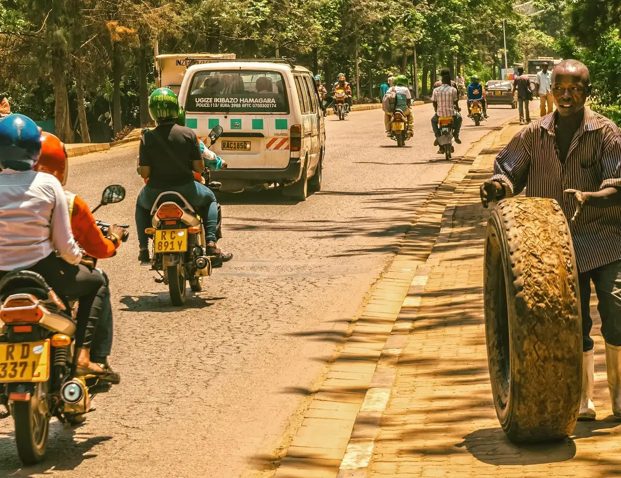
For Volcanoes National Park, the standard approach is to hire a private vehicle and driver for the duration of the stay, either through a Kigali tour operator or through the lodge. The drive from Kigali to Kinigi takes approximately 2.5 hours on good tarmac road through the Musanze valley. Public Mototaxis (motorcycle taxis) operate within Musanze town; minibus taxis (matatus) connect Kigali to Musanze. For Nyungwe, a private vehicle is more or less essential due to the park's remote location and the need to move between trailheads.
Health Precautions
Yellow fever vaccination is required for entry to Rwanda. Malaria prophylaxis is recommended for the lower-elevation areas and Kigali, though Volcanoes National Park and Nyungwe at altitude carry lower risk due to the cold temperatures. Altitude: Karisimbi rises to 4,507 m (14,787 ft), and altitude sickness is a real risk for visitors arriving at speed from sea level. Spend at least one night in Kigali (1,567 m / 5,141 ft) and one more in Musanze (1,849 m / 6,066 ft) before attempting Karisimbi or Bisoke. Drink two to three litres of water per day from the first day of arrival. If you feel headache, nausea, or unusual fatigue, do not ascend further.
Gorilla Permit Booking
Book gorilla permits through the Rwanda Development Board at rdb.rw or through an RDB-accredited tour operator. Permits are date-specific and non-transferable. If you miss your trek date due to illness or weather, the permit is non-refundable; travel insurance that covers gorilla permit cancellation is worth purchasing. Booking through a reputable tour operator often provides more flexibility than booking direct, as operators sometimes hold permit inventory and can advise on family assignment.
Currency and Money
Rwanda's currency is the Rwandan Franc (RWF). Major international cards (Visa, Mastercard) are accepted at Kigali hotels, restaurants, and larger lodges. ATMs are available in Kigali and Musanze. In park headquarters at Kinigi, at village guesthouses, and for porter hire, cash is standard. Carry sufficient Rwandan Francs for incidentals, tips, and porter fees. Tipping rangers and porters after a gorilla trek is standard practice: $10 to $20 per ranger and $5 to $10 per porter is the generally accepted range.
READY TO HIKE RWANDA?
Get started with your Hiking adventure now!
Frequently Asked Questions About Hiking in Rwanda
How difficult is gorilla trekking in Rwanda?
The difficulty varies significantly depending on the family assigned. Some treks are 30 minutes on easy forest paths; others are four to six hours on steep, muddy volcanic terrain at altitude above 3,000 m (9,843 ft). The RDB assigns families with fitness levels in mind, so be honest at the morning briefing if you have limited mountain fitness or a medical condition. A porter is strongly recommended for anyone not accustomed to sustained uphill hiking with limited oxygen. The general baseline is: if you can hike comfortably for three hours on uneven terrain, you can do most gorilla treks.
Do I need to book gorilla permits far in advance?
Yes. For peak season months of June through September and December through February, permits should be booked three to six months in advance, and even earlier is better. The 12 habituated families each allow eight visitors per day, giving a daily total of 96 permits. During peak weeks, this capacity is fully subscribed. Shoulder season permits are more readily available but still require advance booking. Last-minute permits occasionally appear when tour operators release unsold inventory, but planning around availability is not advisable for a trip built around gorilla trekking.
Can I hike the volcanoes without doing gorilla trekking?
Yes. Mount Bisoke, Mount Karisimbi, Mount Sabyinyo, and the trail to Dian Fossey's grave all operate under separate RDB activity permits that are independent of gorilla trekking permits. These permits are significantly cheaper ($100 to $150 per person depending on the activity) and available through the same RDB booking platform. A trip to Volcanoes National Park that combines a volcano summit with a single gorilla trek day is a well-structured itinerary that balances cost and experience.
What is the best trail in Nyungwe for first-time hikers?
The Igishigishigi Trail to the canopy walkway is the most accessible and most rewarding short hike in Nyungwe for visitors with limited forest hiking experience. The 2.1 km (1.3 mi) trail from Uwinka passes through ancient forest with good bird and primate viewing, and the walkway itself gives a perspective on the forest that is genuinely unlike anything at ground level. For those who want a longer day, the Kamiranzovu Marsh Trail at 6 km (3.7 mi) is a moderate route through wetland habitat with unique bird species. Both trails operate with a compulsory guide from Uwinka Visitor Centre.
Is Rwanda safe for solo hikers?
Rwanda is among the safest countries in Africa for independent travellers. Crime rates are low, infrastructure is good, and the gorilla trekking and volcano hiking systems operate with experienced guides and rangers accompanying every group. Solo travellers on gorilla treks are assigned to a group at the morning briefing; you will not trek alone. For volcano hikes and Nyungwe trails, a compulsory guide accompanies you throughout. The one safety consideration specific to the hiking context is altitude: Karisimbi especially requires careful acclimatisation regardless of solo or group status.
What is the 30% gorilla permit discount and how do I qualify?
The Rwanda Development Board offers a 30% reduction on gorilla permit fees for visitors during the low season months of March to May and October to November. To qualify, you must have spent at least two consecutive nights at a registered accommodation in either Akagera National Park or Nyungwe Forest National Park before your Volcanoes visit. The reduced permit is only available through the RDB or an accredited operator, not at the park gate. With the discount, permits cost approximately $1,050 per person, which remains a significant investment but substantially changes the economics of the trip.
Can I see chimpanzees and gorillas on the same trip?
Yes, and this is a natural itinerary for Rwanda. Nyungwe Forest National Park, in the southwest, is the best location for chimpanzee trekking in Rwanda, with three semi-habituated communities available for tracking at $250 per permit per person. A standard Rwanda trekking trip of seven to ten days might spend two days in Nyungwe (chimpanzee trek plus canopy walkway), one day travelling north, and two to three days at Volcanoes National Park for gorilla trekking and a volcano hike. Rwanda's compact size makes this circuit manageable without excessive driving.
What should I wear and carry for gorilla trekking?
Wear long trousers and a long-sleeved top to protect against stinging nettles, safari ants, and scratches from dense vegetation. Gaiters over hiking boots are useful in muddy bamboo sections. Carry at least 2 litres (0.5 gal) of water, a light snack, a rain jacket, a face mask for the gorilla viewing hour, and a camera (no flash). A small daypack is sufficient. Leave large bags at the vehicle or lodge. Do not wear bright colours: neutral greens, browns, and greys are recommended. If you plan to hire a porter (strongly recommended), they will carry your daypack from the trailhead.
Plan Your Hiking Trip to Rwanda
Rwanda rewards hikers who engage with it on its own terms. The trails here are not long-distance routes measured in hundreds of kilometres. They are concentrated, intense, altitude-demanding experiences that put you directly into some of the most biologically significant habitats remaining in Africa. The gorillas are the centrepiece of hiking in Rwanda, and they justify the permit price in a way that is difficult to articulate until you are standing in the forest with a silverback 10 m (33 ft) from your boots, looking straight through you.
Explore our guided hiking journeys at Art of Bicycle Trips.
Plan Your Active Adventure
Create a private trip or join a small-group departure.
