Overview
Hiking Corsica means hiking on one of Europe's most demanding and most rewarding islands. The trails here do not ease you in. They rise steeply from sea level into a jagged granite interior where passes top 2,000 m (6,562 ft), glacial lakes sit in high cirques, and the air carries the sharp scent of the maquis year-round. This is an island that is, geologically and culturally, a mountain dropped into the Mediterranean, and it shows at every turn of the trail.
The centrepiece of hiking in Corsica is the GR20, known across Europe as the continent's toughest long-distance trail. Running 180 km (112 mi) from Calenzana in the northwest to Conca in the southeast, it follows the island's rocky spine across 16 stages, with over 11,000 m (36,089 ft) of cumulative ascent. Only experienced hikers with strong fitness and technical mountain ability should attempt the full route. But the GR20 is not the only story on this island.
Corsica has eight waymarked long-distance trails in total, including the Mare e Monti and Mare a Mare networks, which link mountain villages to coastal bays through forests, gorges, and maquis-covered hillsides. These routes are moderate in difficulty, far less crowded than the GR20, and give a more intimate view of Corsican life. The island's Regional Natural Park, the Parc Naturel Régional de Corse (PNRC), covers 40% of the territory and manages the entire refuge and trail booking system.
No permit is required to hike in Corsica, but refuge bookings on the GR20 are now mandatory for all accommodation types, including tent pitches. The booking platform is run by the PNRC and reservations open each spring for the season. Hikers who arrive without bookings during peak season will find limited options and pay a significant premium.
This guide covers the landscape, history, trail network, food culture, accommodation system, and logistics for hiking in Corsica, with enough detail to begin planning a trip from scratch. Whether you are targeting the full GR20 or a week on the Mare e Monti, this is what you need to know.
DREAMING OF HIKING CORSICA?
Explore our amazing hiking tours in Corsica now !
Geography of Hiking in Corsica
Corsica is the most mountainous island in the Mediterranean. It is 183 km (114 mi) long and 83 km (52 mi) wide at its broadest, yet it contains more than 120 peaks above 2,000 m (6,562 ft), concentrated on the island's western half. The highest point, Monte Cinto, reaches 2,706 m (8,878 ft), making it taller than anything in the British Isles and higher than the highest peak in the Appalachians. This is not a gentle Mediterranean island with rolling hills. It is a serious mountain environment that happens to have beaches.
The island's geological character falls into two broad zones. The western half, where most of the major hiking trails run, is built on ancient granite: hard, pale, and fractured into the sculpted spires, ridges, and boulder fields that define the GR20 experience. The eastern half is made of darker schist, softer in character, with more forested valleys and lower peaks. The central ridge divides these two zones and acts as a weather barrier: western slopes receive more moisture from Atlantic weather systems, while the eastern coast is drier and more sheltered.
The Corsican landscape changes dramatically with altitude. From sea level up to around 800 m (2,625 ft), the maquis dominates: a dense, fragrant scrubland of cistus, rosemary, juniper, lavender, and myrtle that covers the lower hillsides in something approaching impenetrable green. Between 800 m and 1,800 m (5,906 ft), forests take over, first chestnut in the interior valleys, then the tall, straight laricio pine for which Corsica is famous, a species endemic to the island that grows straight and fine-grained and reaches heights of 50 m (164 ft) in old-growth stands. Above 1,800 m, the trees give way to alpine pasture, bare granite, and the glacial lakes that punctuate the GR20's high sections.
Wildlife on the trail is varied and visible. The Corsican mouflon, a wild mountain sheep endemic to the island, is regularly spotted on rocky ridges, particularly in the northern massifs. Golden eagles and ospreys nest in the high terrain. Wild boar move through the chestnut forests at lower elevations. Corsican cows, notoriously independent, graze at surprisingly high altitudes and often turn up at GR20 refuges looking for scraps.
The Scandola Nature Reserve on the northwest coast, accessible only by boat or on foot, is a UNESCO World Heritage Site and one of the most significant marine protected areas in France. The red porphyry cliffs of Scandola and the adjacent Calanches de Piana, also UNESCO-listed, form one of Corsica's most distinctive coastal landscapes. The Mare e Monti Nord trail passes near enough to offer views of Scandola from the heights above Girolata, and the isolated village of Girolata itself, reachable only by boat or on foot, sits within the reserve.
History and Culture
The Corsican interior was settled long before the coastal towns. Megalithic monuments, menhirs, and dolmens from at least the 3rd millennium BCE are distributed across the island's upland regions, and the famous statue-menhirs of Filitosa in the south represent one of the most significant prehistoric sites in the western Mediterranean. The island's recorded history begins around 560 BCE, when Greeks founded the town of Alalia on the east coast. What followed was 2,500 years of foreign occupation that never quite took hold of the interior.
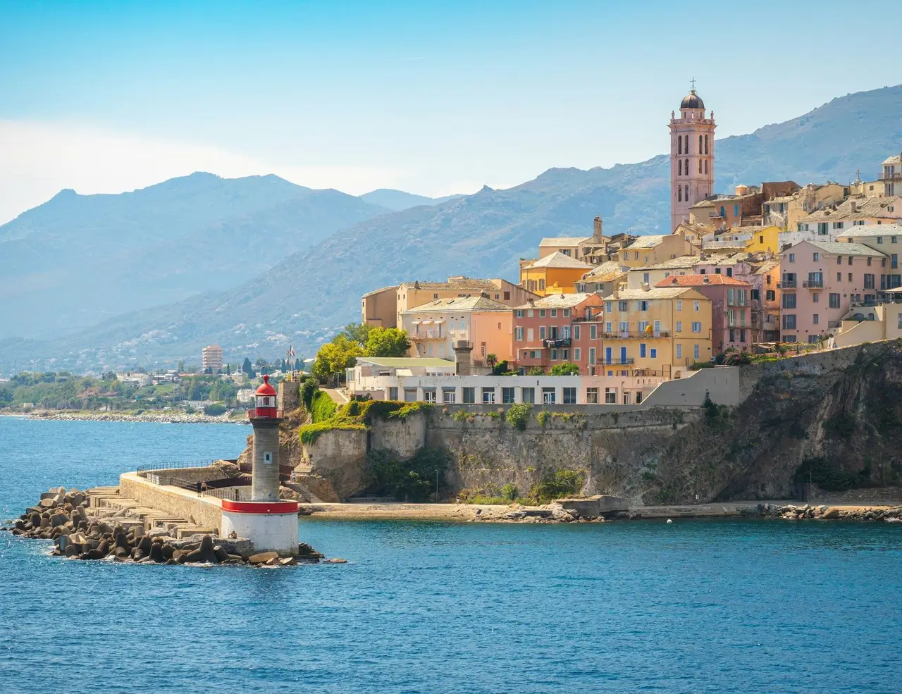
The Romans, Vandals, Lombards, Arabs, Pisans, and Genoese each imposed their authority on Corsica in turn. Of these, the Genoese left the most visible mark on the hiking landscape. Between 1530 and 1620, the Republic of Genoa built a chain of coastal watchtowers to defend against Barbary pirate raids that had enslaved thousands of Corsicans. Around 67 of these circular stone towers still stand today, 12 to 17 m (39 to 56 ft) high, positioned on headlands around the island's 1,000 km (621 mi) of coastline. The coastal trails pass several of them directly, and their silhouettes mark the skyline on the Mare e Monti stages near the Calanches de Piana.
The Genoese also transformed the island's agriculture: they introduced the chestnut tree to the interior on a large scale from 1284 onward, planting it as an alternative to cereal crops on the steep inland slopes. The chestnut forests of Castagniccia in the northeast became so productive that chestnuts fed the Corsican population for centuries, and the flour they produce remains the basis of several of the island's most characteristic dishes. The forests a hiker walks through in the interior are, in part, a Genoese agricultural legacy.
The most consequential period in Corsican history lasted just 14 years. In 1755, Pasquale Paoli unified the island's warring clans and established the Corsican Republic, one of the first modern democratic states in the world, with a constitution so progressive that it offered certain women the right to vote decades before France or America considered it. Paoli founded a university, minted currency, built a navy, and made Corte the capital of an independent Corsican nation. In 1768, Genoa sold its rights over Corsica to France. French forces invaded in superior numbers, and by 1769 the republic was finished. Weeks after Paoli fled to exile in England, a boy was born in Ajaccio to a Corsican noble family. His name was Napoleon Bonaparte.
The French annexation has never sat entirely comfortably on the island. Corsican culture maintains a fierce sense of distinct identity: the Corsican language, Corsu, related not to French but to medieval Tuscan Italian, is still taught in primary schools and used in daily life in many interior villages. Corsican polyphonic music, a tradition of unaccompanied vocal harmony, is performed at village festivals and in churches throughout the island. The Moor's head emblem flies on flags everywhere. And in the later 20th century, a Corsican nationalist movement carried out decades of bombing campaigns against French state institutions in pursuit of autonomy. An independence process remains active in Corsican politics today. For hikers, this translates into a cultural landscape that is unmistakably not mainland France, particularly once you leave the coastal resorts and move into the interior.
The trails themselves carry traces of this long history. The GR20 follows ancient transhumance routes used by shepherds who moved livestock between the coast and mountain pastures for centuries. The refuges on the Mare e Monti pass through villages where stone houses and Romanesque churches date to the Pisan period. The bergeries encountered along many routes are still active in places, with shepherds making cheese in the same high pastures their ancestors used. Hiking in Corsica is not just a physical challenge. It is a walk through a culture that has resisted assimilation for millennia.
Best Time for Hiking Corsica
Late June to Mid-September: Peak Season on the GR20
The primary hiking window on the GR20 runs from late June through mid-September. During these weeks, all 16 PNRC refuges are staffed and serving meals, the trails are clear of snow in almost all sections, and daylight hours are long. June is widely regarded as the sweet spot: the refuges have just opened, the trails are less crowded than July and August, temperatures at altitude are comfortable (typically 15 to 22°C / 59 to 72°F during the day), and the landscape is at its greenest. Snow can linger on north-facing high sections in early June, particularly around the northern massifs and the Bocca di Foggiale, so early starters should check trail conditions with the PNRC before departure.
July and August bring the full Mediterranean summer to lower elevations, with temperatures on coastal sections and at village resupply points regularly reaching 30°C (86°F) or above. At altitude, conditions are cooler but afternoon thunderstorms are common, sometimes violent, and can develop quickly. GR20 hikers should start each stage early, aiming to reach the refuge before midday if conditions look unsettled. July and August are also the busiest months on the trail, with 20,000 to 30,000 hikers completing the route in a typical year. Refuges fill to capacity, so advance booking is not just advisable but mandatory under the PNRC system introduced in 2023.
September: The Best Compromise
Early September offers the best balance of conditions on the island. Crowds thin noticeably after the first week, the afternoon thunderstorm risk decreases, visibility is typically excellent with clear skies, and the evenings in the refuges have a more relaxed atmosphere.
Temperatures remain warm enough for comfortable hiking. The main caveat is that some private bergeries and seasonal services close in September, and bus connections to trailheads become less frequent. Book refuges in advance even in September, as the GR20's growing popularity means popular stages fill out further into the shoulder season each year.
April to June: Ideal for Mare e Monti and Coastal Routes
The Mare e Monti, Mare a Mare, and coastal trails operate on a longer calendar than the GR20, with accommodation typically open from April through October. Spring is the recommended season for these moderate routes: the maquis is in full bloom, temperatures at lower elevations are mild (18 to 24°C / 64 to 75°F), and the trails are quiet. Rainfall is possible in April and early May but rarely persistent. The Restonica Gorge, the Spelunca Gorge, and other river sections are at their most dramatic with high water in spring.
October to November: Autumn Hiking
October is the quietest month on the GR20 and one of the most atmospheric. The autumn palette of the chestnut forests of Castagniccia is at its peak, the high-altitude light is clear and low-angled, and the trails are largely empty. The weather becomes increasingly unpredictable, however, with rain and early-season snow possible on high passes from late October onward. Refuges on the GR20 are closed by early October; the few remaining hikers must carry camping equipment and full self-sufficiency. For the Mare a Mare Sud, which stays passable through winter at lower elevations, autumn into November remains entirely feasible.
November to May: Avoid the High Routes
Winter closes the GR20 to all but ski mountaineers and experienced alpinists. Snow covers the high passes from November through May, refuges are unstaffed, and conditions can turn life-threatening rapidly. The lower routes, including coastal trails around Cap Corse and sections of the Mare a Mare Sud, remain accessible year-round for experienced walkers, but the high-mountain routes should not be attempted without winter mountaineering equipment and skills.
PLANNING A HIKING HOLIDAY IN CORSICA?
Dive into our curated Corsica hiking adventures today!
Best Trails for Hiking in Corsica
GR20: Fra Li Monti
The GR20's Corsican name, Fra li Monti, means 'across the mountains,' and it earns the description. Stretching 180 km (112 mi) from Calenzana in the northwest to Conca in the southeast, the trail runs along the island's main granite ridge through 16 stages, each taking between five and eight hours of sustained effort. Total elevation gain across the route exceeds 11,000 m (36,089 ft). There are no recovery days built into the standard itinerary. There are no easy sections at the start to ease you in. Stage one climbs above the height of Ben Nevis on the day you leave Calenzana.
The trail divides naturally at Vizzavona, a village with rail connection and hotel accommodation at the midpoint. The northern half, from Calenzana to Vizzavona, is the more technically demanding: it crosses the Cintu and Ritondu massifs through rocky passages, chains on steep sections, and exposed ridge traverses. The summit of Monte Cinto at 2,706 m (8,878 ft) is accessible via a side route from Haut Asco. The southern half, from Vizzavona to Conca, is still demanding but generally less technical, with the Aiguilles de Bavella providing the visual highlight: red granite pinnacles rising above the Alta Rocca plateau between the Asinao and Paliri refuges.
The GR20 is the most demanding long-distance trail in this guide. It is not a destination for first-time multi-day hikers. Candidates should have experience of multi-day mountain hiking with a loaded pack, comfort on exposed rock and steep terrain, and the judgment to turn back or wait out bad weather without a support structure around them. Those who commit should also bring cash: the trail is a cash-only economy with no ATMs between Calenzana and Conca.
Quick Facts: GR20 Total Distance: 180 km (112 mi) Duration: 14 to 16 days standard; 10 to 12 days for experienced hikers Difficulty: Extremely Challenging High Point: Monte Cinto access point, 2,706 m (8,878 ft) Best Season: Late June to mid-September Accommodation: PNRC refuges (mandatory pre-booking), bergeries, tent pitches Start / Finish: Calenzana (north) to Conca (south) Highlights: Lac de Melo and Capitello, Aiguilles de Bavella, Monte Cinto massif, Restonica valley views
Mare e Monti Nord: Sea and Peaks
The Mare e Monti Nord runs 122 km (76 mi) from Calenzana, the same village where the GR20 begins, south along the coast to Cargèse over 10 stages. The name translates as 'sea and mountains,' which describes the trail precisely: each day alternates between forested hillsides, high granite viewpoints, and descents to coves and coastal villages. The trail is marked in orange rather than the red and white of the GR20 and carries far fewer hikers.
The highlight section comes between Galeria and Girolata, where the route climbs to a ridge offering views of the Scandola peninsula, a UNESCO-listed volcanic red-rock coastline that cannot be reached by road. The descent leads to Girolata, a village accessible only by boat or on foot, with a single auberge and a handful of permanent residents. From Ota and Evisa, the Gorges de la Spelunca provide a dramatic descent through a deep canyon with crystal-clear rock pools. The trail ends at Cargèse, a village founded by Greek colonists in the 17th century with two facing churches, one Catholic and one Greek Orthodox.
Accommodation on the Mare e Monti is provided by gîtes d'étape in villages along the route, most of which offer demi-pension: a bed in a shared dormitory, a substantial Corsican dinner, and breakfast. This is a significantly more sociable and culturally immersive experience than the GR20 refuges. The gîtes are open from April to October and booking ahead is advisable in June through August.
Quick Facts: Mare e Monti Nord Total Distance: 122 km (76 mi) Duration: 10 days Difficulty: Moderate to Challenging High Point: Approximately 1,250 m (4,101 ft) Best Season: April to October; spring and autumn recommended Accommodation: Village gîtes d'étape with demi-pension Start / Finish: Calenzana to Cargèse Highlights: Scandola views, Girolata village, Gorges de la Spelunca, Calanches de Piana
Mare a Mare Nord: Coast to Coast
The Mare a Mare Nord crosses Corsica at its widest point, connecting the east coast village of Moriani Plage to Cargèse on the west coast over 140 km (87 mi) and 10 to 12 days. Where the GR20 follows the island's spine and the Mare e Monti runs north-south along the western coast, the Mare a Mare Nord cuts directly east to west through the island's interior, climbing through chestnut forests, passing through the old capital at Corte, and traversing the Niolu plateau before descending to the western coast. Its highest point is 1,478 m (4,849 ft).
This is the trail that gives the deepest access to Corsica's interior villages: communities like Calacuccia, Albertacce, and Evisa where Corsican is still spoken, where the bergeries on the hillsides above village are still producing cheese, and where the restaurants serve pork from pigs raised in the forest. The trail shares its final two days with the Mare e Monti Nord, which means accommodation can be tighter in that section in high season. The trail is passable from April to November and is one of the best options for hikers who want cross-island breadth without the technical demands of the GR20.
Quick Facts: Mare a Mare Nord Total Distance: 140 km (87 mi) Duration: 10 to 12 days Difficulty: Moderate High Point: 1,478 m (4,849 ft) Best Season: April to November Accommodation: Village gîtes d'étape and auberges Start / Finish: Moriani Plage (east) to Cargèse (west) Highlights: Corte city, Niolu plateau, interior chestnut forests, cross-island traverse
Sentier du Douanier: Cap Corse
Cap Corse is the narrow peninsula that extends 40 km (25 mi) north from Bastia like a finger pointing toward the Italian coast. The Sentier du Douanier, or Customs Officers' Path, follows the western coast of the cap for approximately 50 km (31 mi) from Centuri to Macinaggio, passing Genoese towers, coves only accessible on foot, and some of the most dramatic coastal walking in France. The trail takes two to three days and is accessible to moderately fit hikers. It is passable year-round at lower elevations, making it one of the few Corsican hiking options for winter visitors.
The western coastline of Cap Corse is wilder and less visited than the east, with sections of path that traverse open clifftop above the sea. The village of Centuri is known for its lobster fishing: the Cap Corse lobster is considered among the best in the Mediterranean and is served grilled at the village's small restaurants at the end of the trail. Several Genoese towers appear directly on or beside the route.
Quick Facts: Sentier du Douanier Total Distance: Approximately 50 km (31 mi) for the full western coast Duration: 2 to 3 days Difficulty: Moderate High Point: Approximately 400 m (1,312 ft) Best Season: Year-round; best in spring and autumn Accommodation: Village gîtes and hotels in Centuri and Macinaggio Start / Finish: Centuri to Macinaggio, or reversed Highlights: Genoese coastal towers, Cap Corse lobster at Centuri, isolated coves, views toward Italy
Gorges de la Restonica: Day Hike
The Restonica Valley, south of Corte in the island's geographic centre, is Corsica's most popular day-hiking destination. The gorge is narrow and dramatic, carved by the Restonica river through pale granite, with a series of natural rock pools and cascades accessible from a road that runs 16 km (10 mi) into the mountains from Corte. From the road's end at the Bergeries de Grotelle at 1,370 m (4,495 ft), a well-marked path climbs to Lac de Melo at 1,711 m (5,614 ft) in about 45 minutes, and continues to the higher Lac de Capitello at 1,930 m (6,332 ft) in another 30 minutes of steeper terrain. These two glacial lakes represent the GR20's most photographed landscapes and are reachable as a day hike from Corte without any overnight equipment.
The road into the gorge is closed to private vehicles in high season, with a shuttle bus running from Corte. This is the correct approach in summer: the valley is popular and the narrow road was not designed for mass tourism parking. Carry water from Corte or fill at the Bergeries de Grotelle, as sources higher up are unreliable. The return from Lac de Capitello to the road takes around two hours of descent.
Quick Facts: Gorges de la Restonica Total Distance: 12 km (7.5 mi) round trip from Bergeries de Grotelle Duration: 4 to 5 hours Difficulty: Moderate High Point: Lac de Capitello, 1,930 m (6,332 ft) Best Season: June to October Gateway Town: Corte (16 km / 10 mi from valley entrance) Highlights: Lac de Melo, Lac de Capitello, granite gorge, GR20 scenery without the commitment
Food and Drink in Corsica
Corsican food is not French. It is rooted in a pastoral mountain culture that has been producing and preserving the same ingredients for centuries: chestnut flour, sheep and goat cheese, cured pork from forest-raised pigs, wild boar from the maquis, and myrtle berries harvested from the same scrubland you walk through on the lower trail sections. The island's cuisine draws on Genoese and Tuscan influences, but it has evolved its own character that belongs to neither.
The single most important ingredient in Corsican cooking is the pig. The cochon nustrale, a regional breed that roams semi-wild in the chestnut and oak forests of the interior, produces charcuterie considered by many experts to be among the finest in Europe. Prisuttu is a cured ham aged for at least 12 months, often served with fresh figs. Coppa is a cured pork neck, aged around five months. Lonzu is a salted and smoked pork tenderloin. Figatellu, Corsica's signature product, is a pork liver sausage smoked over a wood fire, then dried: it is eaten grilled, served with chestnut polenta, or used to flavour winter soups. These four meats hold AOC and AOP status in France, the same denomination given to Champagne and Roquefort.
Brocciu is the island's defining cheese. It holds AOC status and is made from the whey of goat or sheep's milk, giving it a texture similar to fresh ricotta with a delicately tangy flavour. It appears in omelettes, cannelloni, beignets, and in the dessert fiadone, a baked cheesecake of brocciu with lemon zest that is found on almost every Corsican restaurant menu. Brocciu is best eaten fresh, within 48 hours of production. In the interior villages and at the bergeries on the higher trails, you will find it offered directly from the shepherd who made it.
Chestnut flour is the backbone of Corsican starch cooking. The Farine de Châtaigne Corse carries its own AOC designation and is processed from chestnuts grown in the Castagniccia forests using a traditional method of drying over an open hearth that gives the flour its characteristic smoky note. Pulenta castagnina, the island's version of polenta made from this flour, has a slightly sweet, nutty flavour and is typically served alongside figatellu or brocciu. Canistrelli, shortbread biscuits flavoured with lemon, anise, or white wine, are made from chestnut flour and are the standard trail snack found at every auberge and village shop.
On the GR20 and at the mountain refuges, food is practical rather than elaborate. Refuge kitchens serve pasta, soup, omelette, and charcuterie at lunch; stew, more pasta, and salad at dinner. Portions are generous. The demi-pension system at Mare e Monti gîtes is a more interesting proposition: a multi-course evening meal with a fixed menu that typically includes charcuterie, a hearty main of veal with olives or wild boar stew, cheese, and fiadone or canistrelli to finish. This is where the real Corsican food culture is encountered on the trail.
Corsican wine is little-known internationally but has been produced on the island since the Greeks introduced the vine 2,500 years ago. The key red grape varieties are Nielluccio, grown primarily in the Patrimonio appellation in the north, and Sciaccarellu, which thrives on the granite soils around Ajaccio. The white is dominated by Vermentinu, a grape that produces aromatic, mineral wines suited to the island's seafood. Chestnut beer, Pietra, brewed with malt and chestnut flour, is served cold at almost every gîte and refuge on the island and is worth trying. Myrtle liqueur, made from the berries of the maquis plant that borders every trail, is the standard digestif.
Accommodation for Hiking in Corsica
PNRC Refuges on the GR20
The GR20's 15 mountain refuges are run by the Parc Naturel Régional de Corse (PNRC) and sit at the end of almost every stage. They are staffed from the end of May to early October. Outside this window, the refuges remain open but unmanned, with no food or managed facilities. Each refuge has a large shared dormitory with 26 to 32 bunk beds, basic shared bathrooms (a mix of hot and cold showers depending on the refuge), and an outdoor cooking area. Sleeping bags are required as blankets are not provided. Electricity is limited and phone charging is available at some refuges for a fee.
Refuge dinner and breakfast menus are simple: pasta, stew, soup, omelette, and charcuterie. The food is fuel rather than gastronomy, but it is reliable and welcome after a long stage. Dormitory bed with dinner and breakfast costs around 40 to 45 euros per person. As of 2023, pre-booking is mandatory for all types of accommodation at PNRC refuges, including own-tent pitches; hikers arriving without bookings face paying double. Book through the official PNRC platform at pnr-resa.corsica.
Bergeries
Private bergeries are shepherd's farms that have been converted to offer trail accommodation alongside the PNRC refuges. They are similar in standard to the refuges, offering basic dormitory beds and demi-pension, but they are privately run and generally have a more personal atmosphere. Some bergeries also offer tent pitches. They do not always accept card payments, so carry cash.
Gîtes d'Étape on the Mare e Monti and Mare a Mare
The moderate trail networks use a system of village gîtes d'étape: privately run trail hostels that almost always offer demi-pension as the default option. A demi-pension booking covers a dormitory bed, a multi-course Corsican dinner, and breakfast. This is the most culturally rich accommodation option on the island's trail network. Dinner in a good gîte is the evening's entertainment: multi-course, generous, and overwhelmingly local. Gîtes are open from April to October. Booking ahead is essential in June through August and advisable in May and September.
Hotels and B&Bs
Three points on the GR20 offer hotel accommodation within reasonable reach of the trail: Haut Asco (a former ski resort), Vizzavona (the midpoint village with a train station), and Castel di Vergio. Each provides a welcome break from dormitory living for hikers who want a private room and proper shower mid-route. Vizzavona in particular is a useful resupply and rest point: it has a small shop, restaurant, hotel, and train connection to both Ajaccio and Bastia.
Wild Camping
Wild camping is prohibited in Corsica outside designated tent pitches at refuges and bergeries. This rule is enforced more strictly in the PNRC than in many other French national parks. Hikers who pitch tents away from designated areas risk fines. The rule exists to protect the fragile alpine ecosystem and to manage the trail's growing visitor numbers. Tent pitches at PNRC refuges must be booked in advance through the same booking system as dormitory beds.
Planning and Logistics
Getting to Corsica
Corsica is served by four airports: Bastia in the north, Ajaccio on the west coast, Calvi in the northwest, and Figari in the south. For the GR20, Calvi airport is the closest to the northern trailhead at Calenzana, approximately 13 km (8 mi) away; taxis are available from the airport and train station at Calvi, or a bus service connects Calvi to Calenzana. For hikers ending at Conca in the south, Figari airport is the closest exit point. Ferries from Marseille, Nice, Toulon, Genoa, and Livorno connect to the main Corsican ports: Bastia, Ajaccio, Calvi, and Porto-Vecchio. Ferry crossings from Nice to Bastia take around five hours.
Getting Around
Corsica has a narrow-gauge train line, the Trinighellu, connecting Bastia to Ajaccio via Corte and Vizzavona. This line is slow and scenic and genuinely useful for GR20 hikers: it allows you to exit or enter at Vizzavona if hiking only one half of the trail. Bus services connect the main towns and some trailheads, but services are seasonal and infrequent on many routes. A car is useful for reaching trailheads on the Mare e Monti and Mare a Mare networks, though summer driving in the interior on narrow mountain roads requires patience.
Navigation
The GR20 is marked with red and white paint blazes on rocks throughout its length, visible every few hundred metres. Navigation is straightforward in good visibility, but poor weather, fog, and alpine terrain on the northern section can make route-finding genuinely difficult. Download offline maps before you start: the Komoot and Wikiloc apps carry accurate GR20 GPX tracks. The official IGN 1:25,000 maps cover the full route; IGN map series 4250OT and 4349OT cover the north and south respectively. A satellite communicator such as the Garmin inReach is strongly recommended for the northern section, where cell coverage is minimal.
Bookings and Permits
No permit is required to hike on any Corsican trail. For the GR20, all accommodation (dormitory, bergerie, and own-tent pitches at PNRC refuges) must be pre-booked through the PNRC platform at pnr-resa.corsica. Bookings open in spring for the full season. Date-specific reservations are required, which means your itinerary must be planned in advance. Weather delays can disrupt a fixed schedule; most experienced GR20 hikers carry a lightweight tent as a contingency for stages where they need to stay put or change plans.
Money and Resupply
The GR20 is a cash-only economy. There are no ATMs between Calenzana and Conca; the mid-route exception is Vizzavona where the campsite shop accepts cards. Estimate your daily cash requirement (refuge beds, food, drinks) and add a significant buffer before starting. The Mare e Monti and Mare a Mare trails pass through villages with small shops at each stage, making resupply more manageable, but card acceptance is inconsistent at smaller establishments.
Safety
The principal safety concern on the GR20 is the weather. Summer storms develop rapidly in the Corsican mountains and can produce lightning on exposed ridges, flash flooding in gorge sections, and disorienting fog at altitude. Check the Météo-France mountain forecast every morning before starting a stage and take the gardien's advice seriously; they post the day's conditions at each refuge. Do not start a high-level stage if afternoon storms are predicted for the high sections. On water: natural sources along the GR20 are not reliably safe for consumption due to livestock proximity. Fill from designated potable taps at refuges and carry two to four litres per stage depending on conditions and stage length.
READY TO HIKE CORSICA?
Get started with your Hiking adventure now!
Frequently Asked Questions About Hiking in Corsica
Do I need a permit to hike the GR20?
No permit is required to hike the GR20. Access to the trail is free. However, accommodation at all PNRC refuges and bergeries must be pre-booked through the official PNRC platform at pnr-resa.corsica. As of 2023, this includes own-tent pitches. Hikers arriving without reservations pay double the standard rate and may find themselves without a spot entirely during peak weeks in July.
How difficult is the GR20 compared to other European treks?
It is consistently rated among the most demanding long-distance treks in Europe, equivalent in reputation and technical challenge to the Tour du Mont Blanc's hardest variants but with more sustained alpine terrain and fewer escape routes. The northern section involves hands-on scrambling, chain-assisted climbs, exposed ridges, and loose scree. Casual hikers who have completed the Camino de Santiago or similar low-level trails will find the GR20 a significant step up. A solid foundation of multi-day mountain hiking experience is a genuine prerequisite.
Can I hike just one half of the GR20?
Yes, and many hikers do. Vizzavona, the midpoint, is served by a train connection to both Bastia and Ajaccio, making it a practical entry and exit point. The northern half, from Calenzana to Vizzavona, is the more technically demanding and includes Monte Cinto access; the southern half, from Vizzavona to Conca, is still challenging but less technical and passes the Aiguilles de Bavella. Either half takes seven to eight days at a standard pace.
What is the best alternative to the GR20 for moderate hikers?
The Mare e Monti Nord is the most recommended alternative. It runs 122 km (76 mi) from Calenzana to Cargèse over 10 days, alternating between forested mountains and coastal scenery, passing through villages where accommodation is in gîtes d'étape with proper Corsican dinners. The trail's highest point is around 1,250 m (4,101 ft), making it accessible to hikers without alpine experience. Spring and autumn are the recommended seasons.
Is wild camping allowed in Corsica?
No. Wild camping is prohibited throughout the Regional Natural Park of Corsica, which covers 40% of the island and encompasses all the major hiking trails. Camping is permitted only in designated areas at PNRC refuges and private bergeries, and these pitches must be booked in advance on the GR20. The rule is enforced. Hikers caught wild camping risk fines.
When do the GR20 refuges open and close?
PNRC refuges are staffed from the end of May to early October. During this window they provide meals, sell basic supplies, and offer drinking water from designated taps. Outside the staffed season, refuges remain physically open but are unmanned, with no food or facilities and no guarantee of water safety. Hiking the GR20 outside the staffed season requires full self-sufficiency in food, water filtration, and emergency equipment.
What fitness level do I need for the GR20?
The GR20 demands a high level of cardiovascular fitness and the ability to hike with a loaded pack for six to eight hours per day over sustained rocky terrain. As a baseline: you should be comfortable completing 20 km (12 mi) mountain days with 1,000 m (3,281 ft) of ascent, and doing so on consecutive days without significant recovery deficit. Train specifically for the trail in the three to four months before departure, including weighted hillwalking. Most people who underestimate the GR20 and turn back early do so on the first three stages.
What navigation tools should I bring for hiking in Corsica?
The GR20 is well marked but difficult to navigate in poor visibility at altitude. Bring a downloaded offline GPX track on your phone (Komoot or Wikiloc both carry accurate tracks), an IGN 1:25,000 map for the sections you are hiking, and a satellite communicator with emergency SOS capability for the northern section. Do not rely on phone signal for navigation: coverage is minimal on the high-mountain stages. On the Mare e Monti and Mare a Mare trails, orange paint blazes are consistent and navigation is significantly simpler.
Can I see Corsica's beaches as part of a hiking trip?
Yes, and combining trail and beach is one of the island's great pleasures. The Mare e Monti Nord ends at Cargèse, within reach of several beaches, and the trail passes near swimming spots in the Spelunca Gorge. The Sentier du Douanier on Cap Corse accesses coves unreachable by road. Hikers finishing the GR20 at Conca are 45 minutes from Porto-Vecchio and its beaches by taxi. Building in two or three beach days before or after the main trail adds minimal cost and significant recovery value.
Plan Your Hiking Trip to Corsica
Corsica rewards hikers who come prepared. The GR20 is not a trail that forgives underestimation, but it offers something that most European long-distance routes cannot: days on end in genuine high-mountain wilderness, with the Mediterranean visible from the ridgelines and the smell of the maquis rising from the valleys below. It is the kind of hiking that stays with you for years. For those not yet ready for the full route, the Mare e Monti and Mare a Mare networks offer the same remarkable landscape at a more measured pace, with better food and more cultural contact along the way.
Explore our guided hiking journeys at Art of Bicycle Trips.
Plan Your Active Adventure
Create a private trip or join a small-group departure.
