Chat with us on WhatsApp. We're just a message away.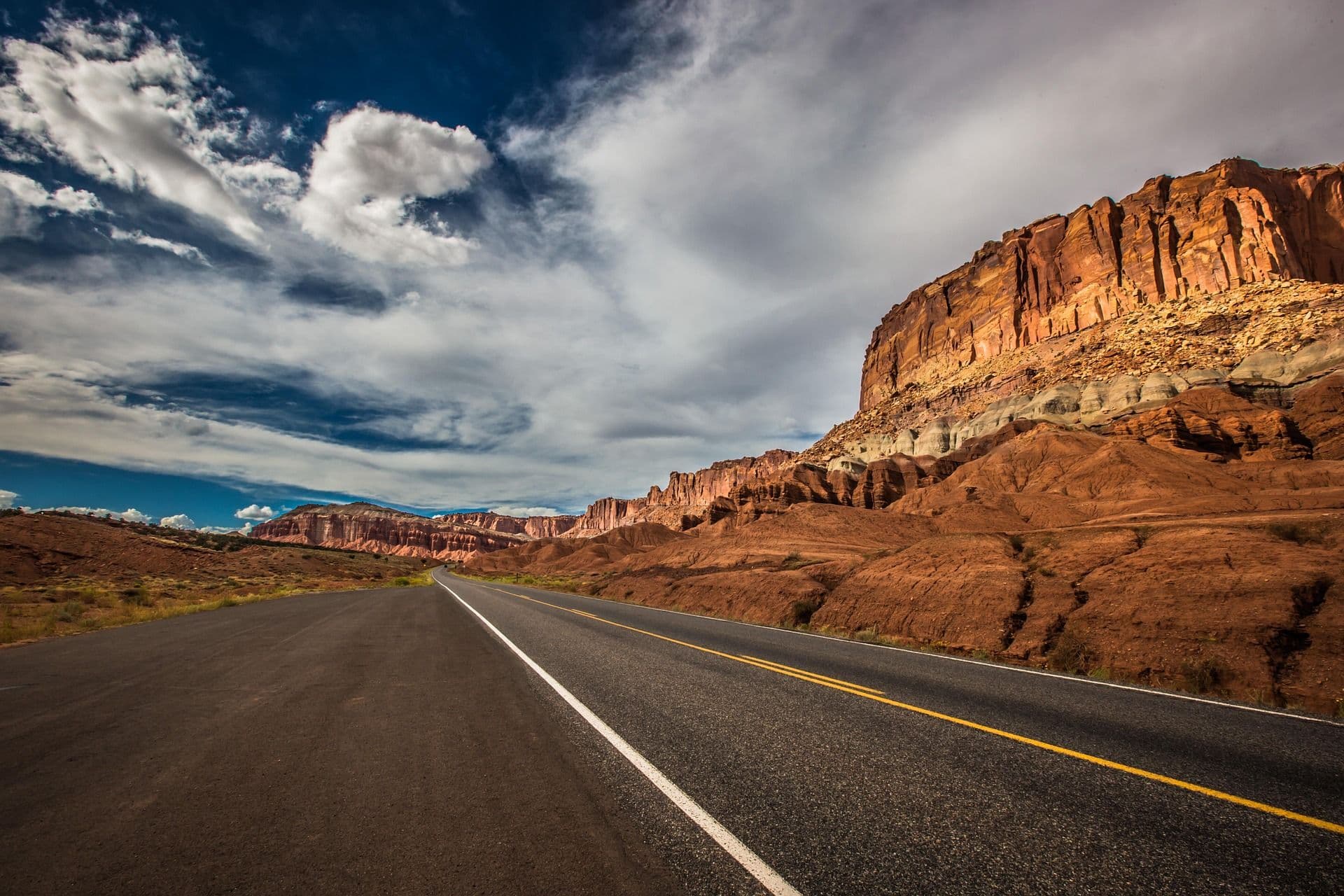
Understanding hiking in the USA requires thinking in regions. The country spans five distinct geological and ecological zones that each produce a different trail experience, different seasonal windows, and different preparation requirements. No single landscape defines it.
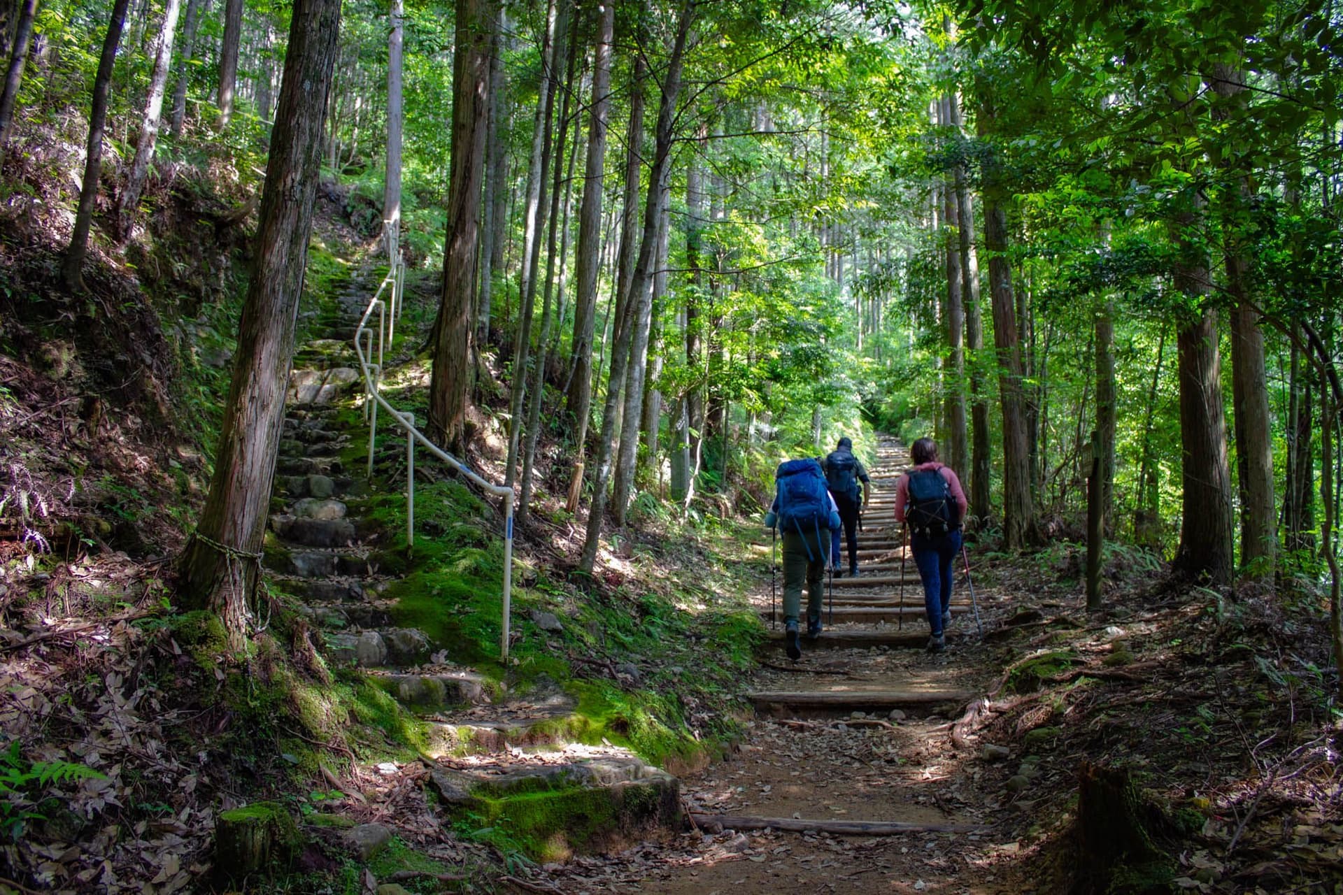
The Appalachian Mountains run the full length of the eastern seaboard from Alabama to Maine, and the Appalachian Trail corridor follows this spine for its entire 3,509 km (2,180 mi) length. Elevations here stay modest by western standards, between 300 m and 1,600 m (985 ft to 5,250 ft) for most of the trail, with the highest point at Clingmans Dome in Great Smoky Mountains National Park at 2,025 m (6,643 ft). The terrain is dense forest, sharp ridgelines, and the notorious rockiness of Pennsylvania and New England. The southern Appalachians are defined by hardwood cover and rhododendron tunnels; the northern section, above New Hampshire's treeline in the Presidential Range, is open and genuinely exposed, demanding a different category of preparation.
The American West is a different proposition in every respect. The Sierra Nevada of California runs roughly 640 km (400 mi) north to south, with a high country that sits almost entirely above 3,000 m (9,840 ft). The John Muir Trail traverses this range for most of its 344 km (214 mi), crossing six passes above 3,400 m (11,155 ft) and finishing on the summit of Mount Whitney at 4,421 m (14,505 ft), the highest point in the contiguous United States. Snow closes the high passes until late June or early July, and early-season conditions require technical skills that standard day-hikers are not equipped for.
The Colorado Rockies add a third altitude tier. Dozens of peaks exceed 4,267 m (14,000 ft), and trails like the Colorado Trail and the Continental Divide Trail spend days above treeline in terrain where afternoon lightning storms arrive with near-daily reliability in summer. The American Southwest, covering Utah and Arizona, is canyon country: sandstone walls layered in red, orange, and cream, slot canyons that narrow to shoulder width, and temperatures that reach 40 degrees C (104 degrees F) on the inner canyon floor of the Grand Canyon in summer. The Pacific Northwest, wetter and greener, is anchored by volcanic peaks. Mount Rainier, Mount Hood, and the Cascade Range lie beneath forest lines that reach 2,000 m (6,560 ft), with the Pacific Crest Trail threading between them on its journey northward.
Wildlife varies by region and matters for route planning. Black bears are present in most wilderness areas on both coasts. Grizzly bears occupy specific zones in Montana, Wyoming, and northern Idaho, where carrying bear spray is considered standard practice rather than optional. Moose, elk, bison (in Yellowstone and parts of the Rockies), pronghorn, mountain lions, and an extraordinary range of birdlife are part of the trail experience across different regions. In the Grand Canyon, California condors, reintroduced after near-extinction, can be seen from the rim and, occasionally, from the canyon floor.
Explore our amazing hiking tours in USA now!
Before the Appalachian Trail had white blazes or the Pacific Crest Trail had a permit system, the landscape was already mapped in footpaths. The Indigenous peoples of North America established trade, hunting, and migration routes across the continent long before European contact, following the logic of the land: ridgelines that stayed dry, passes that were passable, river crossings that were manageable. These were not informal tracks but maintained, well-traveled corridors that connected communities across thousands of miles.
Among the nations whose routes shaped the modern trail landscape are the Cherokee, whose ancestral territory covers much of the southern Appalachians; the Diné (Navajo), whose homeland spans the Colorado Plateau in Arizona and New Mexico; the Shoshone-Bannock and Crow, who occupied the Yellowstone plateau for thousands of years before the park's establishment; the Blackfeet, whose territory in Montana forms the eastern boundary of Glacier National Park; and the Anishinaabe, whose lands border the route of the North Country Trail in the Great Lakes region. The Pacific Crest Trail passes through the ancestral territories of more than 100 tribal nations.
The history of how these landscapes became national parks is layered and, in several cases, inseparable from forced removal. Yellowstone, the world's first national park, established in 1872, was created partly on the premise of empty wilderness, a premise that required displacing the Shoshone-Bannock, Crow, and other nations who had occupied the area for millennia. The reframing of occupied Indigenous land as available wilderness was a pattern repeated across the national park system's early expansion. More recent decades have moved toward co-stewardship arrangements, tribal consultation requirements, and Indigenous heritage programs operating inside park boundaries.
The modern American trail system is largely a 20th-century project. Benton MacKaye, a forester and regional planner, proposed the Appalachian Trail in 1921 as an antidote to industrial urban life. The trail was completed by 1937, maintained entirely by volunteer trail clubs. The National Trails System Act of 1968 formalised the AT and Pacific Crest Trail as National Scenic Trails and established a framework for federal protection. The Continental Divide Trail took decades longer to reach completion and remains the least-developed of the Triple Crown.
The hiker culture that has grown up around the long-distance trail system is specific to the United States. Earl Shaffer completed the first recorded solo thru-hike of the Appalachian Trail in 1948, establishing the concept of walking an entire long-distance trail in a single continuous journey. What followed was a culture of trail names (pseudonyms hikers adopt on the trail), trail magic (spontaneous acts of generosity from strangers at road crossings and shelter areas), and trail angels (the volunteers who supply both). These practices have no direct equivalent on European long-distance routes, and international hikers who arrive expecting something like the Camino or the Kungsleden tend to find the social dimension of US trail culture genuinely surprising.
No aspect of hiking the USA is more distinctive to an international visitor than the national park permit system. The United States manages 63 designated national parks through the National Park Service (NPS), and hiking in the backcountry of most of them requires a permit. The permit system exists because the demand for access to places like the Grand Canyon, Yosemite, and Grand Teton exceeds what the land can absorb without ecological and experiential degradation.
The broad architecture of the system is consistent even if the details vary by park: overnight backcountry permits are required almost everywhere, day-use permits are required on some of the most congested routes (Angels Landing in Zion, the Half Dome cables hike in Yosemite), and both are increasingly managed through lottery systems hosted on Recreation.gov. The Grand Canyon Rim-to-Rim backcountry permit operates through a monthly lottery on Recreation.gov, opening on the 1st of the month four months before the intended start date, with acceptance rates under 10% for peak dates. The John Muir Trail permit requires a Yosemite wilderness permit for the northern trailhead, available 24 weeks in advance through a competitive lottery. The Teton Crest Trail assigns overnight permits by camping zone; reservations open in January and the most sought-after zones fill within minutes of the window opening.
For international hikers, this means permit planning is not logistical background noise but the central planning task, and it must begin months before travel. The standard approach is to identify multiple target dates, apply for all of them simultaneously, and build travel logistics around whichever permit comes through. Walk-up permits exist for most trails as a percentage of daily allocations held back from advance reservations, but they are never guaranteed in peak summer months, and relying on them without a fallback is a common mistake.
Park entry fees are separate from backcountry permits. Individual national park entry runs USD 15 to 35 per vehicle per visit, depending on the park. The America the Beautiful Annual Pass at USD 80 covers all national parks and federal recreation areas for a full 12 months and is the best-value option for any trip involving more than three park visits. It is available online at store.usgs.gov and at national park entrance stations.
There is no universal best season for hiking the USA. The country's geographic range means the seasonal windows differ dramatically by region, and getting the timing wrong in the American West, or in the Grand Canyon, carries real consequences.
The Sierra Nevada, Colorado Rockies, and Cascade Range are all high-altitude environments where the hiking season is constrained by snowpack. High passes on the John Muir Trail, Teton Crest Trail, and Pacific Crest Trail typically do not clear until late June or early July in a standard snow year; early-season crossings require an ice axe and the experience to use one. The reliable window is July through mid-September, when passes are clear, wildflowers are at their peak in the high basins, and daytime temperatures in the high country sit between 5 degrees C (41 degrees F) at night and 20 degrees C (68 degrees F) during the day. Early September can bring the first autumn snowfall at high elevations, particularly in the Rockies and the Cascades.
The Grand Canyon, the canyon country of Utah, and the desert landscapes of the Southwest follow opposite seasonal logic. Spring (March to May) and autumn (September to November) are the windows. Summer temperatures on the Grand Canyon's inner canyon floor regularly exceed 40 degrees C (104 degrees F), and the National Park Service advises against hiking below the rim between 10am and 4pm from May through September. Heat-related illness is the most common medical emergency in the canyon, and the uphill return to the rim in full sun is the specific context in which it occurs. The canyon in April or October is a fundamentally different experience from the canyon in July.
Northbound AT thru-hikers traditionally leave Springer Mountain in Georgia between late March and mid-April, targeting a Katahdin finish before Baxter State Park's season closes in mid-October. The trail's southern sections are accessible year-round. The White Mountains of New Hampshire and the Mahoosuc Range in Maine are genuine alpine environments, with above-treeline exposure and conditions that demand full four-season preparedness outside the June to September window. For section hikers, the Shenandoah section in Virginia and the trail through Pennsylvania run comfortably from April through October, while the New England sections are best approached between late June and early September.
The Kalalau Trail on Kauai's Na Pali Coast is technically hikeable year-round, but summer (May through September) brings drier conditions, lower river levels at crossings, and calmer seas. Winter rain can transform the trail's narrow clifftop sections into genuinely hazardous terrain and swells river crossings beyond safe levels. The trail's reputation for danger is rooted in winter conditions more than its summer character.
The Washington and Oregon sections of the PCT, and circuit routes like the Wonderland Trail around Mount Rainier, have the shortest reliable windows because of persistent snowpack and the instability of Pacific weather systems. August tends to be the driest month across the region; July and September are viable but require tracking current snow conditions. The Cascade volcanoes generate their own weather, and summit-level conditions can change within hours regardless of the season.
The AT is the most walked long-distance trail in the world. It runs 3,509 km (2,180 mi) from Springer Mountain in Georgia to Mount Katahdin in Maine, moving through 14 states along the spine of the Appalachian Mountains. The terrain is almost entirely forested, with above-treeline walking concentrated in the Presidential Range of New Hampshire's White Mountains and on the summit of Katahdin itself. The trail's elevation profile is relentless without being extreme: the highest point is Clingmans Dome at 2,025 m (6,643 ft), but the accumulated ascent over the full trail is roughly equivalent to climbing Mount Everest 16 times.
Most thru-hikers take 5 to 7 months to complete the full trail. For section hikers, the Shenandoah National Park section in Virginia, the White Mountains stretch in New Hampshire, and the approach to Katahdin in Maine each offer condensed versions of the full experience at different difficulty levels. Trail towns like Hanover, New Hampshire, Damascus, Virginia, and Monson, Maine are set up specifically for hikers, with hostels, grocery access, and shuttle connections. No permit is required to hike the AT, but camping at designated shelters and campsites in certain high-use areas may require fee payment.
Quick Facts: Appalachian Trail Total Distance: 3,509 km (2,180 mi) Duration: 5 to 7 months (thru-hike); 3 to 7 days (sections) Difficulty: Challenging; Very Challenging in White Mountains High Point: Clingmans Dome, 2,025 m (6,643 ft) Best Season: April to October; June to September in White Mountains Accommodation: Lean-to shelters every 10 to 20 km; hiker hostels in trail towns Gateway: Springer Mountain, Georgia (south) / Baxter State Park, Maine (north)
The PCT runs 4,265 km (2,650 mi) from Campo, California, at the Mexican border to Manning Park in British Columbia, passing through California, Oregon, and Washington. The trail encompasses three distinct environments that feel like separate hikes: the Mojave Desert and Southern California chaparral for the first 1,000 km; the High Sierra of Central California, including the JMT overlap section with its 3,400 m (11,155 ft) passes; and the volcanic landscapes of Oregon and the Cascades of Washington, where crater lakes, lava fields, and glacier-capped peaks dominate the route.
Northbound thru-hikers typically start between late March and late April, timing the desert section to avoid extreme heat before moving into the Sierra as the snowpack begins to thin. The Sierra section, roughly between Kennedy Meadows and South Lake Tahoe, is where the trail filters most first-timers: sustained snow travel in early season, multiple river crossings from snowmelt, and passes above 3,600 m (11,811 ft) test any hiker's preparation. PCT long-distance permits, required for 500 or more continuous miles, are issued through a lottery by the Pacific Crest Trail Association at pcta.org, with registration opening in autumn for the following year's season.
Quick Facts: Pacific Crest Trail Total Distance: 4,265 km (2,650 mi) Duration: 4 to 6 months (thru-hike) Difficulty: Very Challenging High Point: Forester Pass, 4,009 m (13,153 ft) Best Season: Northbound April to September; southbound June onwards Accommodation: Dispersed camping; resupply towns every 80 to 160 km Gateway: Campo, California (south) / Manning Park, British Columbia (north) Permit: PCT Long-Distance Permit required for 500+ miles via pcta.org
The JMT is the High Sierra in concentrated form. The 344 km (214 mi) trail runs from Happy Isles in Yosemite Valley at 1,230 m (4,035 ft) to the summit of Mount Whitney at 4,421 m (14,505 ft), the highest point in the contiguous United States. The trail spends virtually its entire length above 2,400 m (7,874 ft), crosses six mountain passes above 3,400 m (11,155 ft), and accumulates approximately 14,000 m (45,932 ft) of total elevation gain. There are no towns, no huts, and no bail-out options for much of the southern half. It is remote alpine terrain that demands experience, acclimatisation, and thorough logistics.
The vast majority of hikers walk north to south, starting in Yosemite Valley and finishing at Whitney Portal, which allows gradual acclimatisation before the sustained high-altitude south. Four resupply points, at Tuolumne Meadows, Reds Meadow, Vermilion Valley Resort, and Muir Trail Ranch, allow manageable food carries of 5 to 6 days. Bear canisters are required throughout. The Yosemite wilderness permit is the hardest planning element: issued through a competitive lottery 24 weeks in advance on recreation.gov, it is one of the most oversubscribed permits in the US national park system.
Quick Facts: John Muir Trail Total Distance: 344 km (214 mi) Duration: 18 to 24 days Difficulty: Very Challenging High Point: Mount Whitney, 4,421 m (14,505 ft) Best Season: July to September Accommodation: Dispersed wilderness camping; four resupply points Gateway: Happy Isles, Yosemite Valley (north) / Whitney Portal (south) Permit: Yosemite wilderness permit via lottery at recreation.gov; apply 24 weeks in advance
The Rim-to-Rim is among the most geologically immersive experiences in American hiking. The 34 km (21 mi) point-to-point route descends from one rim of the Grand Canyon to the Colorado River at approximately 730 m (2,395 ft) and climbs to the opposite rim, moving through roughly 1,600 m (5,250 ft) of vertical terrain that exposes rock layers spanning two billion years of Earth history. The canyon is not a mountain landscape seen from a distance: you are inside it, below the cliffs, moving through a world where the scale of time is physically present in the walls around you.
Most hikers walk North Rim to South Rim over two to three days, camping at Bright Angel Campground or Cottonwood Campground near the canyon floor. The North Rim, at 2,440 m (8,005 ft), closes from mid-November to mid-May. The South Rim, at 2,134 m (6,998 ft), is accessible year-round. Spring and autumn are the viable windows: summer temperatures at the canyon floor regularly exceed 40 degrees C (104 degrees F), and the NPS advises against below-rim hiking between 10am and 4pm from May through September. Backcountry permits are required for overnight camping and are issued through a monthly lottery on Recreation.gov, with applications accepted from the 1st of the month four months before the intended start.
Quick Facts: Grand Canyon Rim-to-Rim Total Distance: 34 km (21 mi), point to point Duration: 2 to 3 days Difficulty: Challenging Low Point: Colorado River, approximately 730 m (2,395 ft) Best Season: April to May; September to October Accommodation: Bright Angel and Cottonwood Campgrounds (permit required) Gateway: North Rim Village / South Rim Village, Grand Canyon National Park Permit: Backcountry permit via Recreation.gov lottery; apply 4 months in advance Safety Note: No below-rim hiking recommended between 10am and 4pm in summer. Heat illness is the canyon's most common emergency.
The Teton Crest Trail is roughly 64 km (40 mi) of sustained high-alpine hiking through Grand Teton National Park in Wyoming, and by most measures it is the finest 3 to 5 day backpacking route in the lower 48. The trail stays between 2,130 m (6,988 ft) and 3,260 m (10,696 ft), threading through Death Canyon, Death Canyon Shelf, Alaska Basin, and the South Fork of Cascade Canyon, with the granite spires of the Teton Range in the skyline for virtually the entire route. Death Canyon Shelf, a high bench that traverses directly beneath cliff faces at roughly 2,900 m (9,514 ft), is consistently cited as one of the finest single miles of trail anywhere in the Rocky Mountains.
The classic itinerary begins at Teton Village using the Jackson Hole aerial tram, which lifts hikers 1,219 m (4,000 ft) to eliminate the opening climb. From there the route runs north through the high basins, finishing at Jenny Lake or String Lake in the park's east. The permit process is zone-based and competitive: reservations open on Recreation.gov on January 7 and prime zones, particularly Death Canyon Shelf, fill within minutes. Bear canisters are required, and the grizzly bear designation of this terrain means bear spray is the standard tool rather than a precaution. Early season crossings of Paintbrush Divide, at approximately 3,260 m (10,696 ft), can hold steep snow into August, requiring an ice axe in poor years.
Quick Facts: Teton Crest Trail Total Distance: Approximately 64 km (40 mi) Duration: 3 to 5 days Difficulty: Challenging High Point: Hurricane Pass, approximately 3,260 m (10,696 ft) Best Season: July to September Accommodation: Zone-based backcountry camping; permit required Gateway: Teton Village (south) / Jenny Lake or String Lake (north), Wyoming Permit: Grand Teton backcountry permit via recreation.gov; reservations open January 7
The Kalalau Trail runs 18 km (11 mi) one way along the Na Pali Coast on the Hawaiian island of Kauai, from Ke'e Beach at the end of the north shore highway to Kalalau Beach, a remote crescent of sand accessible only on foot or by sea. The terrain is unlike anything on the continental US: dense tropical forest, sheer sea cliffs above the Pacific, red dirt ridgelines above 300 m (984 ft) drops, multiple river crossings, and a coastal environment where the weather and sea conditions shape the entire experience. The trail ends at a beach that is, by any measure, worth the effort to reach.
The first 3.2 km to Hanakapi'ai Beach can be done as a day hike without a permit, and stands alone as one of the finest short hikes in the Pacific. The full trail requires an overnight camping permit for Kalalau Beach, issued through the Hawaii State Division of State Parks at camping.ehawaii.gov, releasing 90 days in advance. Summer (May through September) brings drier conditions and calmer seas. Winter rain transforms the trail into a significantly more dangerous undertaking, with swollen river crossings, slick surfaces on the exposed ridgeline sections, and seas that make emergency evacuation by boat impossible.
Quick Facts: Kalalau Trail Total Distance: 18 km (11 mi) one way; 22 km (13.7 mi) return to Hanakapi'ai Duration: 2 to 3 days Difficulty: Challenging Best Season: May to September Accommodation: Kalalau Beach primitive campsite (permit required) Gateway: Ke'e Beach, north shore, Kauai, Hawaii Permit: Hawaii State camping permit at camping.ehawaii.gov; releases 90 days in advance Safety Note: River crossings are dangerous in rain. Check conditions before departure. No lifeguard services on the Na Pali Coast.
Dive into our curated USA hiking adventures today!
Hiking in the USA, particularly on the long-distance trails of the east and west, comes with a food culture that has no real equivalent elsewhere. Part of this is necessity, part of it is tradition, and part of it reflects the particular character of American hiking, where the trail and the town exist in close proximity and the passage between the two is a ritual in itself.
On a thru-hike, a hiker burns between 3,500 and 5,000 calories per day. The body recalibrates to this demand over time, and the result is what hikers call hiker hunger, a sustained, near-insatiable drive for calories that sets in around the one-month mark and remains constant for as long as the hiking does. On the trail itself, the standards are lightweight and calorie-dense: ramen, instant mashed potatoes, peanut butter tortillas, Clif bars, jerky, nuts, and instant oatmeal form the backbone of most hikers' resupply strategy. Freeze-dried meals from brands like Mountain House and Backpacker's Pantry are the upgrade option and are available through outfitters in most trail towns.
The trail town resupply is the ritual that distinguishes hiking the USA from most other long-distance destinations. Every 3 to 5 days on the Appalachian Trail, a hiker crosses a road near a town, hitches or walks in, and re-enters civilization long enough to eat, sleep, and reload. The first meal in town is consistent and legendary: pizza, burgers, ice cream, or a full breakfast with eggs and bacon, in whatever order seems most urgent. The half-gallon challenge at Pine Grove Furnace State Park in Pennsylvania, where hikers eat a half-gallon of ice cream to mark the AT's unofficial halfway point, is among the trail's oldest and most-observed informal traditions.
On the Pacific Crest Trail, the resupply dynamic is more complex. The PCT crosses fewer towns and passes through longer stretches of genuine wilderness where resupply requires mailing packages ahead to post offices and outfitters at predetermined stops. Kennedy Meadows, the gateway to the High Sierra, is the first of these critical resupply points; South Lake Tahoe, Cascade Locks on the Oregon border, and several smaller post offices fill the others. Planning a PCT resupply strategy can be as involved as the hiking itself, and most hikers research it months before starting.
For international visitors on shorter itineraries, the gateway towns to the national parks deliver their own regional character. Moab in Utah is high-desert diner culture with some excellent breweries. Jackson, Wyoming, at the southern edge of the Tetons, has a full range from diner breakfasts to serious restaurants. Flagstaff, Arizona, a university town at 2,100 m (6,890 ft), serves as the supply hub for the Grand Canyon, with quality restaurants and good grocery access. On the Na Pali Coast side of Kauai, Hanalei town, just before Ke'e Beach, has the kind of low-key food scene that fits a coastal hiking base.
Get started with your Hiking adventure now!
Accommodation across US hiking routes spans wilderness camping to serviced alpine huts to full lodge hotels inside national parks. The choice depends on the trail, the region, and how far in advance you plan.
Wilderness camping is the default for nearly all long-distance routes. In most national forests and Bureau of Land Management land, dispersed camping is permitted without a fee outside of designated campgrounds, provided you follow Leave No Trace principles and maintain minimum distances from water sources and trails. In national parks, backcountry camping is restricted to designated sites, requires a permit, and in popular parks those permits are competitive. The system is consistent in principle but varies significantly in practice: camping in a remote stretch of the Colorado Trail in a national forest is simple and free; camping in Yosemite requires advance planning at the level of a flight booking.
The Appalachian Trail maintains approximately 250 three-sided lean-to shelters spaced roughly every 10 to 20 km along the trail. These are free, first-come-first-served in most states, and accommodate 6 to 16 hikers on a wooden sleeping platform. They typically include a nearby water source, a privy, and a bear hang cable or bear box. The White Mountain Hut System in New Hampshire is the high-service exception: eight full-service high-altitude huts, operated by the Appalachian Mountain Club, are spaced approximately 20 km apart and provide cooked meals and bunk sleeping from June through mid-September at approximately USD 125 to 175 per person per night. Reservations are required and open months in advance at outdoors.org.
Hiker hostels are common along the Appalachian Trail and, to a lesser extent, the Pacific Crest Trail. These offer bunk-style accommodation for USD 25 to 50 per night, typically with laundry, showers, kitchen access, and locker facilities. In trail towns, motels and budget hotels provide the full-room alternative. At the premium end, lodges within national parks range from functional campground cabins to the historic Phantom Ranch inside the Grand Canyon. Phantom Ranch, the only lodge below the canyon rim, offers dormitory beds and private cabins for approximately USD 60 to 130 per person. Reservations open 15 months in advance through a separate lottery system at grandcanyonlodges.com, and availability at any given date is not guaranteed.
The USA has major international airports in Los Angeles, San Francisco, New York (JFK and Newark), Atlanta, Chicago, Seattle, Denver, and Miami. For western trail routes, including the PCT, JMT, and Teton Crest Trail, Los Angeles and San Francisco are the natural arrival hubs. For Appalachian Trail southbound starts, Portland International Airport in Maine is the nearest major gateway; for northbound starts, Atlanta's Hartsfield-Jackson Airport serves Springer Mountain in Georgia via a shuttle connection. Rental cars are the most practical option for reaching most trailheads, as public transport to national park trailheads is limited outside of a small number of park shuttle systems.
Citizens of 40 countries, including most of the European Union, the United Kingdom, Australia, Japan, and South Korea, can enter the United States without a visa under the Visa Waiver Program. However, all VWP travellers must obtain an Electronic System for Travel Authorization (ESTA) before departure. Applications are made at esta.cbp.dhs.gov and cost USD 21, with approval typically confirmed within 72 hours. Citizens of countries not enrolled in the Visa Waiver Program must apply for a B-2 tourist visa at the US Embassy in their country. Entry requirements and ESTA procedures are subject to change; check the official government site before travelling.
The primary navigation apps for hiking the USA are Gaia GPS and AllTrails. Gaia GPS is the more capable option for backcountry navigation, offering downloadable topographic maps, track recording, and route-planning functions that work offline. AllTrails is more widely used for route discovery and has crowd-sourced reviews and current conditions notes for most popular routes. For AT hikers, the FarOut (formerly Guthook) app provides shelter-by-shelter data, water source locations, and an active community feed from current hikers. Both Gaia GPS and FarOut require paid subscriptions for full offline functionality.
Recreation.gov is the central permit platform for US national parks and most federal wilderness areas. For any hike involving a national park backcountry area, an America the Beautiful Annual Pass, or a campground reservation, this is the booking system. Permit processes differ by trail and park, and they update periodically. The official NPS website at nps.gov is the authoritative source for permit rules, fees, and lottery schedules for each park. Apply at the earliest permitted date, have alternative dates prepared, and treat permit logistics as a non-negotiable first step in trip planning.
Water treatment is required for all backcountry hiking in the USA. Giardia is present in most backcountry water sources; a filter such as the Sawyer Squeeze or a UV treatment device is standard kit. Wildlife safety varies by region: bear canisters are required in most of the Sierra Nevada and the Tetons; bear spray is the recommended or required tool in Montana, Wyoming, and parts of Idaho. Flash flooding in slot canyons in Utah and Arizona is a genuine and serious risk; check weather upstream before entering any canyon system. Cell coverage in the backcountry is typically absent or intermittent; a personal locator beacon or satellite communicator (Garmin inReach or SPOT) is recommended for any multi-day wilderness route.
Citizens of the 40 countries enrolled in the Visa Waiver Program can enter the USA without a visa, but must obtain an ESTA before departure via esta.cbp.dhs.gov, at a cost of USD 21. Approval typically takes 72 hours. Citizens of countries not in the VWP require a B-2 tourist visa from the US Embassy in their home country. Entry requirements can change, so verify current rules before booking travel.
It depends on the trail. The John Muir Trail Yosemite entry permit lottery opens 24 weeks in advance. Grand Canyon Rim-to-Rim backcountry permits operate on a monthly lottery, opening on the 1st of the month four months before the start date. Teton Crest Trail permits open in early January for the full summer season. PCT long-distance permits are issued in late autumn for the following year. As a general rule, 4 to 6 months of advance planning is the minimum for any peak-season national park backcountry trip, and popular permits are frequently oversubscribed regardless.
This depends entirely on which trail and which section. The Grand Canyon Rim-to-Rim is accessible to fit hikers with multi-day hiking experience, provided the season is appropriate and heat precautions are followed. The John Muir Trail requires sustained cardiovascular fitness, acclimatisation to elevations above 3,400 m (11,155 ft), and experience with wilderness navigation. The Teton Crest Trail sits between these in terms of challenge. The Appalachian Trail taken in sections ranges from moderate (Shenandoah section in Virginia) to demanding (White Mountains in New Hampshire). All of the trails described in this guide are serious multi-day routes; none should be approached as a casual walk.
Most major US routes are entirely self-guided. The trail infrastructure on the Appalachian Trail, the Pacific Crest Trail, and within the national parks is comprehensive: detailed waymarking, reliable navigation apps, established camping areas, and large online communities provide the information needed to plan and execute most hikes without professional guidance. Guided trips are available for all major routes and offer advantages including permit procurement on competitive trails, logistics management, and local knowledge. For the JMT, the Teton Crest Trail, and trails in technical terrain, a guided option removes the complexity of the permit lottery and supply planning.
Trail magic is the American practice of unexpected generosity directed at hikers along the trail. A cooler of drinks at a road crossing, a stranger barbecuing for passing hikers, a handwritten note directing people to fresh fruit cooling in a stream. Trail angels are the people who create these moments. The practice is most developed on the Appalachian Trail, where it has been a documented part of hiker culture for decades, but it exists in spirit on most US long-distance routes. International hikers frequently describe it as the most unexpected aspect of the trail experience.
The Triple Crown refers to the three longest and most established National Scenic Trails in the USA: the Appalachian Trail (3,509 km / 2,180 mi), the Pacific Crest Trail (4,265 km / 2,650 mi), and the Continental Divide Trail (4,989 km / 3,100 mi). Hikers who complete all three earn the informal designation of Triple Crowner. The AT and PCT are the most walked and most developed in terms of infrastructure; the CDT is the most remote and logistically demanding, with significant off-trail navigation required in places. Most Triple Crown hikers complete the routes over several years rather than consecutively.
For Grand Canyon hiking, South Rim Village is the primary base, with lodging, restaurants, and campgrounds inside the park. Flagstaff, Arizona (roughly 130 km / 81 mi south) is the nearest city with airport connections and full services. For Utah canyon country, Moab is the hub for Canyonlands and Arches National Parks, while Springdale sits at the entrance to Zion National Park. Both are small towns with solid hiking infrastructure, gear shops, and accommodation at various price points.
The Appalachian Trail is among the most thoroughly documented and socially active long-distance trails in the world. The density of shelters, the frequency of road crossings, and the active hiker community mean that genuine isolation is rare on most sections. Typical trail hazards are weather (particularly on exposed sections in the White Mountains), animal encounters (black bears are present throughout; following bear hang or canister protocols eliminates the vast majority of risk), and the physical difficulty of the terrain. Solo hiking on the AT is normal and widely practiced; the standard precautions of telling someone your itinerary and carrying emergency communication apply.
The currency is the US Dollar (USD). National park entry fees range from free to USD 35 per vehicle, and the America the Beautiful Annual Pass at USD 80 covers all parks for 12 months. Backcountry permits typically cost USD 5 to 15 per person per night, with non-refundable application fees on lottery systems. Hiker hostels charge approximately USD 25 to 50 per night. Major gateway cities are expensive by general international standards; trail towns and rural areas are considerably less so. Budget planning for any western national park trip should include permit application fees, transport (often requiring car rental), and park entry, in addition to accommodation and food.
The USA rewards hikers who understand its scale. This is not a destination where a single two-week trip covers the country's range. What makes hiking the USA worthwhile for an international visitor is the quality of what exists in any given region: the Sierra Nevada, the Grand Canyon, the Na Pali Coast, and the New England high peaks each justify the journey on their own terms. A well-timed permit, a planned trail-town itinerary, and some time spent on the permit lotteries months in advance are the real difference between a good trip and a great one.
The trail culture, the trail names, and the particular generosity of trail magic are things you absorb in the doing rather than plan in advance. They belong to a country where walking long distances through wild country became, over eight decades, a cultural institution with its own language and its own codes of generosity.
If you are planning a hiking trip to the USA and want help with route selection, permit strategy, or a fully guided experience, get in touch with our team at Art of Bicycle Trips. We can tailor an itinerary to your timeline, fitness level, and the landscapes you want to walk through.
Get started with your Hiking adventure now!
Create a private trip or join a small-group departure.