Chat with us on WhatsApp. We're just a message away.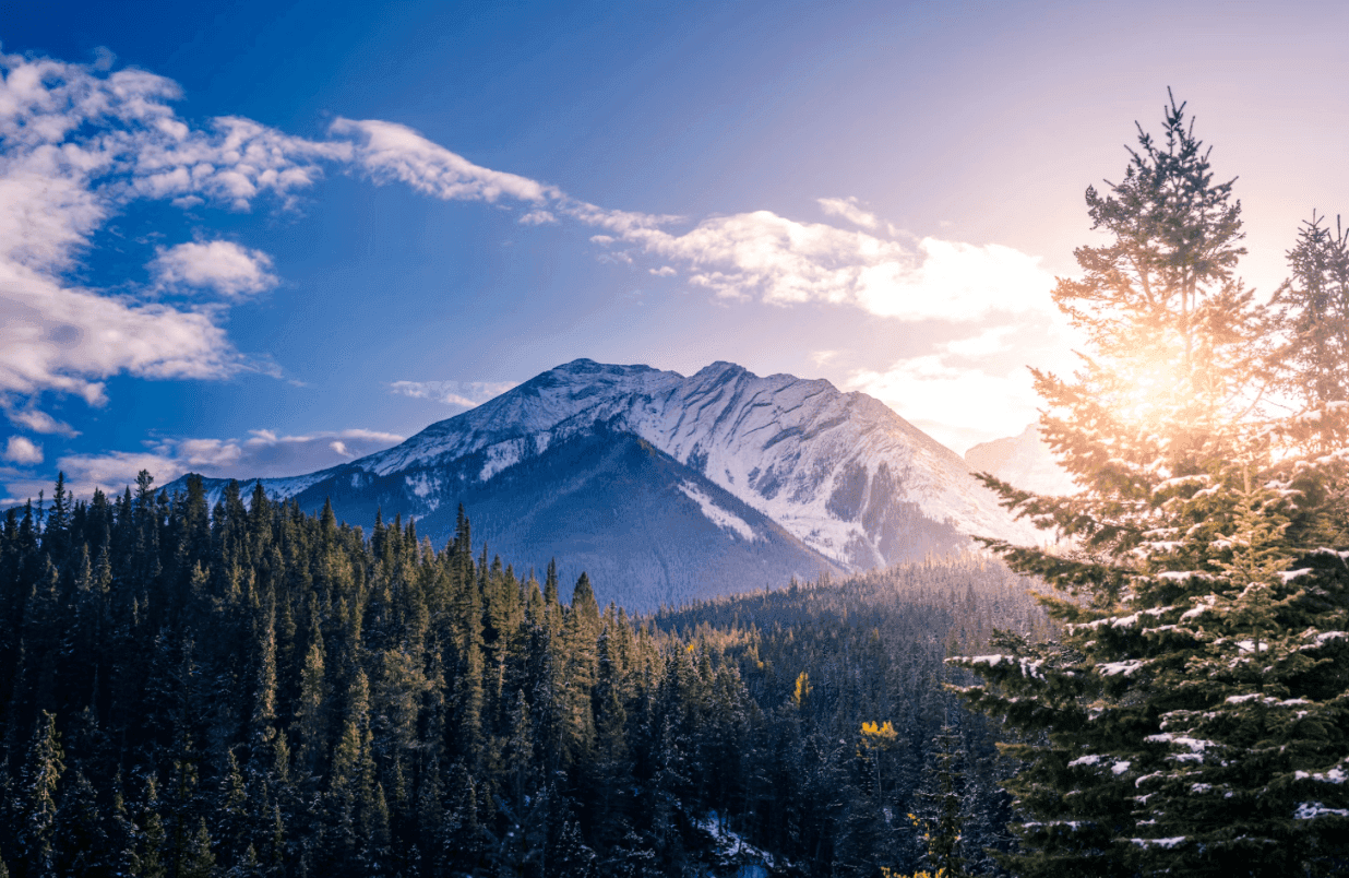
Canada is the second-largest country on Earth, and hiking in Canada means deciding which version of that scale to take on. British Columbia alone holds more mountain terrain than most countries possess in total. Exploring the country from coast to coast to coast, the phrase Canadians use to include the Arctic alongside the Atlantic and Pacific, means moving between temperate rainforest, the glaciated spine of the Canadian Rockies, the granite and lake country of the Canadian Shield, and the fog-bound headlands of Newfoundland's Atlantic coast. No single season or skill level covers all of it. What unifies the country's hiking culture is something more specific than geography: a relationship with genuine wilderness that begins close to major cities and, within a few hours of walking, leaves cell coverage, road access, and short rescue times behind.
Unlike destinations with one centralized trail authority, hiking in Canada runs through a patchwork of jurisdictions. Parks Canada manages the backcountry inside national parks, including the permit systems for the West Coast Trail and the Skyline Trail. Provincial park agencies manage another large share. Independent trail associations, often volunteer-run charities, built and still maintain some of the country's longest and oldest routes, including the Bruce Trail in Ontario and the East Coast Trail in Newfoundland. Threading through all of it is the Trans Canada Trail, the world's longest recreational trail network, covered in its own section below because no single fact says more about the scale of trail-building in this country.
The terrain demands honest preparation. Backcountry distances in Canada are real distances. The Long Range Traverse in Newfoundland has no marked trail at all. The Skyline Trail in Jasper stays above treeline for 25 km (15.5 mi) with no shelter from sudden weather. Black bears range across nearly every forested province, and grizzly bears are resident through much of British Columbia and the Alberta Rockies; this is not an abstract footnote but a genuine part of trip planning, covered in detail in the safety section of this guide. None of this should discourage a well-prepared hiker. It should set expectations correctly before departure.
What this country offers a hiker in return is rare in its range. The West Coast Trail on Vancouver Island follows a coastline of sea stacks, surge channels, and old-growth rainforest along a path First Nations used for travel and trade centuries before it became a hiking route. The Skyline Trail crosses two consecutive days of alpine ridge in the Canadian Rockies with views in every direction. The Long Range Traverse crosses a roadless plateau above a fjord carved into rock that was once part of the Earth's mantle. The East Coast Trail in Newfoundland passes icebergs in June and whales through the summer, often on the same afternoon walk.
Indigenous nations shaped these landscapes and the paths through them long before national parks or trail associations existed. The history section of this guide addresses that history directly, because understanding it changes how several of these trails read from the ground.
This guide covers six trails in depth, spanning British Columbia, Alberta, Newfoundland, and Ontario: the West Coast Trail, the Skyline Trail, the Plain of Six Glaciers, the Long Range Traverse, the East Coast Trail, and the Bruce Trail. It also covers the Trans Canada Trail, the seasonal calendar, the accommodation systems, food culture by region, and the practical logistics, including bear safety, that any hiking trip in Canada needs to take seriously.
Explore our amazing hiking tours in Canada now!
The Coast Mountains and Vancouver Island define hiking on Canada's Pacific edge. Rainfall here is heavy and the forest responds accordingly: old-growth cedar, hemlock, and Sitka spruce form a temperate rainforest canopy that, in places, has stood undisturbed for over 800 years. The west coast of Vancouver Island, where the West Coast Trail runs, alternates between dense forest and beach walking governed by tides, with sea stacks and surge channels cut into sandstone by the open Pacific.
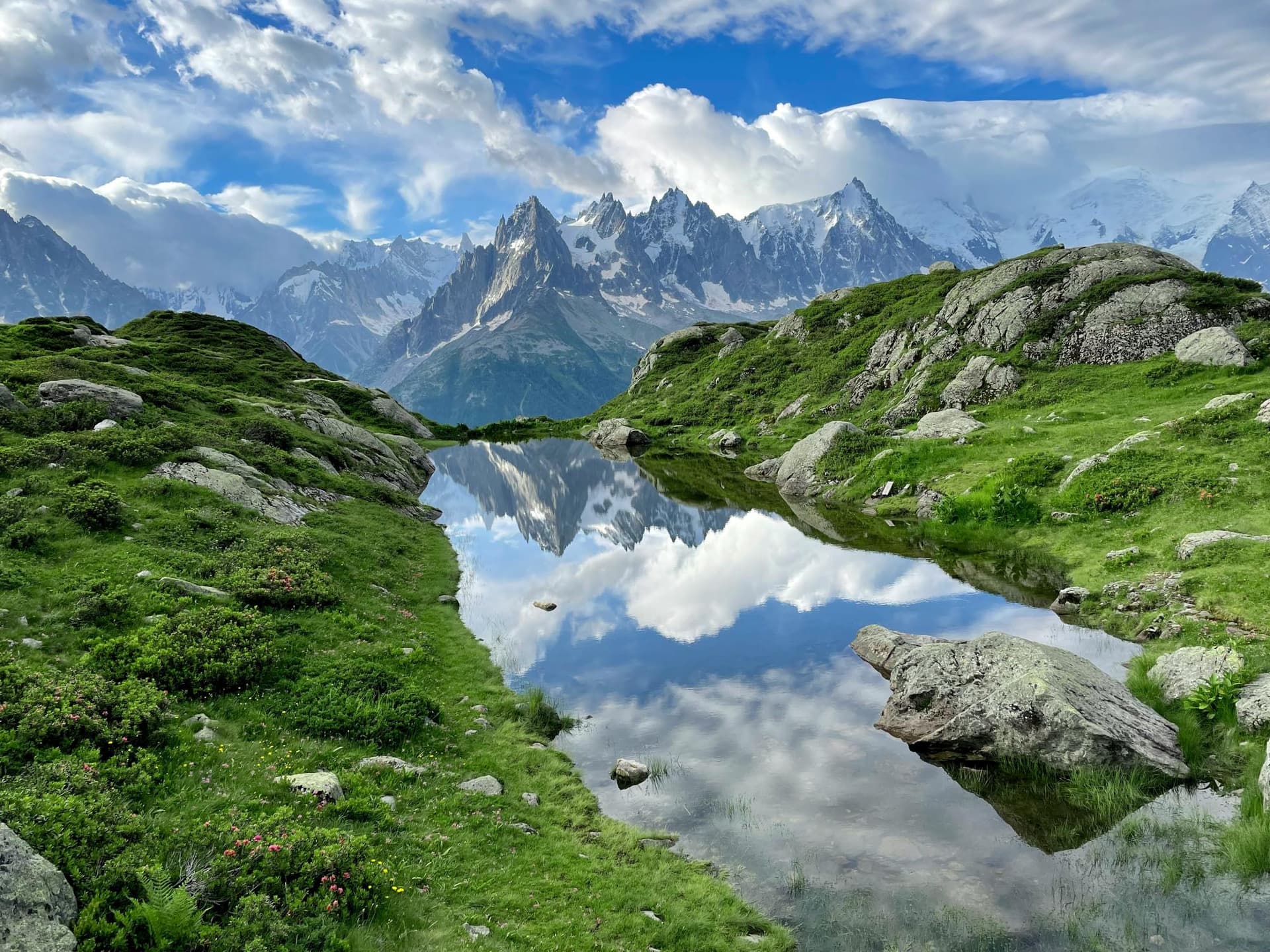
Inland, the Canadian Rockies form the western edge of the continental interior, running along the Alberta-British Columbia border for over 1,400 km (870 mi). Peaks here regularly exceed 3,000 m (9,843 ft), and the range holds the Columbia Icefield, the largest accumulation of ice south of the Arctic Circle. Banff, established in 1885, was Canada's first national park; Jasper, established in 1907, is the largest national park in the Canadian Rockies. Glacial lakes in both parks carry a distinctive turquoise colour from suspended rock flour, fine sediment ground by moving ice.
East of the Rockies, the Canadian Shield covers nearly half the country: a vast expanse of exposed Precambrian bedrock, boreal forest, and tens of thousands of lakes, stretching from the Northwest Territories through Ontario and Quebec to Labrador. The Bruce Trail occupies a narrower geological feature within this region, the Niagara Escarpment, a limestone ridge running from Niagara Falls to the tip of the Bruce Peninsula on Georgian Bay, designated a UNESCO World Biosphere Reserve.
Newfoundland's geology is among the most unusual in the hiking world. Gros Morne National Park exposes the Tablelands, a section of the Earth's mantle thrust to the surface by ancient continental collision, its orange-brown rock too mineral-poor to support most plant life. The Long Range Mountains, the northern terminus of the Appalachian chain, rise as a roadless plateau above fjords carved by glaciers into the bedrock. The East Coast Trail, further south on the Avalon Peninsula, runs along sea cliffs shaped by the North Atlantic, with sea stacks, blowholes, and abandoned outport communities along its length.
Wildlife is a defining feature of backcountry travel in Canada, and not always a benign one. Black bears are present in forested regions nationwide; grizzly bears occupy much of British Columbia's interior and the Alberta Rockies. Moose are common in Newfoundland, the boreal Shield, and the Rockies; caribou range across the alpine sections of Jasper. Bald eagles are a near-constant presence along the Pacific coast, and humpback whales and icebergs appear off Newfoundland's coastline through the early summer months.
Every iconic hiking trail covered in this guide existed, in some form, before it was a hiking trail. Indigenous peoples moved through these landscapes for thousands of years before European contact, establishing the travel corridors, portage routes, and seasonal hunting paths that many of today's trails still follow, knowingly or not.
The West Coast Trail runs through the traditional territory of the Huu-ay-aht, Ditidaht, and Pacheedaht First Nations, whose ancestors fished, traded, and travelled this coastline for thousands of years before European contact. The trail's modern origin lies in tragedy: after the 1906 wreck of the SS Valencia, which killed well over a hundred people within sight of a shoreline with no way out, the Canadian government built a telegraph and lifesaving trail along the coast in 1907, following routes Indigenous communities had used for generations. Today's West Coast Trail still passes through First Nations reserve lands, and signage along the route acknowledges this history directly.
In the Canadian Rockies, the Stoney Nakoda (Iyarhe Nakoda), Ktunaxa, and the Blackfoot Confederacy, comprising the Siksika, Kainai, and Piikani nations, hold ancestral connections to the Bow Valley and the mountains around it dating back more than 10,000 years. The mountains carry Stoney Nakoda names that predate their English ones: Cascade Mountain is Mini Hrpa, and Lake Minnewanka takes its name from the Stoney word for Lake of the Spirits. The 1885 creation of Banff National Park disrupted these traditional land-use patterns and led to the exclusion of Stoney Nakoda people from hunting and gathering inside the new park boundaries, a history Parks Canada has more recently begun to address through co-management agreements signed with the Iyarhe Nakoda and Tsuut'ina Nations.
Newfoundland's Indigenous history carries its own weight. The Beothuk people, the island's original inhabitants, were reduced by disease, conflict, and starvation through the eighteenth and early nineteenth centuries; Shanawdithit, the last known Beothuk, died in 1829. The Mi'kmaq, originally from Nova Scotia and New Brunswick, settled on the island and maintain a living presence in Newfoundland today. Hikers on the East Coast Trail and in Gros Morne National Park walk through this layered and, in the case of the Beothuk, irreversible history.
Across the country, fur trade routes established by Indigenous traders and later used by voyageurs of the North West Company and the Hudson's Bay Company shaped the travel corridors that European settlement, and later trail-building, would follow. Today, land acknowledgments recognising the traditional territories of First Nations, Inuit, and Metis peoples are a standard part of trailhead signage and trip orientation across the country, a small but consistent reminder that these paths carry a much older history than the maps suggest.
No single fact captures the scale of hiking infrastructure in Canada better than the Trans Canada Trail. At over 28,000 km (17,398 mi), it is the longest recreational trail network in the world, more than five times the length of the Pacific Crest Trail. It touches three oceans, the Atlantic, the Pacific, and the Arctic, and connects more than 15,000 rural, urban, and Indigenous communities across every province and territory. An estimated 80 percent of Canadians live within 30 minutes of some section of it.
The idea began in 1992, around Canada's 125th anniversary celebrations, as a proposal to link the country with a single continuous trail. The network, sometimes called the Great Trail, was declared connected in 2017 to mark Canada's 150th anniversary, though construction and improvement continue every year. Roughly 77 percent of the network runs on land and 23 percent on water, a reflection of how much of Canada's interior is accessed as easily by canoe as by foot. Sections range from urban greenways through cities like Ottawa and Vancouver to remote backcountry paths through boreal forest with no services for days.
Unlike a single curated system with one booking platform, the Trans Canada Trail is genuinely decentralized: it links over 400 regional and local trails, each built and maintained by its own community organisation, municipality, or conservation authority. The Bruce Trail in Ontario, the East Coast Trail in Newfoundland, and the Sea to Sky Trail in British Columbia are all, in part, sections of the larger network. A small number of long-distance hikers have walked the entire Trans Canada Trail end to end, a journey that takes the better part of a year. Most visitors instead use the network as a connective thread between the standalone, iconic trails covered later in this guide, the version of backcountry travel this guide is built around.
Dive into our curated Canada hiking adventures today!
The primary season for nearly all of Canada's major hiking trails, and the only realistic window for alpine routes in the Rockies. Average daytime temperatures across the Rockies and the Pacific coast run 18-25C (64-77F), with cooler nights at altitude. The West Coast Trail and Skyline Trail both run their full season through summer. Mosquitoes and blackflies peak in June and July across the boreal regions and in Newfoundland; insect protection is not optional during these months.
Increasingly considered the best window for several trails. Crowds thin, biting insects largely disappear, and fall colour moves through the aspen and larch forests of the Rockies and the maple forests of Ontario. The West Coast Trail's season closes at the end of September. Early snow is a genuine risk at altitude on the Skyline Trail by late September; check current conditions before committing to a late-season alpine itinerary.
Most of the trails in this guide close or become impassable without winter mountaineering skills, avalanche training, and appropriate equipment. The Canadian Rockies receive heavy snowfall and avalanche terrain becomes a serious hazard on routes like the Skyline. Winter is, however, prime season for snowshoeing and Nordic skiing in many of the same parks, and sections of the Bruce Trail and the East Coast Trail remain walkable, with appropriate footwear, through milder winter stretches.
A transitional period with significant regional variation. The West Coast Trail's season opens around the start of May, though high river levels and lingering winter storm damage can affect early-season conditions. Newfoundland's iceberg season, when Atlantic icebergs drift south along the coast visible from the East Coast Trail, typically runs from late May through June. Higher-elevation Rockies trails, including the Skyline, remain under snow well into June most years.
Accepting that the country has no single hiking season is the first step in planning a trip here. The Pacific coast is mild and wet nearly year-round, with a hiking window that runs longer than anywhere else in the country. The Rockies have a short, intense alpine season concentrated in July, August, and early September. Newfoundland's coastal trails run from late spring through early autumn, shaped as much by fog and sea ice as by temperature. Plan around the specific trail's season, not a single national calendar.
The West Coast Trail is the trail most hikers picture when they imagine wilderness hiking on Canada's Pacific coast. Running 75 km (46.6 mi) along the southwest edge of Vancouver Island through Pacific Rim National Park Reserve, it is notoriously technical: more than 100 ladders, roughly 130 bridges, four hand-operated cable cars, and beach sections governed entirely by tide tables. The terrain gain is modest, but the obstacles are constant, and most hikers need 5 to 7 days to complete it comfortably.
The trail passes through the traditional territory of the Huu-ay-aht, Ditidaht, and Pacheedaht First Nations and follows a route used for travel and trade long before its 1907 origin as a telegraph and shipwreck-survivor trail. All hikers must attend a mandatory in-person orientation at one of the three trailheads before starting, and reservations, which open each February for the coming season, sell out within hours for the most popular July and August dates.
Quick Facts: West Coast Trail Total Distance: 75 km (46.6 mi), one-way Duration: 5 to 7 days Difficulty: Challenging Best Season: May to September Gateway: Vancouver Island; trailheads at Gordon River, Nitinaht, and Pachena Bay Highlights: Old-growth rainforest, sea stacks, surge channels, cable car river crossings Safety Note: Mandatory orientation and Backcountry Use Permit; total fees run approximately CAD 265 per person.
In Jasper National Park, the Skyline Trail is widely regarded as the finest extended alpine walk in the Canadian Rockies. Running 44 km (27.3 mi) one-way between Maligne Lake and Maligne Canyon, it spends roughly 25 km (15.5 mi) of its length above treeline, more sustained high-altitude walking than almost any other backpacking trail in the range. The high point, known as the Notch, sits at 2,511 m (8,238 ft), with views across the Maligne Range and down toward the Athabasca Valley.
Most hikers cover the route in 3 to 4 days, walking south to north from Maligne Lake so that the bulk of the elevation loss, rather than gain, comes on the longer days. Wildflower displays peak in late July and into August, and caribou are occasionally seen on the high meadows. A mandatory backcountry camping permit is required, and demand for prime July and August dates regularly exceeds supply within the Parks Canada reservation system.
Quick Facts: Skyline Trail Total Distance: 44 km (27.3 mi), one-way Duration: 3 to 4 days Difficulty: Moderate to Challenging High Point: The Notch, 2,511 m (8,238 ft) Best Season: Early July to late September Gateway Town: Jasper, Alberta Highlights: The Notch, Shovel Pass, sustained alpine ridge walking, wildflower meadows
Not a multi-day trek but the trail most likely to introduce a visitor to the scale of the Canadian Rockies in a single afternoon. Starting at Lake Louise, the Plain of Six Glaciers trail climbs gradually along the lake's northwest shore before switchbacking up through forest to a historic teahouse built in 1927 for the Canadian Pacific Railway, set directly below the ice-clad face of Mount Victoria.
At 14.2 km (8.8 mi) round trip with 587 m (1,925 ft) of elevation gain, the hike is accessible to most reasonably fit visitors while still delivering genuine high-mountain scenery: hanging glaciers, waterfalls fed by glacial meltwater, and views across the Victoria Glacier's moraine field. It pairs naturally with multi-day trips elsewhere in the Rockies as an acclimatisation day or a rest-day option that still counts as a serious hike.
Quick Facts: Plain of Six Glaciers Total Distance: 14.2 km (8.8 mi) round trip Duration: 4.5 to 5 hours Difficulty: Moderate Elevation Gain: 587 m (1,925 ft) Best Season: July to September Gateway Town: Lake Louise, Alberta Highlights: Victoria Glacier views, historic teahouse, Mount Lefroy and Mount Victoria
The most demanding trail in this guide, and one of the most serious backcountry routes in eastern North America. The Long Range Traverse crosses the roadless plateau of Gros Morne National Park's Long Range Mountains, the northern tip of the Appalachian chain, with no marked trail at any point along its official 35 km (21.7 mi) length; most hikers, accounting for route-finding and the side trip to the summit of Gros Morne Mountain, cover closer to 45-50 km (28-31 mi).
Access begins with a boat shuttle across Western Brook Pond, a landlocked glacial fjord enclosed by 600 m (1,969 ft) cliffs, after which hikers climb directly onto the plateau with no trail to follow. Parks Canada limits access to three groups of up to four people per day and requires a mandatory in-person orientation covering navigation and route-finding before issuing a permit. This is not a trail for a first multi-day backcountry trip.
Quick Facts: Long Range Traverse Total Distance: 35 km (21.7 mi) official route; 45-50 km (28-31 mi) typical Duration: 3 to 5 days Difficulty: Very Challenging Elevation Gain: Approximately 1,700 m (5,577 ft) Best Season: Late June to late September Gateway Town: Rocky Harbour, Newfoundland Highlights: Western Brook Pond fjord, Gros Morne Mountain summit, alpine tundra plateau, total solitude Safety Note: Unmarked, off-trail route. Mandatory orientation and strong navigation skills required.
Newfoundland's other major trail could not be more different from the Long Range Traverse in character, while sharing the same province. The East Coast Trail runs 336 km (208.8 mi) along the Avalon Peninsula's dramatic Atlantic coastline, made up of 25 linked wilderness paths connected by community walks through more than 30 small coastal towns. No permits are required, and the trail can be hiked in single-day sections or as a multi-week thru-hike.
The terrain alternates between sea cliff headlands, fishing-village waterfronts, and abandoned outport settlements. Highlights include the Spout, a tidal geyser that shoots seawater through a blowhole, and Cape Spear, the easternmost point in North America. Icebergs are visible from the trail in late spring, and humpback and minke whales feed close to shore through the summer months.
Quick Facts: East Coast Trail Total Distance: 336 km (208.8 mi), 25 wilderness paths Duration: Single sections to 2-3 weeks end-to-end Difficulty: Easy to Strenuous, varies by section Best Season: June to September Gateway: St. John's, Newfoundland Highlights: Cape Spear, the Spout geyser, icebergs, whale watching, coastal outport villages Combined Well With: A city stay in St. John's
Canada's oldest and longest continuously marked footpath, the Bruce Trail has run along the Niagara Escarpment since 1967, when it opened to mark Canada's centennial. The main trail covers roughly 900 km (559 mi) from Queenston, near Niagara Falls, to Tobermory at the tip of the Bruce Peninsula, with over 400 km (249 mi) of connected side trails. Unlike every other trail in this guide, the Bruce passes within an hour of Toronto for much of its southern length, making single-day and weekend sections genuinely accessible without a major trip.
The trail follows the Niagara Escarpment, a UNESCO World Biosphere Reserve, through limestone cliffs, cedar forest, karst crevasses, and farmland, with waterfalls and Great Lakes shoreline views concentrated in its northern third near Georgian Bay. Nine volunteer-run regional clubs maintain different sections, and the trail is blazed in white with side trails marked in blue, a system unchanged since the 1960s.
Quick Facts: Bruce Trail Total Distance: 900 km (559 mi) main trail; 400 km (249 mi) of side trails Duration: Single day sections to multi-week end-to-end Difficulty: Easy to Moderate Best Season: April to November; year-round in milder stretches Gateway: Niagara Falls (south) or Tobermory (north); accessible from Toronto Highlights: Niagara Escarpment cliffs, Georgian Bay views, waterfalls, karst rock formations
Get started with your Hiking adventure now!
Crossing the country end to end means moving through several genuinely distinct food cultures, not one national cuisine. On the Pacific coast, wild salmon is the defining ingredient, smoked, grilled on cedar planks, or served fresh in towns like Port Renfrew near the West Coast Trail's southern trailhead. The Nanaimo bar, a no-bake dessert of chocolate ganache, custard icing, and a coconut-graham base, originated on Vancouver Island and remains a fixture of BC bakeries and trail-town cafes.
In Alberta, the Rockies trail towns of Banff and Jasper sit in cattle country, and Alberta beef is the regional signature: dry-aged steaks, bison burgers, and game meat appear on menus throughout both townsites. A post-hike dinner after the Skyline or Plain of Six Glaciers is as likely to feature elk or bison as beef, reflecting the ranching history of the foothills just east of the mountains.
Quebec, though not home to a trail covered in depth in this guide, anchors the country's most distinctive food tradition: maple syrup. Canada produces roughly three-quarters of the world's supply, and the cabane a sucre, or sugar shack, is a genuine cultural institution: a working sugar bush that serves a set traditional meal each spring, ending with maple taffy poured onto fresh snow. Poutine, fries topped with cheese curds and gravy, and tourtiere, a spiced meat pie, round out Quebec's contribution to Canadian trail-town dining.
Newfoundland's food culture is the most distinctive in Atlantic Canada and closely tied to its hiking trails. Jiggs dinner, a Sunday tradition of salt beef boiled with root vegetables and split peas, remains a weekly fixture in many homes and restaurants near both the East Coast Trail and Gros Morne. Fish and brewis, salted cod rehydrated and served with hard bread and fried pork fat, reflects the province's fishing history directly. A scoff and scuff, a traditional Newfoundland kitchen party combining a hearty meal with music and dancing, is the closest the province comes to a cultural food ritual, and visitors are sometimes invited to one after completing a section of trail.
Resupply logistics vary sharply by trail. The East Coast Trail and the Bruce Trail both pass through towns regularly enough to resupply every few days. The West Coast Trail, the Skyline Trail, and the Long Range Traverse offer no resupply at all; every meal must be carried in from the trailhead.
Most multi-day trails in this guide rely on designated backcountry campgrounds rather than huts. Parks Canada operates reservable campgrounds along the West Coast Trail and the Skyline Trail, each with tent pads, food storage facilities (bear caches or poles), and basic outhouse toilets. Reservations open months ahead of the season and the most popular dates sell out within hours. The Long Range Traverse uses five waypoint campsites with no facilities beyond a flat tent area; this is genuine backcountry camping.
In the Rockies and other mountain regions, the Alpine Club of Canada (ACC) maintains a network of backcountry huts, from simple shelters to fully serviced lodges with cooking facilities and sleeping platforms. As with many national alpine club hut systems, members of the Alpine Club of Canada receive reduced nightly rates; non-members can either pay the higher non-member rate or purchase a membership before booking, which often pays for itself within a single multi-night stay.
On trails that pass through towns regularly, particularly the East Coast Trail and the Bruce Trail, B&Bs and small inns are the standard accommodation, and many hikers structure their itinerary entirely around them, carrying only a daypack while luggage is moved between stops. This style of trip removes the backcountry camping requirement altogether and suits hikers who want the scenery without the full wilderness camping logistics.
A Parks Canada Discovery Pass, priced at approximately CAD 84 per adult for 2026, covers daily entry to all Parks Canada-operated national parks and historic sites for a full year and pays for itself within two to three days of visiting fee-charging parks like Banff or Jasper. It does not cover backcountry camping permits or Great Walk-style reservation fees, which are booked and paid separately.
Canada's hiking regions are served by different gateway airports. Vancouver International Airport is the gateway to the West Coast Trail, with a ferry or floatplane connection to Vancouver Island. Calgary International Airport serves Banff, with Jasper roughly a further three hours north by road; both are reachable by airport shuttle without a rental car. Deer Lake Regional Airport is the gateway to Gros Morne National Park and the Long Range Traverse, while St. John's International Airport serves the East Coast Trail directly. Toronto Pearson International Airport is the natural gateway to the Bruce Trail, with the southern trailhead under two hours away by car.
Parks Canada provides detailed trail maps and current condition bulletins for the West Coast Trail, Skyline Trail, and Long Range Traverse on its website; printed topographic maps from Natural Resources Canada are recommended as a backup to any phone-based app. The Bruce Trail Conservancy publishes its own detailed trail guidebooks and maps. A GPS-enabled satellite communicator is strongly recommended for the Long Range Traverse given its complete lack of marked trail, and is a sensible addition for any extended backcountry trip in Canada given the size and remoteness of the terrain involved.
All payments for park entry, backcountry permits, and accommodation are in Canadian dollars (CAD). Credit cards are accepted in all gateway towns, though some remote outfitters and small B&Bs in Newfoundland still prefer cash.
Bear safety is not a generic precaution in Canada; it is destination-specific and genuinely consequential. Black bears are present in forested terrain nationwide, and grizzly bears are resident through much of British Columbia and the Alberta Rockies. Parks Canada requires bear spray to be carried on most backcountry trails in bear habitat and recommends a minimum group size of four, travelling tightly grouped, on trails with resident grizzly populations. Food and all scented items must be stored in provided bear caches, bear poles, or hung well away from tent sites; cooking should happen away from sleeping areas, and food smells should never linger in a tent. Bear encounters are uncommon and attacks rarer still, but complacency is the actual risk, not the bears themselves. Read the specific bear safety guidance for each park before departure, and treat any posted area closure or bear warning as non-negotiable.
Get started with your Hiking adventure now!
Not for every hike, but for the great majority of backcountry trails covered in this guide. Bear spray is recommended or required on the West Coast Trail, the Skyline Trail, the Long Range Traverse, and most backcountry routes in the Canadian Rockies and British Columbia. It is less critical on the Bruce Trail's southern sections near Toronto, though black bears are still occasionally present. Check the specific park's current bear activity bulletin before any trip and carry spray whenever hiking through forested or alpine terrain in bear habitat.
The West Coast Trail is rated Challenging, and that rating reflects technical difficulty as much as fitness. The terrain involves frequent ladders, cable car crossings, slick boardwalks, and beach sections that demand careful footing under a loaded pack for 5 to 7 consecutive days. Hikers should be comfortable carrying 15-18 kg (33-40 lb) over uneven and sometimes exposed terrain. Previous multi-day backcountry experience is strongly recommended before attempting it.
Yes, on every trail covered in this guide. Independent hiking is the standard approach across Canada's trail network, and guided trips exist mainly as an option for visitors who prefer the logistics and local knowledge a guide provides, particularly on technical or unmarked routes like the Long Range Traverse. The trail itself, in every case, does not require a guide to access.
It depends on the trail. The West Coast Trail, the Skyline Trail, and the Long Range Traverse all require mandatory advance reservations and, in most cases, an in-person orientation before starting. The East Coast Trail and the Bruce Trail require no permits at all. Always confirm the specific requirement for your chosen trail well ahead of travel, since several of the permitted trails sell out within hours of bookings opening.
No. The Long Range Traverse has no marked trail, requires genuine wilderness navigation skills, and is one of the more serious backcountry routes in eastern North America. Parks Canada itself recommends it only for hikers experienced in off-trail travel and route-finding. Hikers without that experience should build it up through one or more marked multi-day trails first, such as the Skyline Trail or the East Coast Trail.
The Trans Canada Trail is a 28,000 km (17,398 mi) network connecting hundreds of local and regional trails across the entire country, including sections of the Bruce Trail and the East Coast Trail. The West Coast Trail, Skyline Trail, and Long Range Traverse are standalone, individually managed wilderness routes, not formally part of the Trans Canada Trail network. Most visitors experience these standalone trails directly rather than the connective network itself.
Reservations for the upcoming season typically open in early February through the Parks Canada online booking system. Popular July and August dates fill within hours. Hikers hoping to walk-up without a reservation should not count on it; walk-up permits are no longer available, and the only realistic fallback is checking for last-minute cancellations once the season is underway.
For most first-time visitors, the Plain of Six Glaciers near Lake Louise or a multi-day section of the Bruce Trail near Toronto offer the most accessible introduction to Canadian hiking, with shorter distances, no permits, and reliable infrastructure. Hikers with prior backcountry experience looking for a defining trip should prioritise the West Coast Trail or the Skyline Trail.
Hiking Canada offers something few destinations can match: genuine scale paired with genuine variety. A trip can move from the cedar rainforest and tide-governed beaches of the West Coast Trail to the sustained alpine ridgelines of the Skyline Trail to the fog and fjords of Newfoundland's Long Range Traverse, and each leg feels like a different country's hiking culture entirely. Indigenous history runs beneath nearly every trail in this guide, not as a footnote but as the original reason these routes exist at all. And the infrastructure, while less centralized than a single national booking system, rewards a hiker willing to plan: permits, bear safety, and seasonal timing are not obstacles so much as the entry price for landscapes this size and this wild.
At Art of Bicycle Trips, we plan and organise hiking journeys across Canada for travellers who want this scale and variety without managing every reservation, permit, and transfer themselves. We can help build an itinerary around the trails in this guide, whether that means a single iconic route like the West Coast Trail or a longer journey combining several regions, and we handle the backcountry permits, accommodation, and trailhead logistics that make a Canadian hiking trip genuinely work. If you would like help planning a hiking trip in Canada, get in touch with our team at Art of Bicycle Trips and we will take it from there.
Dive into our curated hiking adventures today!
Create a private trip or join a small-group departure.