Chat with us on WhatsApp. We're just a message away.
Oregon sits on the northwestern Pacific coast of the United States, sharing its northern border with Washington state, its eastern border with Idaho, and its southern borders with Nevada and California. The Pacific Ocean defines its entire western edge, a coastline of rugged headlands, sandy coves, sea stacks, and river mouths fed by the Coast Range. The state's interior is divided by the Cascade Range into two radically different environments that have direct implications for anyone planning a cycling trip. The western side receives moisture from the Pacific, producing old-growth forests, agricultural river valleys, and a temperate climate. The eastern side sits in the Cascades' rain shadow, with a high desert landscape of volcanic formations, sage flats, and remote river canyons that can feel like a different country from the coast.
For cyclists, this geographic divide means that Oregon cycling encompasses genuinely distinct experiences within a single state. The coast delivers dramatic Pacific views and rolling headland terrain. The Willamette Valley offers quiet agricultural roads through wine and hop country. The Cascades present volcanic mountain passes with lava-field summits and old-growth forest descents. Central Oregon provides sun-drenched rimrock canyon routes under 300 days of annual sunshine. Eastern Oregon offers remote, self-reliant desert and mountain touring that rewards careful preparation with wildlife encounters and solitude that are rare on more accessible routes. Understanding these distinctions is the starting point for any Oregon cycling itinerary. Oregon's population of approximately 4.3 million is concentrated in the Willamette Valley, with Portland anchoring the north and Eugene the south. The smaller cities of Salem, Corvallis, and Albany form a corridor through the valley's agricultural center. East of the Cascades, population density drops to single-digit figures per square mile across vast stretches of the high desert and mountain ranges. This distribution shapes the cycling infrastructure available in each region and determines how self-sufficient riders need to be. The Willamette Valley and coast have frequent services, low-traffic roads, and an established cycling culture. Eastern Oregon demands more planning and a different mindset.
What makes cycling in Oregon particularly significant in a wider context is the institutional investment that has grown around it. Portland has been a national model for urban cycling infrastructure since the 1990s. The Oregon Scenic Bikeway program has created a framework of curated, signposted routes covering the state's full geographic range. The Cycle Oregon organization, which manages the bikeway program alongside an annual touring festival, has made Oregon cycling culture something with genuine civic dimensions rather than just a recreational category.
Explore our amazing bike tours in Oregon now !
The Oregon coastline is built from volcanic rock, marine sediment, and headlands that rise abruptly from the Pacific. Highway 101, which the Oregon Coast Bike Route follows for most of its length, climbs and descends through capes, river mouths, and coastal forest continuously. Elevation ranges from sea level to around 300 m (985 ft) on the higher headland sections, with individual climbs of 4-6 kms separated by descents back toward shore. Road surfaces are paved throughout and generally well-maintained, though shoulders narrow significantly near older bridges and through the two major tunnels at Arch Cape and Cape Creek. Prevailing westerly winds carry Pacific moisture across the coast in all seasons, making waterproof gear an essential item regardless of the month.
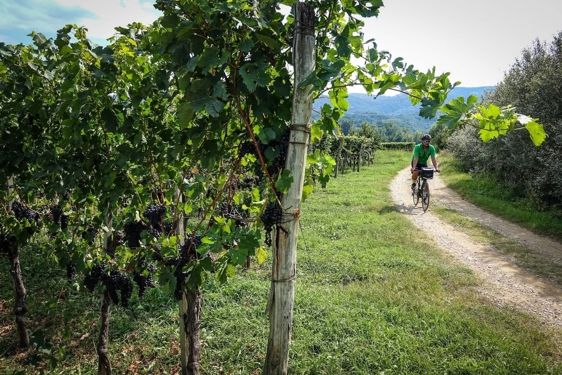
Running roughly 240 kms (150 mi) from the southern outskirts of Portland to the Calapooya foothills near Cottage Grove, the Willamette Valley floor sits at 60-90 m (200-300 ft) elevation and provides some of the most accessible road cycling terrain in the Pacific Northwest. The landscape is flat to gently rolling, threaded by low-traffic farm roads that pass through hop yards, hazelnut orchards, berry fields, and the vineyard country that has made Oregon Pinot Noir internationally significant. The valley receives most of its 100-130 cm (40-50 in) annual rainfall between November and March, leaving spring through fall as the reliably dry riding window. The Willamette Valley Scenic Bikeway runs 217 kms (135 mi) along this corridor on roads that carry minimal vehicle traffic outside of farm harvest periods.
The Cascades form a continuous volcanic spine running north to south through the center of Oregon. Major peaks include Mount Hood at 3,429 m (11,249 ft), the Three Sisters ranging from 3,064 to 3,157 m (10,052 to 10,359 ft), Mount Jefferson at 3,199 m (10,495 ft), and Crater Lake's rim at approximately 2,164 m (7,100 ft). Road cycling in the Cascades centers on the designated mountain pass routes, most notably the McKenzie Pass at 1,619 m (5,312 ft), which crosses a 2,000-year-old lava field with views of multiple volcanic peaks in a setting unlike anything else on a paved road in the US. These are demanding routes requiring sustained climbing fitness. The passes typically close to motor vehicles from October through late spring, sometimes allowing cyclists on foot-propelled vehicles before the road is fully plowed.
East of the Cascades, the terrain transitions abruptly from dense forest to juniper-and-sage high desert. Bend at 1,108 m (3,635 ft) sits at the western edge of this transition and serves as the hub for central Oregon cycling. Annual precipitation in Bend averages 30 cm (12 in), and the region averages over 300 sunny days per year. Road surfaces on the designated bikeways are paved throughout, but secondary routes become gravel quickly. The Crooked River Canyon south of Prineville offers dramatic basalt canyon terrain, while the Sisters-to-Smith Rock Scenic Bikeway connects two of the region's most iconic landscapes through high desert ranch country.
The Blue Mountains, Wallowa Mountains, and Warner Range define the far eastern and southeastern corners of the state, and they represent Oregon cycling at its most remote and demanding. The Blue Mountain Century Scenic Bikeway covers 174 kms (108 mi) with approximately 2,438 m (8,000 ft) of total elevation gain on roads with minimal traffic and extended stretches without water sources. The Oregon Outback, running 563 kms (350 mi) from Klamath Falls to Bend on a mix of paved and unpaved surfaces, has become one of the foundational bikepacking routes in North America. The Grande Tour Scenic Bikeway offers a 216 km (134 mi) figure-eight loop through the Eagle Cap Mountains and the Elkhorn Range near La Grande. These routes reward riders who arrive genuinely self-sufficient.
The Oregon Coast Bike Route is the state's defining long-distance cycling corridor, covering 595 kms (370 mi) from the Washington state line near Astoria in the north to the California border near Brookings in the south. The route follows the Oregon Coast Highway 101, a federally designated National Scenic Highway, for the majority of its length, with several detours onto secondary roads to pass through scenic headland sections or to avoid vehicle-heavy stretches where Highway 101 becomes unsafe for cyclists. Oregon cycling along the coast is almost universally ridden north to south, using the prevailing northerly winds as a tailwind or manageable crosswind. Riding against these winds in the opposite direction adds significant accumulated effort across what is already a multi-day route.
The terrain is not flat. The Oregon coast is a sequence of headlands, capes, and river mouths, and the highway climbs and descends through this landscape continuously. Expect regular ascents of 100-300 m (330-985 ft) between descents back toward sea level. No single climb is technically extreme, but the cumulative elevation over a full week or more of riding is substantial, and riders who underestimate the coast route based on its Pacific location tend to find themselves underprepared. Plan for daily distances of 65-95 kms (40-60 mi) on a standard multi-day itinerary with full camping kit.
The route begins at Fort Stevens State Park near Astoria, close to the mouth of the Columbia River, and runs south through Warrenton and Seaside before reaching Cannon Beach at around the 80 km (50 mi) mark. This opening section passes through coastal forest and low dunes, with the Pacific horizon opening and closing between headlands. Just south of Cannon Beach, the route reaches the Arch Cape tunnel, the first and more complex of the two major tunnel challenges on the OCBR. The Arch Cape tunnel is 396 m (1,300 ft) long with no shoulder inside for cyclists to use in the lane. A signal button at the entrance activates a road sign alerting drivers to a cyclist inside, and most riders walk the narrow sidewalk through rather than sharing vehicle space in the bore. The climb to the tunnel entrance gains over 150 m (490 ft) from Cannon Beach and marks the first real test of the route.
South of Arch Cape, the route descends to Manzanita and continues through the Three Capes Scenic Loop, a detour off Highway 101 that bypasses a vehicle-heavy inland section near Tillamook and passes three distinct headlands in succession. Cape Meares sits at the north, Cape Lookout extends further into the Pacific than any other headland on the Oregon coast, and Cape Kiwanda overlooks the sandstone cliffs above Pacific City. Each cape has its own character and worthwhile viewpoints. The town of Tillamook, reached partway through this section, is the home of a creamery that has operated since 1909 and is worth the short detour for riders in need of resupply and ice cream.
From Lincoln City south through Newport to Florence, the route covers roughly 200 kms (125 mi) through what is considered the mid-coast section. Newport at the midpoint of this stretch has Oregon's largest commercial fishing fleet and a historic bayfront within easy cycling distance of the route. The town's seafood market and working fish docks offer some of the most direct access to fresh Dungeness crab and wild salmon on the entire OCBR. South of Newport, the route passes the Heceta Head Lighthouse, built in 1894 and still in active operation, sitting on a promontory visible from Highway 101. The Cape Creek tunnel just north of Florence is the second major tunnel on the route, similar in length to Arch Cape and requiring the same approach with the signal system at the entrance.
From Florence to Brookings, the route covers the southern 210 kms (130 mi) through progressively smaller towns and more remote headland country. Just south of Florence, the Oregon Dunes National Recreation Area stretches for 72 kms (45 mi), where sand dunes rising to 61 m (200 ft) create an almost surreal landscape largely invisible from the highway but accessible via short side trails. The town of Bandon is known for its sea stacks and cranberry growing. Gold Beach sits at the mouth of the Rogue River, one of Oregon's most significant wild and scenic rivers. Brookings, near the California line, enjoys a climate measurably warmer and sunnier than anywhere north of it on the coast, a microclimate produced by a warm offshore current that gives this southern stretch its character.
Oregon's state park network provides hiker-biker campsites at near-regular intervals along the full 595 km (370 mi) route. These sites cost approximately $7-8 USD per person per night and operate on a first-come, first-served basis with a maximum of three consecutive nights at any single campground. Amenities typically include flush toilets, outdoor showers, drinking water, and a designated area for cycling visitors separate from vehicle campers. The system makes it possible to complete the full OCBR without any advance accommodation booking. The one section requiring more careful planning is the stretch south of Florence through the dunes area, where services thin before picking up again around Reedsport. Coastal towns are frequent enough along most of the route that food and water resupply is straightforward throughout.
217 kms (135 mi) | Flat to gently rolling | 3 to 4 days | Moderate
The Willamette Valley Scenic Bikeway was Oregon's first formally designated cycling route and remains one of the country's finest agricultural touring corridors. Starting from Champoeg State Heritage Area, about 40 kms (25 mi) south of Portland, the route runs south to Eugene on low-traffic rural roads through farmland that produces Pinot Noir grapes, Cascade hops, hazelnuts, marionberries, and grass seed. Oregon's state capital Salem is the largest town on the route and provides a natural midway stopping point. The gradients are mild enough for riders who do not cycle regularly, making this an accessible option for first-time touring riders prepared for 50-80 km (30-50 mi) daily distances. The route is signposted with green-and-white bikeway markers throughout and never requires navigation guesswork.
78 kms (48 mi) | Mountain pass | 1 day | Hard
The McKenzie Pass Scenic Bikeway is the most visually singular road cycling route in Oregon. Beginning in the town of Sisters at 999 m (3,281 ft), the route follows an 1860s wagon trail through ponderosa pine forest before entering a 2,000-year-old lava field near the 1,619 m (5,312 ft) summit. The Dee Wright Observatory at the top, built from lava rock by the Civilian Conservation Corps in the 1930s, provides a panoramic view of volcanic peaks including the Three Sisters, Mount Washington, and Mount Jefferson. Total elevation gain from Sisters to the summit is approximately 620 m (2,034 ft). The road ends at Belknap Hot Springs on the McKenzie River, where thermal pools offer a restorative finish that matches the effort the climb demands. The pass is closed to motor vehicles in winter and early spring, and the period between the first snowplow clearing and the official vehicle opening is a local tradition for cyclists riding the road car-free.
97 kms (60 mi) one way | Forested mountain road | 1 to 2 days | Hard The Aufderheide begins in the community of Westfir, south of Eugene, and climbs steadily for 97 kms (60 mi) through some of the finest remaining old-growth forest in western Oregon, gaining nearly 1,219 m (4,000 ft) along the way. The road follows the North Fork of the Middle Fork Willamette River before crossing a watershed divide and descending along the McKenzie River to the community of Rainbow near Highway 126. Douglas firs along the corridor reach heights and trunk diameters that place their germination several hundred years in the past. Wildlife in this zone includes elk, black-tailed deer, and occasional black bears. Traffic is minimal and road surfaces are fully paved throughout. The route works well as a two-day trip camping at one of the forest service sites along the way.
61 kms (38 mi) | River gorge with moderate grades | 1 day | Moderate
Built in 1916, the Historic Columbia River Highway was among the first paved scenic roads in the country. The non-motorized section from Troutdale east to The Dalles provides a paved cycling path through the Columbia River Gorge with continuous views of the river, basalt cliffs, and Mount Hood to the south. The route passes the trailheads for Crown Point, Vista House, and multiple major waterfalls including Multnomah Falls at 189 m (620 ft), the second-tallest year-round waterfall in the US. The route is accessible via commuter rail from Portland, making it a practical day trip without vehicle logistics. Wind in the gorge can be a significant factor, with strong east-to-west flows developing through summer afternoons.
174 kms (108 mi) loop | Remote mountain | 2 to 3 days | Epic
The Blue Mountain Century is Oregon cycling at its most demanding and most remote. Starting and finishing in the cattle town of Heppner in northeastern Oregon, the route climbs approximately 1,000 m (3,280 ft) in the first major ascent before descending to Ukiah at the halfway point. Total elevation gain across the full loop is approximately 2,438 m (8,000 ft). Traffic is minimal, surfaces are well-maintained throughout, and the Blue Mountains provide high-country scenery that is difficult to access any other way. Some sections have no water sources for 50 kms (30 mi) or more, and cellular coverage is unreliable across much of the loop. This route is suited to experienced, self-sufficient touring cyclists who want something well outside the ordinary.
53 kms (33 mi) loop | High-elevation volcanic | 1 day | Hard
Crater Lake sits in the caldera of Mount Mazama, a volcanic peak that collapsed approximately 7,700 years ago following an eruption that spread ash across much of the Pacific Northwest. The lake, fed entirely by snowmelt and rainfall with no river inlet, reaches 592 m (1,943 ft) in depth and holds a color that deepens from brilliant turquoise at the shallows to an intense deep blue at the center. The Rim Drive loop at 53 kms (33 mi) and approximately 2,164 m (7,100 ft) elevation offers continuous caldera views for the full circuit, with several short climbs of 100-200 m (330-660 ft) along the way. The park road opens to cyclists in June once snowplow clearing is complete. Early-morning riding gives the best light on the water and fewer vehicle encounters.
Portland is the natural entry point for Oregon cycling and a world-class urban cycling destination in its own right. The city has over 400 kms (250 mi) of dedicated cycling infrastructure, including a network of neighborhood greenways that allow riders to cross the urban area with minimal exposure to heavy vehicle traffic. Seven bridges over the Willamette River carry cycling access, and the Tom McCall Waterfront Park runs several kilometers along the western bank as a car-free path. The 40 Mile Loop, a 64 km (40 mi) urban trail, circles the city through parks, riverfront, and neighborhoods. Just east of Portland, the Columbia River Gorge opens into a dramatic basalt canyon where the Historic Columbia River Highway offers paved cycling alongside waterfalls and river views. Best suited to all fitness levels in the city; increasingly challenging terrain on gorge routes east of Troutdale.
The Willamette Valley between Portland and Eugene is Oregon's agricultural heartland and one of the quietest, most satisfying cycling environments in the Pacific Northwest. The terrain is flat to gently rolling at low elevation, making it accessible to riders who want meaningful daily mileage without demanding climbing. Over 500 wineries operate in the valley alongside craft breweries, hazelnut farms, berry fields, and hop yards. The university town of Corvallis and the state capital Salem both provide mid-route character and services. The valley rides comfortably year-round for riders prepared to manage winter rain. Best suited to casual to intermediate cyclists, families on multi-day tours, and anyone drawn by wine country and farm-to-table food culture.
The coast is the most popular long-distance cycling destination in the state and among the most iconic Pacific touring routes in North America. The 595 km (370 mi) OCBR provides a complete through-route, but individual sections around Newport, Cannon Beach, and Bandon are equally rewarding as day or weekend rides. The coastal landscape is consistently dramatic throughout its length, with sea stacks, tidal estuaries, and offshore rocks active with marine life. Oregon cycling on the coast is moderate rather than easy, requiring preparation for persistent climbing and changeable Pacific weather. Best suited to intermediate cyclists with some touring experience; fit beginners who allow adequate time will find the infrastructure supportive.
Bend is the most cycle-friendly city in eastern Oregon and serves as the hub for a cluster of bikeways through high desert terrain. The Twin Bridges Loop departs from Drake Park in downtown Bend and covers 58 kms (36 mi) of rimrock canyons, river crossings, and views of snowcapped Cascade peaks. The Crooked River Canyon bikeway south of Prineville offers a more remote experience through basalt canyon walls. Central Oregon averages over 300 days of sunshine annually and maintains a dry, warm climate from spring through fall. Mid-summer heat regularly exceeds 35 degrees C (95 degrees F), making early-morning starts important in July and August. Best suited to intermediate to advanced cyclists who prefer open, arid landscapes and clear skies.
Southern Oregon encompasses the Rogue Valley, the Cascade Siskiyou, and the Wild Rivers Coast near Port Orford. The Cascade Siskiyou Scenic Bikeway covers 89 kms (55 mi) through a zone where the Cascades, Siskiyous, and Great Basin ecosystems converge, producing a mix of oak savannah, pine forest, and open plateau with views of Pilot Rock, a 25-million-year-old volcanic plug. The Wild Rivers Coast bikeway, anchored in Port Orford, follows the Wild and Scenic Elk River through old-growth forest to Cape Blanco Lighthouse, built in 1870 and still the westernmost operating lighthouse in Oregon. The Rogue Valley around Ashland and Medford grows Cabernet and Syrah alongside the more familiar Pinot of the northern valley. Best suited to experienced cyclists with solid climbing fitness.
Eastern Oregon is the state's most remote cycling territory. The Grande Tour Scenic Bikeway, a 216 km (134 mi) figure-eight loop from La Grande, takes riders through the Eagle Cap Mountains, the Elkhorn Range, and the historic mining town of Baker City. The Oregon Outback, 563 kms (350 mi) of mixed paved and unpaved surfaces from Klamath Falls to Bend, has become one of the foundational bikepacking routes in North America. Wildlife encounters can include pronghorn antelope, mule deer, golden eagles, and sage grouse. Cellular service is largely absent on these routes and water sources must be identified and planned before departure. Best suited to experienced, self-reliant cyclists comfortable with remote, multi-day desert and mountain touring.
June through August is the primary riding season across western Oregon and the only reliable window for high Cascade pass routes. Western Oregon dries significantly from June, with coastal temperatures ranging from 15-20 degrees C (59-68 degrees F) through summer. Morning coastal fog, known locally as the marine layer, is common in summer and typically clears by mid-morning. High mountain passes including McKenzie become reliably rideable in June once snowplow clearing is complete. East of the mountains, Bend and Central Oregon reach 35-38 degrees C (95-100 degrees F) in peak July and August, making early-morning starts essential on desert routes. Daylight in late June exceeds 15 hours at Oregon's latitude, giving touring cyclists a generous window on either side of the midday heat. June also marks the beginning of Portland's Pedalpalooza festival, which runs through August with hundreds of community cycling events.
Spring is an underappreciated window for Oregon cycling, particularly on the coast and in the Willamette Valley. Valley and coastal routes become reliably pleasant from April, with temperatures of 10-16 degrees C (50-61 degrees F) and rainfall declining noticeably from the wet winter months. The Willamette Valley in April and May is at its most vivid, with wildflowers, fruit tree blossoms, and the fresh green growth of hop vines climbing their support structures in the fields alongside the bikeway. Rain remains possible through May, and cloud cover is more frequent than in summer. The Oregon coast in late spring offers particularly rewarding conditions, with thin crowds and exceptional afternoon light on headlands and sea stacks. Mountain pass routes are generally not yet accessible for cyclists in April and may be restricted through May depending on snowpack.
September is arguably the best month for Oregon cycling in the Willamette Valley. Grape harvest begins in September and runs through October, bringing visible energy to the vineyards alongside the bikeway. Temperatures of 20-25 degrees C (68-77 degrees F) are comfortable for riding, the light has the quality characteristic of Pacific Northwest early fall, and roads are less congested than in peak summer. Coastal routes remain excellent through September before autumn rain begins returning in October. Eastern Oregon is at its best in September as well, with mid-summer heat having eased but winter road closures still weeks away. The annual Cycle Oregon festival, a week-long supported group ride through a different region of the state each year, typically takes place in September and offers access to corners of the state that reward an organized approach.
Western Oregon's wet season runs from November through March, with the Willamette Valley receiving most of its 100-130 cm (40-50 in) annual rainfall in these months. Cascade passes close to cycling due to snow. The coast is technically rideable year-round, though winter means persistent rain, limited daylight of 8-9 hours, and temperatures of 7-12 degrees C (45-54 degrees F). Portland's organized club ride scene and cycling advocacy culture fill the gap for urban riders through the wet months. Eastern Oregon experiences drier winters by comparison, with some high desert routes remaining snow-free on warmer days, though temperatures drop sharply after dark and careful route research is essential before committing to a winter desert ride.
The Oregon coast is an active marine environment, and Oregon cycling on the OCBR passes alongside or through wildlife habitat for much of its 595 km (370 mi) length. Gray whales migrate in two phases each year along the Oregon coast, moving south from Alaska toward Baja California between November and January, and returning north from March through May. The headlands at Cape Meares, Yaquina Head near Newport, and the town of Depoe Bay are among the most consistent land-based whale-watching locations on the US Pacific coast, accessible from viewpoints close to the highway. Steller sea lions occupy rocky outcrops near Newport and gather at Sea Lion Caves south of Florence, a natural sea cave accessible by elevator from the highway cliff top. Harbor seals haul out on river sandbars at estuary mouths throughout the coastal route. Brown pelicans and double-crested cormorants nest on offshore sea stacks visible as dark forms from the coastal road, particularly in the southern coast section between Florence and Brookings.
The old-growth forests through which routes like the Aufderheide Scenic Bikeway pass shelter wildlife at densities reflecting centuries of undisturbed habitat. Roosevelt elk, the largest subspecies in North America, gather in herds that are sometimes visible from the road in coastal meadows between Reedsport and Gold Beach through the winter months. Black-tailed deer are present throughout the western Cascades year-round. The Ankeny National Wildlife Refuge in the Willamette Valley, passed directly by the valley bikeway south of Salem, hosts wintering Canada geese in numbers that can reach tens of thousands from October through March. Great blue herons wade in the shallows of the Willamette's backwater channels throughout the year, and osprey nest on bridge structures and tall snags along the river corridor. Native Chinook salmon and steelhead return to the McKenzie and Willamette rivers through late fall, and their runs are visibly present in the river pools below many bridges on the valley bikeway.
East of the Cascades, the wildlife shifts to species adapted to open arid terrain. Pronghorn antelope, the fastest land animal in North America, graze across sage flats in the Oregon Outback country in groups that can be large on undisturbed range land. Mule deer are common along all Eastern Oregon routes. Rocky ridgelines in the Crooked River Canyon south of Prineville support golden eagles and prairie falcons nesting on the basalt cliffs above the river. Bighorn sheep were reintroduced to the Hart Mountain National Antelope Refuge in southeastern Oregon and are sometimes seen from the Oregon Outback bikeway in the Warner Mountains. Sage grouse, an indicator species for healthy sagebrush habitat, are present in Eastern Oregon's more remote areas in the early morning hours of spring and early summer, when their elaborate courtship displays occur on traditional lekking grounds near the route.
The botanical scale of Oregon's western forests is one of the defining sensory experiences of riding through them. Douglas firs on routes like the Aufderheide reach heights of over 70 m (230 ft) with trunk diameters that indicate trees 500-700 years old, placing their germination roughly in the medieval period of European history. Sitka spruce and western red cedar grow in the moister sections of the Coast Range closer to the ocean. In spring, the Willamette Valley and Coast Range foothills produce wildflower displays of blue camas, red-violet lupine, and white trillium along roadsides and in forest clearings. The alpine meadows near the McKenzie Pass summit bloom with Indian paintbrush, aster, and avalanche lily from July through August, accessible on foot from the parking area at the Dee Wright Observatory. The visual intensity of these high-elevation meadows, set against the black lava field and volcanic peaks, makes the climb worth every kilometer of effort.
Dive into our curated Oregon cycling adventures today!
Oregon's identity as a cycling state operates at two distinct scales that have developed largely independently and together create the full picture of cycling in Oregon as a place. At the urban level, Portland has become the most bicycle-committed large city in the US, building an infrastructure and culture around cycling as everyday transportation rather than recreational activity. At the statewide level, the Oregon Scenic Bikeway program has framed cycling as the medium through which the state's geographic and cultural diversity can be most directly experienced.
Portland's cycling investment began in earnest with the founding of the Bicycle Transportation Alliance in 1990 and accelerated through the following decades on the back of consistent advocacy, infrastructure planning, and a civic culture that embraced cycling as a marker of the city's progressive identity. By 2004, the Pedalpalooza festival had been established, now running June through August as a volunteer-led, entirely non-commercial community cycling celebration with hundreds of individually organized rides. The festival is deliberately open and non-competitive, reflecting a cycling culture that prizes accessibility over performance. Around 6 percent of Portland commuters travel by bike, a rate approximately ten times the national average and higher than any other major American city. The city has earned platinum-level bicycle-friendly designation from the League of American Bicyclists and ranked second in CNBC's most bicycle-friendly US cities list in 2019.
The Scenic Bikeway program, launched in 2009 in partnership between Oregon State Parks, Cycle Oregon, Travel Oregon, and the Oregon Department of Transportation, was the first formally designated statewide cycling route network in the country. Routes are nominated by local communities, tested and vetted by a statewide advisory committee of cyclists, tourism providers, and land managers, then designated with on-road signage, downloadable maps, and GPS cue files. The program currently covers 17 routes across the full geographic range of the state, from the first designated Willamette Valley route through to the remote Eastern Oregon bikeways. The model has since been adopted or adapted by other states as a framework for making cycling infrastructure legible and usable for visiting riders who cannot rely on local knowledge.
Oregon's place in American cycling history extends beyond urban policy and route designation. The state has been central to the development of bikepacking as a distinct discipline, with the Oregon Outback route from Klamath Falls to Bend having established itself as one of the foundational self-supported gravel routes in North America. The annual Reach the Beach event, now in its third decade, brings hundreds of riders from Portland to the coast each summer along routes that reinforce the coast as the symbolic center of Oregon cycling tourism. Cycling Oregon across multiple landscapes in a single extended trip, from the coast to the valley to the mountains, remains one of the most complete expressions of what the state's terrain and infrastructure make possible. The Tour de Oregon and Cycle Oregon festival events bring organized supported riding to different regions of the state each year, offering a structured entry point to landscapes that might otherwise require independent logistical planning to access.
Get started with your Cycling adventure now!
Dungeness crab is the culinary anchor of the Oregon coast. Oregon's fisheries land an average of 7 million kilograms (16 million pounds) per season, and the sweet, firm meat of the Dungeness is considered among the finest crab on the Pacific coast. The official season runs from December through August, with regulations varying by year and area. Coastal towns from Astoria to Brookings sell fresh-cooked crab at fish docks, seafood shacks, and sit-down restaurants. In the working ports of Newport, Charleston near Coos Bay, and Gold Beach, crab is sometimes available directly from boats at the dock. After a long day on the OCBR, a whole boiled Dungeness with butter and sourdough is as effective a restorative as anything more elaborate. The simplicity of the preparation is the point, and the proximity of the source to the table on the Oregon coast is unusually direct.
The marionberry is a hybrid blackberry developed by researchers at Oregon State University in the 1940s and named for Marion County in the Willamette Valley. Oregon produces more marionberries than anywhere else in the world, and the berry appears in pies, jams, syrups, ice cream, and craft beverages throughout the state. The pie is the definitive preparation. The berries have a deep, complex flavor, more intense and less sweet than a standard blackberry, and the best examples are made with fresh summer fruit between July and August. Bakeries, farm stands, and diners along the Willamette Valley bikeway tend to serve excellent versions, and the fruit is reliably available at farmers markets in Salem, Corvallis, and Eugene from midsummer onward. A slice with vanilla ice cream after a long afternoon on the valley route is a specific pleasure of the season and the place.
The town of Tillamook on the northern coast sits roughly midway through the most topographically varied section of the OCBR and produces some of the best-known dairy products in the American Pacific Northwest. Tillamook County Creamery has operated since 1909, producing sharp cheddar cheeses aged to varying intensities, butter, yogurt, and a range of ice creams sold widely across the US. The creamery's production facility in Tillamook is open to visitors with exhibits on the production process, and the creamery cafe is a natural mid-ride stop for cyclists on the coast route. The hazelnut and salted caramel ice cream, made with Oregon hazelnuts, is a product specific to this place and worth seeking out.
The Willamette Valley is recognized internationally as one of the world's premier Pinot Noir-producing regions. The combination of warm summer days, cool nights, and moderate growing-season rainfall creates conditions suited to Pinot's need for slow, cool ripening with acid structure intact. Over 500 wineries operate in the valley, many of them small, family-run estates that welcome cyclists at tasting rooms. The towns of Dundee, Carlton, and McMinnville sit at the heart of the Yamhill-Carlton and Dundee Hills sub-appellations, where some of the oldest Oregon vineyards are located. The best valley Pinots are considered internationally competitive with Burgundy references at a fraction of the price, and the tasting room culture in Oregon wine country has an informality and openness that suits riders arriving by bike rather than by car.
Oregon has more craft breweries per capita than almost any other state, with over 300 operating statewide. Portland's brewing culture has been called the most concentrated in the world at various points in its development, and the Cascade hops grown in the Willamette Valley were instrumental in defining the American IPA style in the 1970s and 1980s. The connection between local agricultural production and the brewing industry remains literal on the valley bikeway, where hop yards line the route and local craft beer menus reflect the harvest. Bend has its own brewing identity east of the mountains, fitting its outdoor-oriented economy. Nearly every coastal town on the OCBR of any size has at least one local brewery within cycling range of the state park campground.
Oregon's rivers and coastal shallows produce two of the Pacific Northwest's most prized seafood species. Wild Chinook salmon from the Rogue, Umpqua, and Columbia rivers appear in coastal and river-town restaurants from spring through fall, prepared simply with wood smoke, pan-seared with local mushrooms and hazelnuts, or served in chowder at fish docks. Razor clams are a low-tide harvest along the northern coast beaches between Cannon Beach and Newport, regulated seasonally by the Oregon Department of Fish and Wildlife. Freshly harvested razor clams fried in butter are a specific pleasure of the northern coast available only when the season and the tidal timing align, which makes finding an open clamming day during a coast ride feel like a genuine piece of luck.
Oregon produces approximately 99 percent of the US hazelnut harvest, and the nuts appear throughout the state's food culture in forms ranging from roasted trail snacks to hazelnut-chocolate bark to the Tillamook hazelnut and salted caramel ice cream already mentioned. The Willamette Valley is the center of production, with orchards covering the hillsides north and east of Salem. Cyclists on the valley bikeway pass directly alongside hazelnut orchards in the fall harvest season, when mechanical tree shakers work the rows from late September through November, dropping nuts to the orchard floor for collection. Roasted hazelnuts sold at farm stands along the bikeway are an on-bike snack that connects the rider to the landscape in a particularly direct way.
The Oregon Coast Bike Route requires moderate cardiovascular fitness and the physical capacity to sustain effort over a week or more of consecutive riding days. Daily distances on a standard itinerary run between 65-95 kms (40-60 mi), with continuous elevation change accumulating over the full route. Riders who do not regularly cycle long distances should build up with a training program of at least 10-12 weeks, progressing to rides of 80-100 kms (50-60 mi) with loaded bags on varied terrain before departure. The Willamette Valley bikeway is significantly more forgiving and suits riders who can comfortably manage 50-80 kms (30-50 mi) per day on flat roads. Mountain routes like the McKenzie Pass and Aufderheide are appropriate for cyclists with solid climbing fitness and experience on demanding single-day efforts. The Blue Mountain Century and Eastern Oregon bikeways require the kind of endurance and self-sufficiency that comes from accumulated touring experience rather than fitness alone.
For the Oregon Coast Bike Route and the Willamette Valley bikeway, a touring bike or a gravel bike with rack mounts and a comfortable riding position is the standard choice. Drop handlebars allow multiple hand positions over long days, and low gearing handles the coastal headland climbs without pushing riders out of the saddle. A compact chainring paired with a cassette reaching 30-32 teeth is advisable. Road bikes work on the valley route but are less comfortable over multi-day coast distances. The McKenzie Pass and other Cascade routes suit road bikes with climbing-oriented gearing. Eastern Oregon routes benefit from a gravel bike capable of handling occasional unpaved sections and the self-sufficiency demands of remote touring. Panniers on front and rear racks, or a bikepacking setup using frame bags and handlebar rolls, are the two main luggage approaches, each with tradeoffs between carrying capacity and handling.
Oregon's cycling infrastructure supports visiting riders with rental options at the state's main cycling hubs. Portland has the most extensive rental market, with city bikes, performance road bikes, and e-bikes available across the urban area. The Biketown bike share program offers short-term self-service access through an app. Bend has a strong rental market oriented toward road, gravel, and mountain bikes. Coastal towns with significant cycling traffic, including Newport and Lincoln City, have shops with basic touring equipment and repair services. Riders planning remote Eastern Oregon routes should carry comprehensive tool kits and spare parts, including cables, tubes, and a chain tool, as bike shops in the high desert and eastern mountains are sparse and widely separated.
Portland International Airport (PDX) is the primary gateway for international and domestic visitors. It sits approximately 12 kms (8 mi) from downtown Portland and connects to the city center via MAX light rail, which accepts bikes at no additional cost. The airport serves direct routes from major US and Canadian cities and connects internationally via partner hubs in Seattle, San Francisco, and Los Angeles. The Amtrak Coast Starlight train runs from Los Angeles to Seattle with Oregon stops in Klamath Falls, Chemult, Eugene, Albany, Salem, and Portland, accepting bikes in a reservation-based baggage car. The Empire Builder serves Portland on its Chicago-to-Seattle route, making it practical for riders from the Midwest and East Coast to arrive with bikes by rail.
Amtrak's Cascades service connects Portland with Eugene to the south and Seattle to the north, making it practical to start or end a Willamette Valley bikeway ride without vehicle logistics. Bikes are accepted on Cascades trains for approximately $5-20 USD depending on the service. Portland's TriMet bus and light rail network carries bikes on external racks throughout the urban area. Rural Oregon and Eastern Oregon have limited or no public transit options, requiring self-powered travel, a support vehicle, or shuttle arrangements made directly with accommodation providers in advance of the ride.
In Oregon, a bicycle is legally defined as a vehicle and all standard traffic laws apply. Cyclists must ride in the same direction as vehicle traffic, obey signals and stop signs, and use a front white light and a rear red light or reflector when riding after dark. Cyclists under the age of 16 are required by law to wear a helmet. For adults, helmets are strongly recommended regardless of the legal requirement. Highway 101 has variable shoulder widths that narrow significantly near older bridges and through the Arch Cape and Cape Creek tunnels. Farm vehicles, logging trucks, and tourist traffic all share the coastal highway. Both major tunnels have signal systems at their entrances that cyclists should activate to alert approaching drivers to their presence in the bore.
Citizens of the US require no documentation for travel within Oregon. Visitors from most European countries, Australia, New Zealand, Japan, South Korea, and several other nations can enter the US under the Visa Waiver Program using an Electronic System for Travel Authorization (ESTA), applied for at least 72 hours before departure through the official US Customs and Border Protection website. Citizens of countries not included in the Visa Waiver Program must apply for a B-2 tourist visa at a US embassy or consulate. Entry requirements are subject to change and should be verified with the relevant embassy or consulate before booking travel.
The currency is the US dollar (USD). Oregon has no state sales tax, which makes prices straightforward compared to neighboring states. Budget cyclists camping at hiker-biker state park sites along the coast can manage daily costs of $50-80 USD covering accommodation, food, and incidentals. Mid-range accommodation in coastal towns and the Willamette Valley runs $100-180 USD per night. Restaurant meals in smaller towns are generally $15-30 USD per person for a main course. Wine tasting in the Willamette Valley typically costs $20-35 USD per person at a winery, sometimes waived with a bottle purchase.
English is the primary language across Oregon. Spanish is widely spoken in the Willamette Valley, reflecting the agricultural workforce, and is understood at most rural stores and restaurants along the valley bikeway. No additional language preparation is typically needed for cyclists on the designated routes or coast corridor.
Portland, the Willamette Valley towns, and Central Oregon around Bend have reliable cellular service on all major US networks. Highway 101 on the coast has service in and near towns but significant dead zones on headland sections between them. Eastern Oregon routes, including the Blue Mountain Century and Oregon Outback, have extended stretches where cellular service is absent for 50 kms (30 mi) or more. Riders on remote routes should carry downloaded offline maps and printed cue sheets as a minimum. A satellite communicator is worth considering for any multi-day route in Eastern Oregon, where the nearest assistance can be many hours away.
Oregon operates on Pacific Time. Standard time is UTC minus 8, in effect from November through March. Daylight Saving Time adjusts the offset to UTC minus 7 from March through November. Sunrise in Portland in late June arrives around 5:30 a.m. and sunset approaches 9 p.m., giving riders close to 15.5 hours of daylight. By late December, usable daylight falls to approximately 8.5 hours. Eastern Oregon's position further east on the same time zone delivers slightly earlier sunrises and marginally sharper morning light on high desert terrain in summer.
Oregon's accommodation options for cyclists range from the state park hiker-biker campsite network that runs the full coast route to vineyard inns and B&Bs in the Willamette Valley wine country. The appropriate choice depends on route, season, and budget, and the state's infrastructure is genuinely oriented toward cycling visitors in a way that simplifies the logistical side of a trip.
The hiker-biker campsite system maintained by Oregon State Parks is one of the most functional cyclist-specific camping networks in North America. For approximately $7-8 USD per person per night, riders on the OCBR access designated sites at nearly every state park along the full 595 km (370 mi) route. Sites include access to flush toilets, outdoor showers, drinking water, and in most cases a communal cooking area. The maximum stay is three consecutive nights at any single campground, and sites operate on a first-come, first-served basis. This infrastructure makes it possible to complete the full coast route without any advance accommodation booking, a logistical freedom that is unusual on a route of this length and popularity.
In coastal towns, independent motels and small hotels provide a step up from camping for riders who prefer indoor accommodation. Larger towns including Newport, Coos Bay, Cannon Beach, and Brookings offer a range from basic roadside motels to full-service hotels. Advance booking is advisable for Cannon Beach during summer weekends, as this town draws consistent overnight traffic from Portland throughout the season. A growing number of coastal properties have adapted to cycling guests, providing bike storage, a hose or bike wash station, and laundry facilities as standard.
The Willamette Valley offers a different character, dominated by vineyard B&Bs, farm stays, and small inns in the wine country north of Salem. These tend to be more expensive than coastal motels but provide cyclist-friendly environments given their clientele. Eugene and Salem both have hostel-style and budget accommodation for riders seeking lower-cost options. Central Oregon and Bend offer a full range from established campgrounds to boutique hotels, with an outdoor-oriented hospitality culture well-adapted to cyclists. In Eastern Oregon, accommodation is available in the towns anchoring each of the major scenic bikeways, but the options are fewer and advance planning is more critical given the lower density of services.
"Astoria" by Peter Stark tells the story of the 1811 Astor Expedition and the establishment of the first American settlement at the mouth of the Columbia River, exactly where the Oregon Coast Bike Route begins. The book places the northern coast section of the OCBR in a historical context of exploration and survival that gives the landscape an additional dimension for riders who arrive knowing something of what happened here. "Pacific" by Simon Winchester covers the history and ecology of the Pacific Ocean across its full reach, providing broader context for the coastal landscape that forms the backdrop of the coast route. For practical route planning, the Adventure Cycling Association's Pacific Coast Route maps and cue sheets remain the authoritative on-ground reference for the full coast route, with detailed elevation profiles, service listings, and campsite information updated regularly from rider reports.
"Oregon Field Guide," produced by Oregon Public Broadcasting, has run for over three decades covering the state's natural and cultural landscapes in short-form documentary episodes spanning everything from the Oregon Dunes to the Cascade volcanoes to Eastern Oregon high desert wildlife. Many episodes are freely available online and provide visual context for riders planning specific routes. The documentary "Pedal Driven," produced by Oregon filmmaker, covers the diverse community of riders on the Pacific Coast route and captures the social texture of long-distance coast touring in a way that sets realistic expectations while making the experience more appealing. For an understanding of Portland's cycling culture from the inside, Jonathan Maus's BikePortland, the longest-running urban cycling blog in the US, offers an archive going back to 2005 that documents the city's infrastructure debates, community rides, and policy evolution in unusual depth.
The Pedalpalooza festival in Portland, running from June through August each year, is one of the more unusual event-tourism experiences in American cycling culture. The festival has no tickets, no corporate sponsorship, and no organizing theme beyond the proposition that anyone can lead a ride and anyone can join. Hundreds of individual events take place across the three-month window, registered by volunteers through the Shift organization's online calendar. Rides range from midnight neighborhood explorations to advocacy events to themed costume rides to group food-cart tours. For visitors to Portland who want to experience the city's cycling culture from the inside rather than observing it as spectators, Pedalpalooza is the most direct access point available.
The Cycle Oregon festival, which has run annually since 1988, offers a week-long supported group ride through a different Oregon region each year. Routes are organized around rural communities, farmland, and landscapes that are logistically demanding to access on a self-supported tour. Accommodation, meals, and support vehicles are provided by the organization, and the community of several hundred riders traveling together for a week creates a social dimension distinct from independent touring. The festival typically takes place in September, making it a natural capstone to a summer of Oregon cycling for riders who want to finish their season in good company and good countryside.
Crater Lake in the early morning hours of a clear June or July day is an experience that earns its reputation in a way that photographs do not fully prepare visitors for. The lake's depth, 592 m (1,943 ft), and its isolation from any river inlet system create a water clarity and color intensity that must be seen from the rim rather than from an image. The Rim Drive at 53 kms (33 mi) and 2,164 m (7,100 ft) elevation offers continuous caldera views and a setting for cycling that is unlike any other loop on a paved road in the US. Arriving by bike after a multi-day approach across the Cascades makes the rim drive feel earned in a way that driving to the parking lot does not.
Oregon rewards thoughtful planning more than most cycling destinations. The state's geographic range means that a poorly structured itinerary can leave a rider in the wrong climate for the season, on a route that does not match their fitness level, or missing the complementary landscapes that give Oregon cycling its particular depth. The coast, the valley, the Cascades, and the high desert each require different timing, different equipment priorities, and a different logistical approach. The best Oregon itineraries bring at least two of these worlds together in a sequence that builds on itself rather than simply accumulating mileage.
Cycling Oregon across its full geographic range, from the coast through the Cascades to the high desert, is a trip that different riders will define very differently depending on their fitness, interests, and available time. Whether you are considering your first multi-day coast tour, a wine country itinerary through the Willamette Valley, a self-guided crossing of the Cascades, or a remote bikepacking route through Eastern Oregon's high desert and mountain terrain, the team at artofbicycletrips.com is available to help with route design, logistics, and a trip structure that matches your fitness level and interests. Reach out to begin the conversation about your Oregon cycling adventure.
Get started with your cycling adventure now!
Create a private trip or join a small-group departure.