Colombia occupies the northwest corner of South America, sharing borders with Venezuela and Brazil to the east, Peru and Ecuador to the south, and Panama to the northwest. The country covers 1.14 million square kilometers (slightly larger than Texas and California combined) and contains within that area an extraordinary range of elevations, climates, and ecosystems. The Andean mountain system, which enters from the south as a single range and splits into three distinct cordilleras at the Massif Colombiano in Huila, is the backbone of both the country and its cycling culture.
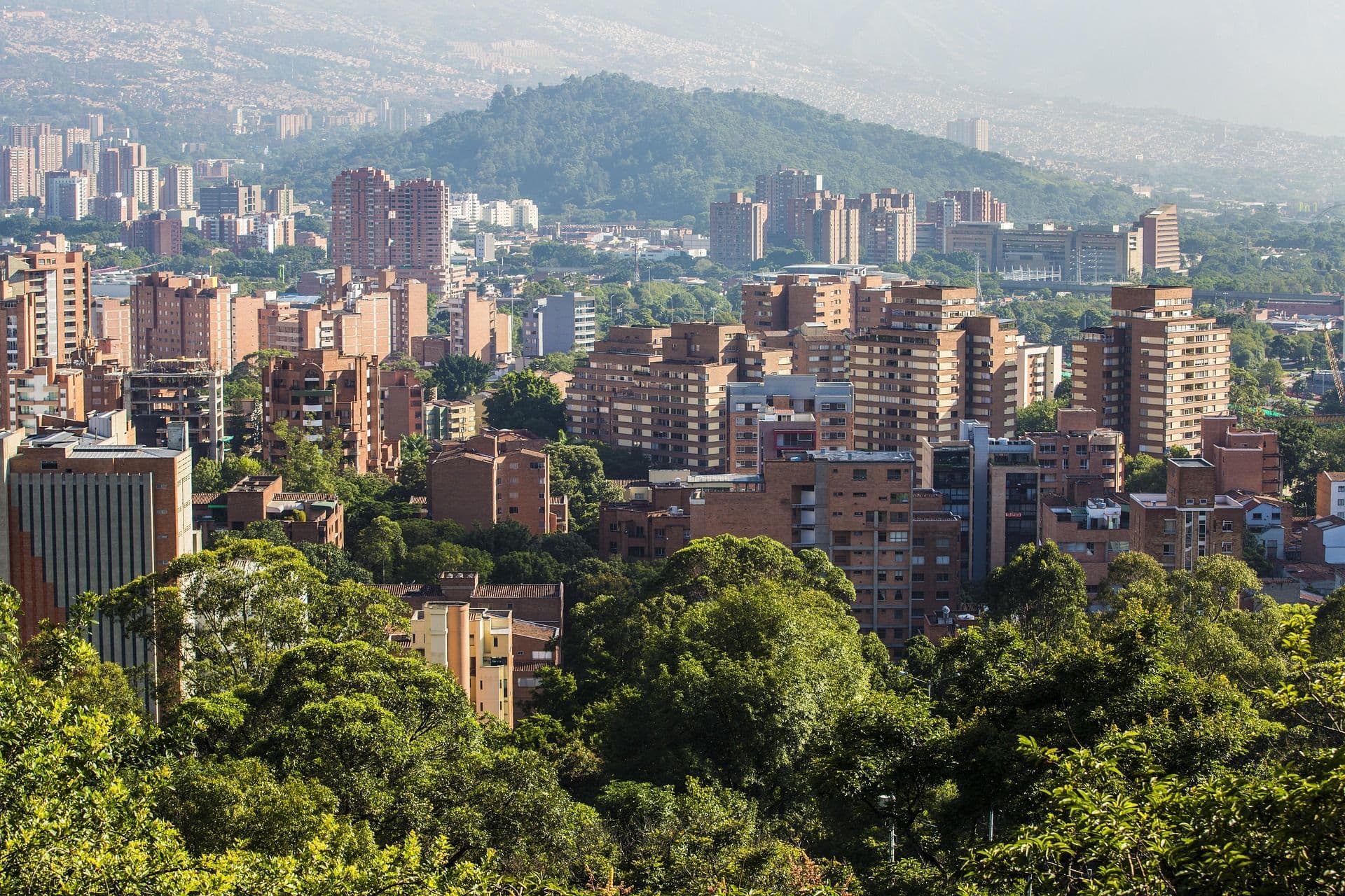
At the center of Colombian life are its cities in the highlands. Bogota, the capital, sits at 2,640 m (8,660 ft) on a high plateau in the Eastern Cordillera, giving it a permanently cool climate and a cycling infrastructure that is the envy of Latin America. Medellin, in the Abura Valley at 1,495 m (4,905 ft), is surrounded on all sides by the ascending ridges of the Central Cordillera, the same ridges that serve as daily training grounds for professional and amateur riders alike. Manizales, Pereira, and Armenia in the Coffee Triangle sit between 1,400 m (4,590 ft) and 2,100 m (6,890 ft), each connected to the others by mountain roads that pass through shade-grown coffee farms and native cloud forest.
What makes cycling Colombia uniquely meaningful as an experience is the relationship between the sport and the population. Colombia began producing international cycling talent in the 1970s, but it was the 1980s, when riders like Lucho Herrera won at Alpe d'Huez in the Tour de France, that cycling entered the national consciousness as a source of pride. The Vuelta a Colombia, first run in 1951, is the oldest stage race in Latin America, and its route through the Andean departments has always drawn large roadside crowds. When Egan Bernal won the Tour de France in 2019 at the age of 22, becoming the first Colombian to claim cycling's most prestigious title, the celebration was nationwide. In Bogota, in Medellin, in mountain villages hours from any city, people marked the moment as a shared achievement.
For the visiting cyclist, this cultural weight is felt immediately. Colombians on road bikes are rarely solo. Group rides form organically, strangers nod in recognition, and a cyclist stopped at the side of a mountain road will receive more offers of assistance than anywhere else on earth. The phrase "cycling Colombia" describes more than just geography. It’s an entry into a specific kind of national passion.
Explore our amazing cycling tours now!
Colombia cycling is defined by altitude, and understanding the relationship between elevation and climate is essential for planning any route. The country uses the concept of "pisos termicos" (thermal floors) to describe how temperature changes with height: tierra caliente (hot land) below 1,000 m (3,280 ft); tierra templada (temperate land) from 1,000 to 2,000 m (3,280 to 6,560 ft); tierra fria (cold land) from 2,000 to 3,000 m (6,560 to 9,840 ft); and the paramo above 3,000 m (9,840 ft), where the vegetation shifts to low scrub, frailejones, and fog. A single day's riding can move through three of these zones.
The Western Cordillera runs from the Pacific coast to the department of Choco and rises to a maximum of around 4,000 m (13,100 ft). It is the least developed of the three ranges for cycling tourism, but offers some of the most raw and remote routes in the country. The roads here are often narrower, the traffic lighter, and the connections between departmental towns more provisional. For experienced gravel cyclists and those seeking genuine isolation, the Western Cordillera rewards exploration.
The Central Cordillera is the highest and most dramatic of the three ranges, home to Nevado del Ruiz (5,321 m / 17,457 ft), Colombia's highest active volcano, and the snowcapped peaks of Los Nevados National Park. It is also the spine of Colombia's cycling identity. Medellin sits in the Abura Valley on the eastern flank, and from the city, climbs radiate in every direction: Alto de Las Palmas to the east, Alto de Minas to the west, El Retiro and the roads toward Guatape to the southeast. The riding here is technical, relentlessly hilly, and scenically dense. Road quality on the main routes is excellent; smaller roads vary considerably.
The Eastern Cordillera is the widest of the three ranges and contains both the highest plateau in Colombia, the Sabana de Bogota, and the rural department of Boyaca. Boyaca is Colombia's most celebrated cycling region after Antioquia, producing riders including Nairo Quintana from the town of Combita and Rigoberto Uran from Urrao in Antioquia. The roads around Tunja, Villa de Leyva, and the high paramos of Boyaca offer sustained climbing at altitude with light traffic, colonial architecture in the valley towns, and views across the Eastern Andes that extend to Venezuela on clear days.
The departments of Caldas, Quindio, and Risaralda form the Eje Cafetero, Colombia's coffee-growing heartland, where altitudes of 1,400 to 2,000 m (4,590 to 6,560 ft) produce the optimal conditions for arabica cultivation. The roads here are among the most scenic in the country: narrow paved lanes linking towns like Salento, Filandia, and Jerico, winding through plantations of tall shade trees and coffee plants. Climbs are frequent but rarely exceed 20 km in length, making the Coffee Triangle more accessible to intermediate cyclists than the long passes of Antioquia or the high paramos of Boyaca.
Explore our amazing bike tours in Colombia now !
No single route defines cycling Colombia more completely than Alto de Letras, the paved road climb that connects the warm lowland town of Mariquita in the department of Tolima with the cold paramo of the Central Cordillera. Recognized by the Union Cycliste Internationale as the longest sustained mountain pass used in professional racing, the climb covers approximately 80 km (50 mi) with an elevation gain of 3,800 m (12,460 ft), rising from 468 m (1,535 ft) above sea level at Mariquita to 3,663 m (12,018 ft) at the Paramo de Letras. On the complete version extending to the western descent, the full route approaches 100 km (62 mi).
The raw statistics ‘80 km, 3,800 m, average gradient of around 4%’ are only partially accurate as a description of the effort involved. The climb includes several short descents of 1 to 3 km that briefly relieve the legs but extend the time on the road. The true average gradient across the climbing sections only is closer to 7.5%, and sections of 10% to 12% appear regularly after the midpoint. At the 3,600 m summit, oxygen availability is roughly 36% lower than at sea level, a physiological reality that arrives gradually but accumulates through the hours of climbing. A competent amateur completes the full ascent in 5 to 7 hours. The Vuelta a Colombia stage record, set by Santiago Botero in 2007, stands at 2 hours 52 minutes.
The landscape changes dramatically as the altitude increases. From Mariquita, the road enters the hot lowland zone through sugar cane fields and cattle pasture. After 20 km, the temperature has dropped by several degrees and the crops have shifted to banana, plantain, and cacao. By the 40 km mark, near the town of Fresno, coffee farms appear on the hillsides. Above 2,500 m (8,200 ft), the vegetation transitions to cloud forest, and the road enters banks of mist that appear even on dry days. The final 15 km to the paramo pass through open moorland, where frailejones, the tall, silver-leafed plants endemic to high Andean wetlands, grow on both sides of the road. The temperature at the top is typically between 4 and 8 degrees C (39 to 46 degrees F) regardless of season.
Letras is best started early in the morning, ideally before 7 a.m., to avoid increasing truck traffic on the central section and afternoon cloud that limits visibility on the upper slopes. The road is the main connection between Manizales and the Magdalena Valley, so it carries commercial transport throughout the day. Roadside cafes and fruit stands appear at regular intervals, with Fresno (around km 40) offering the most reliable stop for a substantial meal, fresh juice, and coffee before the harder upper section begins. Water refills are available at most small stores throughout the climb.
The descent to Manizales on the western side is a separate experience: 32 km (20 mi) with 1,800 m (5,900 ft) of descent through coffee country and into the city. The western approach is a legitimate climb in its own right and a worthwhile day's ride from Manizales for cyclists who want the sense of Letras without the full eastern commitment. For riders acclimatizing at altitude before attempting the full climb, several days based in Medellin or Manizales at 1,500 to 2,100 m (4,900 to 6,900 ft) significantly reduces the physiological shock of the upper sections.
For cyclists who have completed Letras and want to go further, Alto el Sifon in the department of Caldas extends the definition of what is possible on a paved road climb. At 115 km (71 mi) with 4,770 m (15,650 ft) of elevation gain, it became the longest climb used in a UCI professional race after featuring in the 2024 Vuelta a Colombia. Few visiting cyclists attempt it without significant local knowledge and support logistics in place, but its existence reflects the extraordinary ambition embedded in Colombia cycling's landscape.
Distance: Variable | Terrain: Urban to mountain | Duration: Half day to full day | Difficulty: Easy to Moderate Bogota's Ciclovia program, launched in 1974, closes over 120 km (75 mi) of city roads every Sunday and on public holidays to create the largest regular cycling event in the world. Up to two million people take to the streets on active Ciclovia days, making it a rare urban experience where cyclists, runners, rollerbladers, and walkers share the full width of major arterial roads. Beyond the Ciclovia, the climb from Bogota toward La Calera on the eastern edge of the Sabana de Bogota is one of the classic local rides: a steady 9 km (5.6 mi) ascent from the urban fringe to a rural area at 2,700 m (8,860 ft), with views back across the city and the plateau. This climb features in the Vuelta a Colombia and has been ridden by generations of Bogotano cyclists as both a weekend challenge and a training standard.
Distance: 140 to 160 kms (87 to 99 mi) roundtrip | Terrain: Rolling mountain roads with sustained climbs | Duration: Full day | Difficulty: Moderate to Hard East of Medellin, the road to Guatape passes through the municipality of El Penol and arrives at a reservoir-filled landscape of flooded valleys and granite inselbergs. The famous El Penon rock rises 200 m (656 ft) from the valley floor and can be climbed via 740 steps for a panoramic view over the reservoir and the fractured green landscape around it. The cycling route from Medellin combines rolling highlands, several significant climbs between 10 and 20 km in length, and fast descents into warm valleys. The town of Guatape itself is known for its zocalos, the painted friezes decorating the lower sections of building facades, each depicting scenes from local history, nature, or everyday life. The route is popular among Medellin-based riders on weekends and passes through enough small towns for regular food and water stops.
Distance: 40 to 80 kms (25 to 50 mi) depending on route | Terrain: Rolling to hilly, paved and gravel options | Duration: Half day to full day | Difficulty: Easy to Moderate The town of Salento in the department of Quindio is the most visited settlement in the Coffee Triangle and the gateway to the Cocora Valley, where the world's tallest palm trees, the Colombian national tree, grow to heights of 60 m (197 ft) on open hillsides. The cycling routes around Salento connect to neighboring towns including Filandia, Circasia, and Montenegro through narrow mountain roads lined with coffee farms. The terrain is persistent but not extreme: climbs rarely exceed 500 m (1,640 ft) of gain, and the road surfaces are generally in good condition. The light coffee-region traffic, the scenery of the Eje Cafetero, and the proximity of excellent food in Salento's central square make this circuit one of the most enjoyable in Colombia for cyclists who want a full cultural experience without committing to high-altitude objectives.
Distance: Multi-day routes of 80 to 200 kms (50 to 124 mi) | Terrain: High plateau and rolling Andean passes | Duration: 2 to 4 days | Difficulty: Moderate The department of Boyaca, northeast of Bogota, offers some of the most historically layered cycling in Colombia. The town of Zipaquira, famous for its underground salt cathedral carved 180 m (590 ft) into a salt mine, sits at 2,652 m (8,701 ft) and is itself a landmark on the route of the Vuelta a Colombia. The colonial town of Villa de Leyva, surrounded by an arid valley landscape unique in the Andes, links to the broader Boyaca plateau via passes that connect small towns with colonial churches and pre-Columbian archaeological sites. The roads are relatively lightly trafficked by Colombian standards, the altitude moderate at 2,000 to 2,700 m (6,560 to 8,860 ft), and the region well-suited to riders who want to combine cycling with Colombian history and culture.
Distance: 200 kms (124 mi) direct, more with detours | Terrain: Flat coastal highway with optional hill sections | Duration: 2 to 3 days | Difficulty: Easy For cyclists who have been in the Andes and want to arrive at the sea, the route along Colombia's Caribbean coast between Santa Marta and Cartagena offers a complete change of register. The riding is largely flat, the heat significant at 28 to 32 degrees C (82 to 90 degrees F), and the reward is Cartagena's walled old city at the finish: a UNESCO World Heritage Site of cobblestone streets, colonial facades, and a harbor that has been active since the 16th century. The route passes through coastal fishing communities, mangrove lagoons, and the Sierra Nevada de Santa Marta foothills, where the highest coastal mountain range in the world rises directly from the Caribbean. Timing matters: the dry season from December to April makes this route considerably more comfortable than the wet months.
Medellin is the de facto capital of Colombian cycling culture, the city whose surrounding mountains have produced more professional cyclists than anywhere else in the country. Rigoberto Uran, Fernando Gaviria, and dozens of WorldTour riders have trained on the roads above the Abura Valley. For visiting cyclists, Antioquia offers riding at every level: the gentle lakeside circuit at Embalse El Penol, the medium-length passes toward Rionegro and Guarne, and the long, demanding climbs of Alto de Minas and Alto de San Miguel for those seeking serious elevation. The city itself, at 1,495 m (4,905 ft), provides a comfortable acclimatization base before attempting higher routes. The Arvi Natural Park east of the city offers mountain bike and road cycling routes through secondary cloud forest with views over the Abura Valley. Suitable for: all levels, with routes calibrated to fitness.
Boyaca is the department that cycling Colombia most closely associates with its grass-roots tradition. The region is home to the Alta Boyaca area around Duitama, Paipa, and Sogamoso, where the Tour Colombia (formerly Tour Colombia 2.1) has run stages in recent years, drawing WorldTour teams to roads that wind through agricultural plateau at 2,500 m (8,200 ft). The Paramo de Pisba, a high-altitude wetland ecosystem at over 3,400 m (11,150 ft), can be crossed on unpaved roads that challenge even experienced riders. Villa de Leyva and its surrounding valley offer gentler riding through an arid landscape of white colonial architecture and red volcanic soil. Suitable for: experienced road cyclists and gravel riders seeking high-altitude challenge with strong cultural context.
The Eje Cafetero is the Colombia cycling region most accessible to intermediate riders, offering altitude without extreme gradients, excellent road surfaces on most principal routes, and immediate access to the food, coffee, and colonial architecture that make the region one of Colombia's most celebrated tourist destinations. Manizales, at 2,153 m (7,064 ft), is the highest and most urban of the three main cities and serves as the eastern gateway to the Alto de Letras. Pereira and Armenia are more centrally located in the valley between the cordilleras, offering warmer starts for climbs into the surrounding hillsides. The towns of Salento, Jerico, and Marsella are each reachable by cycling routes through coffee country. Suitable for: intermediate cyclists and those seeking a cultural-cycling blend.
Bogota itself is a cycling city of scale. With 608 km (378 mi) of permanent bike lanes and a Ciclovia program that dates back 50 years, cycling Colombia's capital means participating in a daily urban cycling culture that is unparalleled in South America. Beyond the city, the high plateau of the Sabana de Bogota connects to surrounding colonial towns, Zipaquira, Chia and Cajica on flat to gently rolling roads at around 2,600 m (8,530 ft). The climb to Monserrate via the road (not the funicular) provides a 1,600-step challenge at 3,152 m (10,341 ft) that rewards with views over the entire city. Suitable for: urban cyclists, beginners acclimatizing to altitude, and those wanting to combine city exploration with cycling.
The department of Huila, in south-central Colombia, is one of the country's least-visited cycling destinations and among its most rewarding for those willing to travel. San Agustin, a UNESCO World Heritage Site, sits at 1,730 m (5,676 ft) and is surrounded by hundreds of pre-Columbian stone statues scattered across the hills above the Magdalena River. The Tatacoa Desert, a semi-arid landscape of red and grey rock formations at 430 m (1,410 ft), offers a stark visual contrast to the Andes and can be reached via gravel roads from the main highway. The cycling here is exploratory and often remote, with road surfaces that demand appropriate tires and local knowledge. Suitable for: experienced cyclists and those interested in archaeological Colombia rather than high-performance climbing.
The department of Santander, east of Boyaca, contains one of the most dramatic landscape features in Colombia: the Canyon of Chicamocha, a gorge reaching 2,000 m (6,560 ft) in depth, carved by the Chicamocha River through the Eastern Cordillera. The roads into and out of the canyon are among the most technically demanding in the country, with sustained gradients of 8 to 12% over 20 to 30 km. The town of Barichara, a perfectly preserved colonial settlement at 1,300 m (4,265 ft), is frequently cited as the most beautiful village in Colombia and sits above the canyon rim connected to Jerico by a historic paved mule track that has been converted into a cycling and walking path. Suitable for: advanced cyclists comfortable with long, steep descents and remote support logistics.
Colombia is an equatorial country and does not experience seasons in the European or North American sense. Temperature is determined primarily by altitude, not by time of year, which means the climate in Medellin is much the same in January as in August. What does change across the year are rainfall patterns, which follow a bimodal calendar across most of the Andean region: two dry periods (December to March and July to August) and two wet periods (April to June and October to November).
The first dry period is the most reliable window for cycling Colombia across the major Andean regions. Bogota, Medellin, and the Coffee Triangle all experience their most stable weather, with morning rides typically sunny and afternoon showers rare rather than daily. Temperatures in Bogota hover between 14 and 18 degrees C (57 to 64 degrees F) year-round, while Medellin sits comfortably at 22 to 25 degrees C (72 to 77 degrees F). The Caribbean coast is at its most pleasant in this period: warm and dry at 28 to 32 degrees C (82 to 90 degrees F), with reliable conditions from Cartagena to Santa Marta. The altitude climbs in Antioquia and Boyaca benefit from clearer skies, which matters on long routes where cloud cover on the upper sections can affect both visibility and morale.
April and May mark the primary wet season across the Andes. Rain is typically concentrated in the afternoons, meaning morning rides are often still viable, but multi-day routes in exposed mountain terrain carry more risk of disruption. The landscape in this period is extraordinarily green, the coffee farms are lush, and the roads are usually less trafficked by touring cyclists. Accommodation and logistical support are easier to arrange at short notice. May specifically has a curious reputation: rainfall picks up on paper, but many riders find it drier in practice than April, with pockets of stable weather that suit shorter mountain routes around Medellin and the Coffee Triangle.
The second dry period is shorter but highly reliable for the Andes, particularly the departments of Antioquia and Caldas. July is a mixed month for the Pacific coast, which receives heavy rain throughout the year, but for the interior mountain routes this is the second-best time to ride. August is the month of Medellin's Feria de las Flores, the Flower Festival, a 10-day celebration when the Abura Valley fills with floral displays, silletero parades, and live music. Cycling in and around Medellin during the first half of August combines route riding with festival atmosphere. The Tour Colombia road race typically takes place in February, and riders who want to see professional cycling on the same roads they are riding should plan around that date specifically.
October and November are the wettest months across most of Colombia, with frequent afternoon storms in the highlands and sustained rain on some days. For most cycling purposes, this is the period to approach with flexibility rather than fixed itineraries. That said, the routes are quiet, accommodation is at its most affordable, and the paramo landscapes take on a particular quality in low cloud that some riders find more atmospheric than the dry-season clarity. Riders specifically targeting the Coffee Triangle, where the secondary dry periods can extend later, often find decent conditions into November. The altitude is the other consideration: Bogota at 2,640 m (8,660 ft) can feel cold and damp in the rainy months, while Medellin's lower elevation and spring-like baseline climate make it more resilient to the wet season.
Dive into our curated Colombia cycling adventures today!
Colombia is the most biodiverse country on earth by surface area, home to approximately 1,900 bird species, which represents nearly 20% of all bird species globally. Cycling Colombia means moving through landscapes that shift rapidly between ecosystems, each supporting distinct wildlife communities visible from the road without any detour.
The Eje Cafetero and the surrounding cloud forest zones of the Central Cordillera host some of the most concentrated bird diversity in the Western Hemisphere. The Andean cock-of-the-rock, a large crimson-orange bird found in dense cloud forest, is visible at dawn near leks (communal display areas) in valleys around Salento and along the Quindio River. Tanagers, of which Colombia has over 150 species, are a constant roadside presence: blue-gray, flame-colored, and golden tanagers are typical sightings at coffee farm elevations between 1,200 and 2,000 m (3,940 and 6,560 ft). The hummingbird presence throughout the Coffee Triangle is exceptional. The booted racket-tail and the green thorntail are frequently seen hovering above roadside flowering plants.
Above 3,000 m (9,840 ft), the cloud forest gives way to the paramo, one of the most unusual ecosystems in South America. The dominant plants are frailejones (Espeletia), giant rosette plants that can live for hundreds of years and play a critical role in water capture for the rivers below. Cycling the upper sections of Alto de Letras and similar high passes takes riders through paramo landscapes that look unlike anything in Europe, Asia, or North America. The Andean condor, with a wingspan of up to 3.2 m (10.5 ft), soars over the high valleys and ridges of the Central Cordillera. Spectacled bears, the only bear species native to South America, are present in the paramo and cloud forest zones, although sightings from roads are rare. White-tailed deer and tapir are more frequently seen near dawn on the upper sections of mountain routes.
The Cocora Valley near Salento contains the largest remaining stands of Ceroxylon quindiuense, the Colombian wax palm and the country's national tree. Individual trees reach heights of 60 m (197 ft), making them the world's tallest palm species. The valley itself sits at around 2,400 m (7,870 ft), surrounded by cloud forest on the upper slopes and the distinctive grassland floor where the palms grow. The cycling approach from Salento follows the Quindio River through progressively narrower valley until the palms appear on the ridgelines above. Yellow-eared parrots, a critically endangered species that nests exclusively in wax palms, are among the wildlife most closely associated with this landscape.
At the other extreme of the Colombian altitudinal range, the Tatacoa Desert in Huila at 430 m (1,410 ft) presents a red and grey arid landscape cut by erosion into labyrinthine canyons and spires. The desert hosts reptile species rarely seen elsewhere in Colombia, including several endemic lizard species, as well as condors that descend from the Andes to feed on the valley floor. Observatories operate at the desert margins, taking advantage of exceptionally clear, dark skies. Cycling to and through the Tatacoa on gravel roads from Villavieja is one of the most visually distinctive cycling experiences in the country.
The history of cycling Colombia begins with necessity before it becomes about competition. In the 1940s and 1950s, when Colombia's road infrastructure was limited and rural poverty widespread, the bicycle was the primary means of transport for goods and people in the Andean departments. Arrieros (muleteers) who had traditionally moved goods by mule adapted to the bicycle on the new roads, and the physical culture of long mountain days on a loaded bike became the foundation for something Colombia would not fully understand for decades: an entire generation of elite climbing cyclists.
The Vuelta a Colombia, first run in 1951, was conceived in the image of the Tour de France but routed through terrain that was fundamentally different. The Colombian Andes did not offer the rolling classics terrain of Belgium or the mixed stage profiles of France. They offered climb after climb after climb, days of sustained upward effort that favored the light, altitude-adapted riders who had grown up moving through these same mountains on bikes loaded with provisions. The race was an immediate cultural phenomenon, drawing spectators from across the country and establishing cyclists as national heroes before any of them had set foot in Europe.
The first Colombian to race the Tour de France was Martin "Cochise" Rodriguez, a track world champion who entered the 1975 race at the invitation of Bianchi. In 1984, Luis "Lucho" Herrera won a stage on Alpe d'Huez at the age of 22, becoming the first Colombian to take a Tour stage victory and one of the first non-Europeans to scale cycling's most famous climb in competition. Herrera's victory was followed by the 1987 Vuelta a Espana title, a moment that firmly positioned Colombia among the world's cycling powers.
The years between 1990 and 2010 saw Colombian cycling contract under the pressure of the country's internal conflict. Sponsorship dried up, riders who could not afford to travel to Europe stalled at the national level, and the Vuelta a Colombia continued as a domestic institution but without the international bridge that had produced the Herrera generation. The recovery was led by individual riders who found their way to European teams regardless: Santiago Botero's 2002 UCI time trial world championship, and then the arrival of Nairo Quintana, Rigoberto Uran, and a new generation who trained in the same Andean valleys but found the route to the WorldTour more open than their predecessors had.
When Egan Bernal won the Tour de France on 28 July 2019 at the age of 22, making him the youngest Tour winner in 110 years at the time, the significance was understood immediately in Colombia. His face appeared on murals across Bogota. Schools were let out early in Zipaquira, his hometown. The yellow dream that Colombian cycling had pursued since 1975 had been realized. The sport is now part of Colombia's formal identity in a way that few countries can match: a connection between the everyday cycling of its people and the extraordinary achievements of those who have climbed furthest.
Explore our amazing cycling tours now!
Food in Colombia follows altitude and region with the same logic as its climate. The meal that fuels a pre-dawn departure on Alto de Letras will be different from the seafood eaten at the end of a coastal day north of Cartagena, and both will be different from the hearty midday almuerzo served in a Boyaca fonda. What unites them is generosity of portion, directness of flavor, and the consistent presence of fresh fruit juices that are among the best riding fuel available anywhere in the world.
The Bandeja Paisa is the defining meal of Antioquia, the Coffee Triangle, and much of the interior highland region. And for cycling Colombia it is the post-ride plate above all others. A traditional version arrives as a platter carrying white rice, red beans slow-cooked with pork, ground beef (carne molida), crispy chicharron (fried pork belly), chorizo, a fried egg, sweet plantain (platano maduro), a slice of avocado, and a small grilled arepa. The dish was originally consumed by arrieros and farm workers as a high-calorie breakfast before a long day in the hills, which makes it an appropriate choice for cyclists with similar energy demands. In Medellin, the Bandeja Paisa is almost a point of civic pride, and roadside fondas in Antioquia will serve versions that vary slightly by altitude and available ingredients.
Ajiaco is the signature soup of Bogota and the highland central plateau, a thick, deeply flavored stew made with three varieties of potato (papa criolla, papa pastusa, and papa sabanera), shredded chicken, corn on the cob, and the dried herb guascas, which gives the soup its distinctive earthy aroma. The guascas herb is native to the high plains of the Eastern Cordillera and is virtually impossible to replicate outside Colombia, which makes ajiaco one of the most distinctly local dishes in the country. It is typically served with a clay bowl of cream, a side of capers, and sliced avocado. After a cold morning ride on the Sabana de Bogota, a bowl of ajiaco in a small restaurant near the market is a restorative experience in the truest sense.
The arepa is the foundational food of Colombian daily life, a round cake made from ground white or yellow maize that can be grilled, baked, or fried and served with any combination of cheese, butter, eggs, or hogao (a slow-cooked tomato and scallion sauce). Regional variations are substantial: the arepa paisa of Antioquia is thinner, whiter, and milder, eaten as an accompaniment to nearly every meal. The arepa de choclo (sweet corn arepa) found in the Coffee Triangle is thicker, sweeter, and often filled with fresh cheese. Coastal arepas are larger, crispier, and sometimes filled with egg before frying. For cyclists, the arepa serves as the reliable pre-ride carbohydrate across all regions.
No aspect of cycling Colombia generates more consistent enthusiasm from visiting riders than the roadside fruit stands and the jugos naturales (natural juices) found at tiendas along every major route. Colombia's altitudinal diversity means that tropical, subtropical, and temperate fruits grow within hours of one another: lulo (naranjilla), a tart orange fruit native to the Andes; guanabana (soursop), which grows in the warm lowlands; tomate de arbol (tree tomato), served cold and slightly sweetened as a juice at mountain cafes; maracuya (passionfruit); and mora (blackberry), which grows along cloud forest margins and is pressed into juices that appear on virtually every menu from Bogota to Medellin. The tinto, a small cup of black coffee served in a ceramic or plastic mug, is the social ritual of the Colombian road: offered at tiendas, fondas, and small family restaurants alike, strong, sweet, and often provided before the price is discussed.
Sancocho is Colombia's great communal soup, a broth made with chunks of chicken, beef, or fish depending on the region, combined with cassava (yuca), green plantain, corn, and local root vegetables. On the Caribbean coast, it is made with coconut milk and fresh fish. In the Andean interior, it is heavier and meat-based, thickened by long cooking and served with rice, avocado, and arepas. Sancocho is eaten at celebrations, after long rides, on weekend lunches with families, and at markets. Its alternative name, "levanta muertos" (raise the dead), references its reputation as a restorative dish of particular potency.
The two most reliable cycling snacks in Colombia are bocadillo, a firm block of guava paste cut into small rectangles and often paired with fresh cheese, and panela, the unrefined cane sugar pressed into blocks and dissolved into hot or cold agua de panela for a quick, inexpensive energy drink. Both are available at virtually every roadside tienda on any significant climbing route, including the intermediate stops on Alto de Letras. Panela water is the traditional fuel of the arrieros and rural workers who built Colombia's road culture; for cyclists, it is simply the cheapest and most effective carbohydrate replenishment available at altitude.
Cycling Colombia demands altitude acclimatization above almost everything else, particularly for riders arriving from sea level. Bogota at 2,640 m (8,660 ft) provides useful acclimatization for the first two or three days, during which easier rides on the Sabana are advisable before attempting significant climbing. Medellin at 1,495 m (4,905 ft) is a gentler arrival point and a more practical base before moving to higher routes. The general recommendation for riders targeting Alto de Letras or similar high passes is a minimum of five days at altitude before the main objective. The diminished oxygen at 3,500 m (11,480 ft) affects even fit, experienced cyclists, and the slow-onset nature of the effect means it often goes unnoticed until performance drops sharply on the upper sections of a long climb.
Fitness requirements depend entirely on intended routes. The Ciclovia routes around Bogota, the flat coastal roads, and the gentler Coffee Triangle circuits are accessible to recreational cyclists with a moderate fitness base. The long Andean climbs, particularly in Antioquia and Boyaca, require sustained aerobic capacity and comfort with multi-hour efforts at low speeds and high gradients. Alto de Letras specifically requires the ability to ride 5 to 7 hours at moderate pace, manage nutrition and hydration independently over extended distance, and maintain concentration on a steep, sometimes technical descent after hours of climbing effort.
The great majority of Colombian cycling routes are paved, and a road bike with gearing appropriate for sustained climbing is the standard choice. The key gearing consideration for the high Andean passes is a low enough bottom gear to allow 6 to 8% gradients over 30 to 40 km without excessive muscle stress: a compact chainset with a 32 or 34-tooth cassette sprocket is appropriate for most riders. Gravel bikes have become increasingly popular on Colombian routes and offer more versatility on the smaller connecting roads between Andean towns, many of which are graded dirt or cobble. Mountain bikes are used for the Cocora Valley approach tracks and for routes in Boyaca that cross paramo terrain on unpaved passes, but are not necessary for the major road routes. Race-replica bikes with shallow gearing are possible on most routes but will result in miserable experiences on Letras above km 60.
Rental bikes are available in Bogota, Medellin, and the major Coffee Triangle towns, with quality ranging from basic urban bikes through to decent road bikes suitable for mountain routes. Cycle touring with supported logistics, where a vehicle carries bags and a guide manages route planning, is the most efficient way to access the full range of Colombian cycling without independent transport. Colombia has a well-developed network of cycling-specific support services, including bike shops in all major cities with mechanics capable of handling road, gravel, and mountain bike repairs. Spare parts availability is high in urban areas and more limited in remote departmental towns, making it advisable to carry basic consumables including tubes, a chain link, and cable segments on longer routes.
El Dorado International Airport in Bogota (BOG) is the main international gateway, with direct connections from North America, Europe, and South America. Jose Maria Cordova Airport near Medellin (MDE) receives direct flights from the United States and within South America. For cyclists, Medellin is the more convenient arrival point if the primary objective is Antioquia and the Coffee Triangle; Bogota serves better for Boyaca, the Eastern Cordillera, and routes connecting to the south of the country. Getting Around Colombia
Domestic flights connect the major cities quickly and inexpensively by international standards, with Bogota to Medellin taking approximately 45 minutes. Buses serve all intercity routes and can be booked in advance; the long-distance bus network is extensive and relatively comfortable, with reclining seats and luggage holds that accommodate bike bags on most services. Within cities, Bogota's TransMilenio bus rapid transit system has limited bike accommodation, but Medellin's Metro and cable car system is bike-friendly in designated carriages and is useful for avoiding the steepest sections of the valley when not riding.
Colombian road safety has improved significantly over the past decade as infrastructure investment has expanded. The main concerns for cyclists are the same as in most developing cycling destinations: trucks on mountain roads (particularly the national routes connecting highland cities to valley lowlands), and the frequent absence of road shoulders on secondary routes. The most important safety practice is starting early, reaching exposed sections before peak truck traffic, and descending with caution on roads where trucks may be ascending around blind corners. Colombian drivers are generally tolerant of cyclists; the cycling culture means that a person on a road bike is recognized and given reasonable space on most routes. Urban riding in Bogota and Medellin has designated infrastructure, and the cities are relatively safe by regional standards during daylight hours.
Citizens of the United States, European Union, United Kingdom, Canada, and Australia do not require a visa to enter Colombia for stays of up to 90 days for tourism. Passports must be valid for at least six months beyond the intended stay. Entry is typically stamped at the airport with an automatic 90-day tourist authorization, which can be extended once at the Migracion Colombia offices in Bogota or Medellin. Yellow fever vaccination is required for travelers visiting the Amazon region and recommended for jungle areas; it is not required for Andean cycling routes.
Colombia's currency is the Colombian Peso (COP). At the time of writing, 1 US dollar exchanges at approximately 4,000 to 4,200 COP. Cash is widely used and necessary in smaller towns and rural areas. ATMs are available in all cities and most departmental towns; Visa and Mastercard are accepted at hotels and larger restaurants. Colombia is among the more affordable cycling destinations in the Western Hemisphere: a solid lunch at a local restaurant (almuerzo del dia) typically costs 15,000 to 25,000 COP (approximately 3.50 to 6 USD), accommodation at mid-range hotels runs 150,000 to 300,000 COP (approximately 35 to 70 USD) per night, and a tinto coffee at a roadside tienda is 1,000 to 2,000 COP (approximately 0.25 to 0.50 USD).
Spanish is the official language throughout Colombia. English proficiency in cycling and tourism contexts is growing, particularly in Medellin and Bogota, where English-speaking guides, hotel staff, and tour operators are available. Outside the major cities and tourist circuits, English is limited, and basic Spanish is useful for navigating road stops, tiendas, and accommodation in rural areas. Connectivity is good in urban areas and along major routes; 4G coverage extends to most departmental capitals and main highways. Remote mountain passes and gravel routes in Boyaca and the Southern Andes can have patchy or no coverage, making offline maps essential for self-guided touring.
Colombia operates on Colombia Time (COT), which is UTC minus 5, with no daylight saving time adjustments. At equatorial latitudes, daylight hours are consistent year-round: sunrise around 5:45 a.m. and sunset around 6:15 p.m. The consistency of light is a practical advantage for cyclists planning early starts and avoiding afternoon heat or rain. The equatorial sun is intense even at altitude, and high-factor sunscreen, sunglasses, and sun protection on the back of the neck and arms are essential for rides in open terrain.
Altitude sickness (soroche) is a genuine consideration for cyclists arriving from sea level and immediately undertaking rides at 2,500 m (8,200 ft) or above. Symptoms include headache, fatigue, dizziness, and reduced appetite. The standard precautions apply: ascend gradually, drink more water than usual, avoid alcohol for the first two or three days at altitude, and reduce the intensity of the first few rides at height. The paramo sections of major climbs above 3,500 m (11,480 ft) should not be attempted until the body has had 4 to 5 days to begin adapting. Diamox (acetazolamide) is available without prescription in Colombian pharmacies and can assist acclimatization in riders with a history of altitude sensitivity.
Colombia's accommodation range has expanded considerably in the past decade as the country has developed as a tourism destination. In the major cycling hubs of Medellin, Bogota, and the Coffee Triangle, options span from budget hostels to boutique hotels and luxury properties, all within reasonable distance of key cycling routes.
In Medellin, the districts of El Poblado and Laureles have the highest concentration of cyclist-friendly hotels, where secure bike storage, early breakfasts, and proximity to the route network are standard expectations at properties catering to sports tourism. Manizales, the Coffee Triangle city closest to Alto de Letras, has a range of mid-range hotels and several fincas (traditional farm stays) on the outskirts that offer road cycling access directly from the property. The coffee finca as accommodation is one of the distinctive formats of the Eje Cafetero: properties that combine traditional coffee production with hospitality, meals using farm ingredients, and route planning for the surrounding hills.
In Boyaca, colonial town hotels are the norm in Villa de Leyva and Tunja, typically housed in converted 17th or 18th century buildings around central plazas. They offer character and location but rarely the bike-specific facilities of sports hotels in larger cities. For remote paramo routes, basic accommodation exists in departmental towns, but planning around known stopping points is advisable since options between major towns can be limited. The Colombia cycling tour circuit has generated a category of dedicated cycling hotels and retreat centers in Antioquia, particularly in the municipalities east of Medellin, where groups base themselves for training camps.
"Killing Pablo" by Mark Bowden (2001) is a journalistic account of the hunt for Pablo Escobar that provides essential background on the decade of conflict that shaped modern Colombia and affected cycling sponsorship and participation during the early 1990s. For cycling specifically, the writing of American journalist Andrew Hood on Colombian cycling's rise through the 2010s, published across VeloNews and Cyclingnews, provides the most detailed English-language account of how the country returned to the top of the sport after a generation-long absence. For the landscape and culture of the Coffee Triangle, "The Jaguar's Children" by John Vaillant offers a broader Latin American context for understanding rural Andean economies.
"The Two Escobars" (ESPN, 2010) covers the intersection of Colombian football and drug-era politics but captures the specific period that also defined the cycling landscape of the same era. The documentary "Transcordilleras," produced around the 2022 edition of the unsupported gravel race across the Colombian Andes, is the most direct cycling-specific visual document of the country's terrain and culture available in English. Egan Bernal's Tour de France 2019 stage footage, particularly the high-mountain stages in the Alps, documents the style of climbing for which Colombian riders are specifically prepared by their Andean training.
The Tour Colombia, a UCI stage race held annually in February across the departments of Cundinamarca and Boyaca, is the most accessible professional race in the country for visiting spectators. Stages pass through towns including Zipaquira, Tunja, and Duitama on roads that cyclists can themselves ride in the days before or after the event. The Feria de las Flores in Medellin, held over 10 days in August, is the largest cultural festival in Antioquia and combines cycling with floral parades, concerts, and the silletero procession in which farmers carry enormous flower arrangements on their backs down from the surrounding hillsides. For riders in the Coffee Triangle, the region's coffee harvest (which runs across different months in different altitude bands but peaks October to December) brings the fincas to full activity, and farm visits during this period offer a direct connection between the cycling landscape and the agricultural culture that created it.
Get started with your cycling adventure now!
Colombia cycling is a destination that rewards proper preparation and local knowledge more than almost anywhere else in the world. The altitude demands respect, the routes require calibration to fitness and experience, and the cultural richness of the country is fully accessible only to those who have the time to slow down and engage with it. The result, for riders who arrive with realistic expectations and genuine curiosity, is one of the most layered and memorable cycling experiences available on the planet.
Art of Bicycle Trips specializes in cycling journeys that combine outstanding routes with authentic cultural immersion, carefully selected accommodation, and logistics that let riders focus on the riding itself rather than the planning. If you are considering a Colombia cycling trip and want guidance on the right routes for your fitness level, the best time to visit for your specific objectives, or how to combine the high Andean climbs of Antioquia with the coffee roads of the Eje Cafetero and the colonial heritage of Boyaca, we would love to help you plan it.
Reach out to the Art of Bicycle Trips team at artofbicycletrips.com to begin the conversation. Colombia cycling waits at altitude, and the roads are better than you expect.
Get started with your Cycling adventure now!
Create a private trip or join a small-group departure.