Chat with us on WhatsApp. We're just a message away.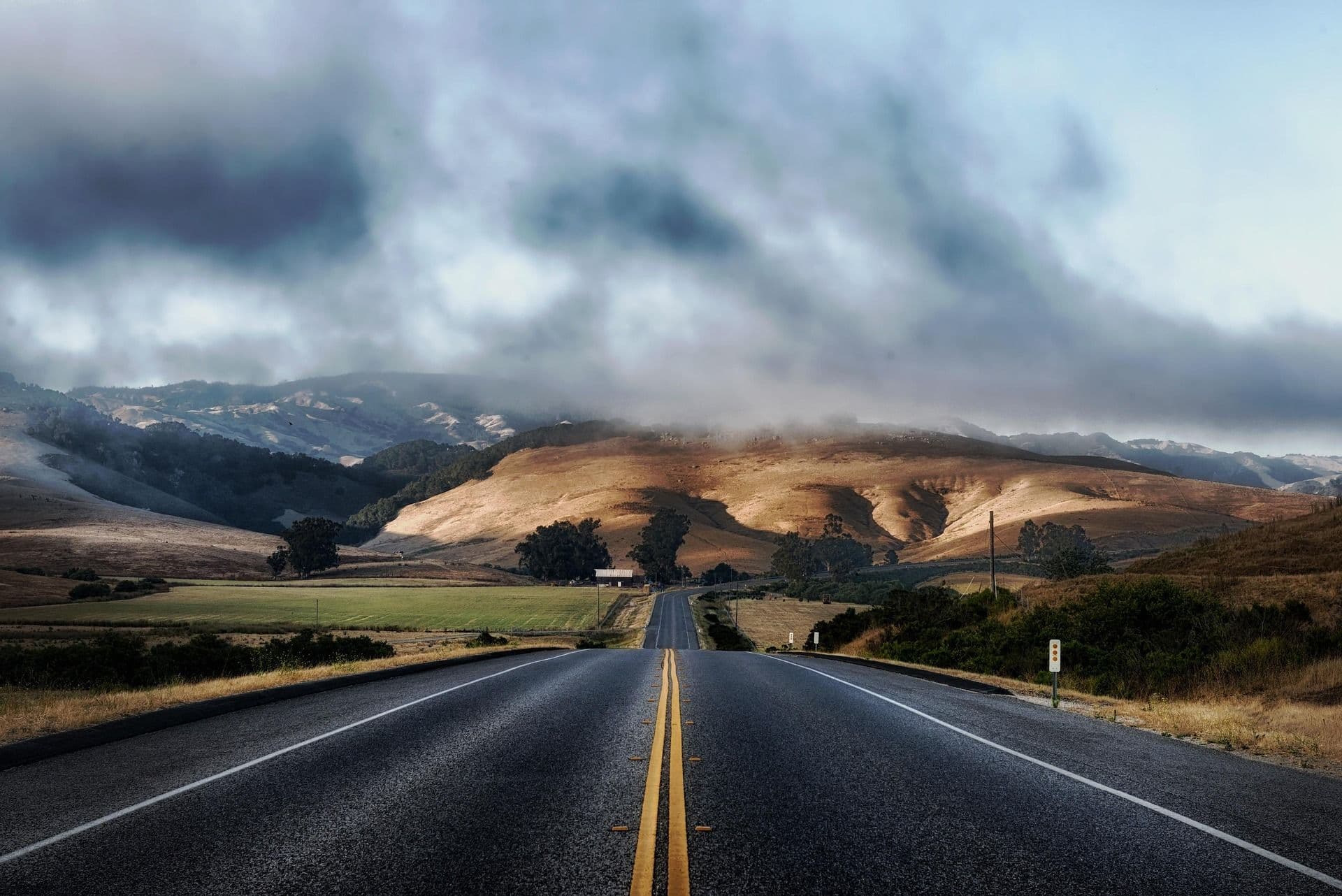
California is the third-largest state in the United States by area, stretching approximately 1,240 kms (770 mi) from its border with Oregon in the north to its border with Mexico in the south, and averaging around 400 kms (250 mi) wide at its broadest point. Its population of nearly 40 million people is concentrated in three major metropolitan regions, including the San Francisco Bay Area in the north, Greater Los Angeles in the south, and a growing cluster of cities in the Central Valley between them. Outside these corridors, vast stretches of the state remain sparsely populated, high desert plateaus, coastal wilderness, mountain ranges, and agricultural valleys that are as quiet and remote as anything in the American West.
The state is broadly divided into distinct geographic zones that directly shape the cycling experience. The North Coast and Bay Area offer redwood forests, sea stacks, and the kind of dramatic Pacific edge that rewards riders willing to climb for views. Wine Country, centered on Napa and Sonoma counties, delivers rolling vineyard roads, mild temperatures, and some of California's most civilized cycling. The Sierra Nevada forms a high-altitude spine running north to south through the state's interior, containing Lake Tahoe and the passes that once challenged the Donner Party and today challenge cyclists seeking altitude and gradient. The Central Valley stretches between mountain ranges as agricultural flatlands. Southern California, centered on Los Angeles and extending south to San Diego, offers a sunnier, more urban riding experience, with coastal bike paths, mountain climbs, and suburban roads used daily by some of the country's most dedicated training riders.
Cycling in California carries real cultural weight. The state is home to some of the most prolific cycling communities in the world, including the Marin County mountain biking scene that literally invented the sport; the San Francisco Bay Area's commuter and recreational culture; the training grounds of professional cyclists in the Santa Monica Mountains; the competitive road cycling clubs of San Diego. California's cycling culture is diverse in its modes and motivations. You will find serious roadies climbing Glendora Mountain Road before 7 a.m., bikepacking tourists rolling south along Highway 1, families on cruisers along the Marvin Braude Bike Trail in Los Angeles, and gravel riders threading forest roads through the Sierra Nevada. This breadth is one of the state's defining qualities as a destination.
Explore our amazing bike tours in California now !
The coastal terrain along Highway 1 and the parallel 101 varies significantly by region. North of San Francisco, the road climbs constantly over headlands, dips into forested canyons, and runs along exposed cliff edges where the shoulder can narrow without warning. Sections between Leggett and the coast require a significant climb and descent that separates serious touring riders from those who prefer calmer conditions. The Mendocino coast is wilder and more rugged, with sea stacks visible from the road and almost no services between towns. South of San Francisco, the terrain becomes more managed through Half Moon Bay and Santa Cruz before opening into the agricultural Salinas Valley.
The Big Sur section, running roughly from San Simeon to Carmel, represents the apex of coastal cycling in the state, a stretch of road carved into the Santa Lucia Mountains at elevations of 150 to 400 m (490 to 1,300 ft) above the ocean, with gradients reaching 8 to 12 percent on key climbs like the ascent from sea level to the ridge above Bixby Creek Bridge.
Napa and Sonoma counties offer a fundamentally different terrain, mostly flat or gently rolling valley floors with a series of more demanding climbs into the surrounding mountains. The Silverado Trail, which runs parallel to Highway 29 along the eastern side of Napa Valley, is one of the best-surfaced and least-trafficked roads for cycling in Wine Country. The valley floor from Napa town to Calistoga covers approximately 50 kms (31 mi) at gradients rarely exceeding 3 percent, making it accessible to riders at any fitness level. For those wanting more elevation, the surrounding mountains offer serious climbing, with Mount Veeder on the western side of Napa reaches its highest point at around 820 m (2,690 ft), while the Geysers route from Healdsburg in Sonoma includes a challenging 6 km (4 mi) sustained climb with grades averaging 7 to 8 percent.
The Sierra Nevada is California cycling at its most demanding and most rewarding. The range runs approximately 640 kms (400 mi) north to south through the state, with its highest points exceeding 4,200 m (13,800 ft). Cycling routes in this zone include serious high-altitude road rides around Lake Tahoe, which sits at 1,897 m (6,225 ft) above sea level, and the legendary Death Ride in Alpine County, which climbs over five passes including Ebbetts Pass at 2,176 m (7,138 ft) and Monitor Pass at 2,572 m (8,438 ft). The roads are generally well-paved but subject to snow closures from November through April at altitude. Gravel terrain is extensive, with the Tahoe National Forest alone containing 1.2 million acres of forest roads and old wagon routes. Riders should account for the physiological effects of altitude, particularly those arriving from sea level, with a noticeable performance reduction kicking in above 1,500 m (4,900 ft).
Southern California's terrain is more varied than its reputation for beaches and freeways suggests. The Santa Monica Mountains, running between Malibu and the San Fernando Valley, contain more than 160 kms (100 mi) of road cycling on quiet canyons and ridge roads where professional cyclists from local teams train year-round. Mulholland Drive, Tuna Canyon Road, and Topanga Canyon Road are staples of the Los Angeles riding community, with Mulholland's ridge offering views across the city in one direction and the Pacific in the other. Further east, Glendora Mountain Road and the climb to Mount Baldy in the San Gabriel Mountains provides 70 kms (43 mi) of demanding climbing with grades reaching 10 to 16 percent on the upper sections. San Diego's terrain is varied between coastal flatlands and rolling hills heading inland, with Palomar Mountain to the north offering a challenging 20 km (12 mi) ascent to 1,714 m (5,623 ft).
No route defines cycling in California quite like Highway 1, the two-lane coastal road that runs the length of the state from Leggett in the north to Dana Point in the south. The Adventure Cycling Association's Pacific Coast Bicycle Route, which uses Highway 1 as its California spine, is one of the most celebrated long-distance cycling routes in the world, a route where the Pacific Ocean is your constant companion for weeks at a time, and where each day brings a different climate, landscape, and coastal community. The full California section covers approximately 1,400 kms (870 mi) and is typically ridden southbound to take advantage of prevailing tailwinds and the direction of coastal views.
The northern section of the California coast route is the most remote and the most demanding. After the major climb and descent between Leggett and the junction with the coastal road, riders enter a stretch of Highway 1 that passes through small fishing communities and logging towns with services spaced 30 to 60 kms (19 to 37 mi) apart. The route passes the Avenue of the Giants, a parallel road through the redwoods that offers relief from truck traffic, before reaching the more populated Mendocino coast. This section includes the iconic Mendocino Headlands, where the road runs along a bluff above the Pacific with sea stacks and kelp forests visible below. South of Fort Bragg, the road continues through Bodega Bay and Point Reyes before the final climb over the Marin Headlands and the crossing of the Golden Gate Bridge into San Francisco. 480 kms (300 mi) | Hilly to very hilly, with significant daily climbing | 5 to 7 days | Strenuous.
Crossing the Golden Gate Bridge into San Francisco represents one of the great moments in California cycling, with the city skyline behind and the Marin Headlands ahead. South from San Francisco, the route passes through Pacifica and Half Moon Bay on roads with dramatic sea cliffs, before reaching the agricultural flatlands of the Salinas Valley. This segment of Central Coast cycling passes through Monterey and Carmel, two of the most reliably photogenic coastal towns on the route, before beginning the Big Sur section at Carmel-by-the-Sea. Big Sur is the climactic stretch of the entire California coast ride, covering 145 kms (90 mi) of road that climbs and drops repeatedly between sea level and 400 m (1,300 ft), passing the famous Bixby Creek Bridge at km 31 (mile 19) and the McWay Falls overlook further south. Services are sparse through Big Sur and advance planning for water and food is essential. The route continues through Morro Bay, a charming harbor town with a distinctive 177 m (581 ft) volcanic rock visible from the water. 400 kms (250 mi) | Rolling coastal with significant Big Sur climbs | 4 to 6 days | Moderate to strenuous.
South of Morro Bay, the terrain eases into the gentler Santa Barbara coast, where the road runs close to sea level through beach communities with wide shoulders and good services. Santa Barbara itself is bicycle-friendly and worth a rest day, where the city's grid of palm-lined streets connects directly to the coast path, and the Santa Ynez Mountains to the north offer testing climbs for riders with energy to spare. Continuing south through Ventura, the route enters the Los Angeles megalopolis. Cyclists use the Marvin Braude Bike Trail through Santa Monica and Venice Beach, a dedicated seaside path that avoids the six-lane Pacific Coast Highway through Malibu. Through Los Angeles and south through Long Beach, the route follows a combination of bike paths and roads before reaching Orange County and eventually San Diego, where the route ends at the Mexican border. 520 kms (320 mi) | Mostly flat to rolling | 5 to 7 days | Moderate.
117 kms (73 mi) | Hilly alpine | 1 to 2 days | Strenuous.
The loop around Lake Tahoe at 1,897 m (6,225 ft) elevation is one of the most celebrated road rides in California, passing through forested shoreline, exposed ridge roads, and the iconic western shore with its views of Emerald Bay. The route begins in Stateline and proceeds clockwise, with the main challenges concentrated on the eastern and northern shores where the road climbs away from the lake on exposed switchbacks. The climb to Spooner Summit on the eastern side reaches 2,144 m (7,031 ft), while Brockway Summit on the north shore rises to 2,110 m (6,924 ft). The iconic American Most Beautiful Bike Ride event, held annually each June, uses this route as its course, attracting thousands of cyclists to the lake. Altitude is a significant factor for riders arriving from sea level; allow one or two days to acclimatize before attempting the full loop.
166 kms (103 mi) | High-altitude mountain passes | 1 day | Extreme.
Held annually each July in Alpine County, the Death Ride is California's most demanding single-day road cycling event, a one-day ride over five mountain passes in the Sierra Nevada with a cumulative elevation gain of approximately 4,267 m (14,000 ft). The five passes, Ebbetts Pass, Monitor Pass (both ascents and descents), Woodfords Canyon, and the final climb to Kirkwood, average grades between 6 and 9 percent with steeper pitches up to 14 percent. Starting from Markleeville, the route is largely car-free through the high passes and rewards finishers with one of the most respected achievements in American amateur cycling. Riders attempting the Death Ride outside of the organized event can ride the same roads independently but should carry sufficient food, water, and cold-weather gear, as conditions above 2,500 m (8,200 ft) can change rapidly even in summer.
80 to 130 kms (50 to 80 mi) depending on the variant | Flat valley floor with optional mountain climbs | 1 to 2 days | Easy to strenuous.
The roads between Napa and Sonoma constitute California's most reliably pleasurable cycling terrain, with well-paved vineyard lanes, light traffic on the Silverado Trail, and small towns with excellent cafes placed at convenient intervals. The Napa Valley Vine Trail provides 20 kms (12 mi) of fully car-free riding from Napa town north toward Yountville along a purpose-built path through vineyards and alongside the Napa River. For harder riders, the mountains flanking both sides of the valley offer serious climbing, with the Lake Hennessey Loop from St. Helena covers approximately 64 kms (40 mi) with 940 m (3,080 ft) of elevation gain through quiet back roads and oak woodlands. In Sonoma, Levi's GranFondo, the annual event founded by former professional cyclist Levi Leipheimer and based in Santa Rosa, draws thousands of riders each fall through the redwood-lined back roads north of the city.
45 to 90 kms (28 to 56 mi) depending on the loop | Steep canyon and ridge roads | 2 to 4 hours | Moderate to strenuous.
The Santa Monica Mountains north of Malibu contain some of the most technically satisfying road cycling in Southern California. Mulholland Drive along the ridge offers panoramic views that stretch from the Pacific to the San Fernando Valley, while the canyon roads descending from the ridge include Tuna Canyon (27 mi loop), Topanga Canyon, and Las Virgenes Road, each offering different gradient profiles and traffic levels. Professional cycling teams from the Los Angeles area use these roads daily for training, and early morning rides here frequently encounter fast-moving group rides from local clubs. Spring is the optimal season for the Santa Monica Mountains, when wildflowers bloom on the canyon walls and temperatures remain below 25 degrees C (77 degrees F) before summer heat arrives.
400 kms (250 mi) | High-elevation gravel and forest roads | 5 to 8 days | Expert.
The Lost Sierra Route is California's premier bikepacking route, traversing high-elevation mountain passes, river canyons, and forest roads in the northern Sierra Nevada between Reno, Nevada, and various California start and end points. The route crosses Heness Pass, Dog Valley, and the eastern Sierra foothills through terrain that mixes unpaved forest roads, old wagon routes, and alpine byways. Services are infrequent, and riders should carry multi-day food supplies. The route passes through Downieville, a mountain town known in California cycling circles as a mountain biking destination, before descending toward the Nevada border. Snow can persist into June at higher elevations; the optimal window for the Lost Sierra Route is late June through September.
Marin County, just north of San Francisco across the Golden Gate Bridge, is the historic center of California cycling and the birthplace of the modern mountain bike. Mount Tamalpais, rising to 784 m (2,571 ft) above sea level, is the mountain where the Larkspur Canyon Gang first raced modified klunker bikes down the Repack Trail in the 1970s, directly inspiring the development of the purpose-built mountain bike by pioneers including Gary Fisher, Joe Breeze, and Tom Ritchey. Today the Marin Museum of Bicycling and Mountain Bike Hall of Fame in Fairfax preserves this history. For road cyclists, the Alpine Dam Loop from San Francisco is among the most popular rides in the state, an 85 km (53 mi) circuit with significant climbing through the Marin hills. The Marin Headlands offer shorter but more exposed coastal rides with some of the finest views of the Golden Gate Bridge and San Francisco Bay. Suitable for mountain bikers of all levels, road cyclists seeking challenging but accessible terrain.
Northern California's Wine Country offers cycling at a more civilized pace, with smooth valley-floor roads, vineyard views in all directions, and the knowledge that a glass of something excellent is available at almost any stopping point. Napa Valley's terrain is predominantly flat to gently rolling, making it accessible to casual cyclists, while the mountains surrounding the valley offer genuine climbs for riders seeking elevation. The Silverado Trail along the valley's eastern edge carries far less traffic than Highway 29 and connects a series of wineries and cellar doors. Sonoma County's roads extend into redwood forest and Alexander Valley terrain that varies from the lush and sheltered to the open and windswept. The cycling season in Wine Country runs effectively year-round, though harvest season from August through October adds significant vehicle traffic on the main valley roads. Suitable for recreational riders, wine enthusiasts, and riders seeking moderate terrain with excellent food and drink options.
Lake Tahoe is one of the preferred training and recreational destinations for professional cyclists, as noted by riders from Peter Sagan to numerous Tour de France contenders over the years. The combination of high altitude, clean mountain air, and well-maintained roads makes the Tahoe basin exceptional for cyclists building fitness or seeking a multi-day cycling holiday in the mountains. The lake loop itself is a serious undertaking requiring good fitness and altitude acclimatization, while the Truckee River Bike Path provides 11 kms (7 mi) of family-friendly flat cycling between Olympic Valley and Tahoe City. The broader Sierra Nevada contains the Death Ride passes, Yosemite Valley's cycling loop, and the Mammoth Lakes basin, which at 2,438 m (7,999 ft) elevation suits experienced riders comfortable with altitude and variable weather. Suitable for experienced road cyclists, fit recreational riders, and those seeking high-altitude cycling challenge.
The stretch of Highway 1 through San Luis Obispo County, from Ragged Point in the north to Nipomo in the south, represents what many experienced California cyclists cite as the finest 90 km (56 mi) of coastal riding in the state. The road passes coastal bluffs, the historic Piedras Blancas Lighthouse, the elephant seal rookery at San Simeon, and the long sandy sweep of Morro Bay, all within a single day's ride. The terrain is rolling rather than brutally hilly, making it more approachable than the Big Sur section to the north while losing none of the visual drama. San Luis Obispo town itself is genuinely cycling-friendly, with a strong local bike culture and a network of paths connecting the town center to surrounding farmland and vineyards. The climate here is noticeably warmer than San Francisco, typically reaching 20 to 25 degrees C (68 to 77 degrees F) in summer with very little fog. Suitable for touring cyclists, road cyclists seeking manageable coastal terrain, and riders of intermediate fitness.
The urban cycling culture of Los Angeles and San Diego is more developed than outsiders expect. Los Angeles's Marvin Braude Bike Trail runs 35 kms (22 mi) of dedicated coastal path from Will Rogers State Beach to Torrance County Beach, threading through Santa Monica, Venice, Manhattan Beach, and Redondo Beach as a flat and largely car-free option for riders arriving in the city. For more serious cycling, the Santa Monica Mountains and San Gabriel Mountains to the east provide the kind of climbing that attracts professional teams to train in the area. San Diego's cycling scene centers on the coast and the backcountry hills heading toward Palomar Mountain, with the Donut Loop in Palos Verdes and the Swami's Loop in Encinitas among the most popular local group ride circuits. The year-round warm weather of Southern California makes it a viable cycling destination in any month, including December and January when the rest of the state's mountains are under snow. Suitable for all levels on the coast; experienced riders in the mountains.
Death Valley National Park, the largest national park in the contiguous United States at 3.4 million acres, offers cycling unlike anywhere else in California, with roads that dip below sea level at Badwater Basin (86 m/282 ft below), pass through iridescent badlands formations, and climb to Dante's View at 1,669 m (5,476 ft) for views across the entire valley. Cycling here is exclusively a winter and spring activity; from June through September, daily high temperatures regularly exceed 46 degrees C (115 degrees F), making outdoor exertion genuinely dangerous. Between November and March, the park's roads are largely free of traffic, the temperatures moderate to 15 to 22 degrees C (59 to 72 degrees F) at valley level, and the quality of light on the Mesquite Flat Sand Dunes and Artists Palette formations is extraordinary. The route from Furnace Creek to Badwater Basin covers approximately 26 kms (16 mi) at essentially zero gradient, while the climb to Daylight Pass on the park's eastern edge covers 16 kms (10 mi) of sustained climbing averaging 5 to 6 percent. Suitable for experienced cyclists visiting in winter or spring only.
Malibu offers year-round cycling in a climate that rarely dips below 12 degrees C (54 degrees F) or rises above 30 degrees C (86 degrees F), making it a reliable training ground for the professional cyclists who live and train in the Los Angeles area. The canyon roads are narrow and winding enough to discourage heavy through-traffic, while the ridge roads along Mulholland Drive command views in both directions. Tuna Canyon Road is a 44 km (27 mi) loop from the Pacific Coast Highway that climbs steeply through oak chaparral to the ridge and descends through grassland on the return, with spring wildflowers visible from late February through April. Riders seeking longer challenges can combine the Santa Monica Mountains with routes into the San Fernando Valley or connect via PCH to the longer coastal route south to Redondo Beach. Suitable for road cyclists of all levels, professional training groups, and riders seeking warm-weather winter cycling.
California's climate varies more dramatically by region than almost any other state, and the best time to visit depends entirely on where you plan to ride. The coast, wine country, and Southern California operate on different calendars from the Sierra Nevada, which is itself a different proposition from Death Valley. There is no single optimal month; there is instead an optimal month for each region.
Spring is the peak season for most California cycling destinations and the period most riders who are visiting the state for the first time should target. The Sierra Nevada passes are typically open by late May or early June, depending on snowfall. Wine Country is at its most photogenic in March and April, when the valley floors are carpeted with wild mustard between the dormant vine rows, temperatures sit between 12 and 22 degrees C (54 and 72 degrees F), and traffic on the Silverado Trail is manageable. The Central Coast reaches its greenest state in March and April after winter rains. The Santa Monica Mountains bloom with wildflowers on the canyon slopes through March and April. Spring also offers the best conditions for Death Valley, where March temperatures at valley level average 25 degrees C (77 degrees F), warm enough to be pleasant but cool enough for sustained cycling. The main trade-off in spring is the possibility of rain through March and early April, particularly on the North Coast.
Summer is the high season for cycling in California's mountains. Lake Tahoe and the Sierra Nevada routes are fully accessible from June, and the long days, low rainfall, and moderate temperatures at altitude make this the most popular period for the Tahoe loop, the Death Ride (held in July), and gravel routes through the national forests. At the coast, however, summer brings two significant challenges, heavy tourism traffic on Highway 1, particularly through Big Sur and the Central Coast, and the coastal fog that blankets the Bay Area coast most mornings from June through August. This "June Gloom" phenomenon keeps coastal temperatures in the 12 to 18 degrees C (54 to 64 degrees F) range even in July, which is pleasant for cycling but can dampen the experience for those expecting California sunshine. Southern California avoids the coastal fog south of Malibu and is reliably sunny and hot in summer, with temperatures above 32 degrees C (90 degrees F) possible in the canyons. Riders in Southern California in summer should start before 8 a.m. to avoid the worst heat.
September and October represent a strong case for the best overall cycling months in California. Wine Country reaches harvest season, when the vines turn gold and the valleys fill with the smell of fermenting grapes; traffic increases on the main roads but the quality of light and the visual intensity of the vineyards at harvest is difficult to match. The Sierra Nevada remains open and clear through September and into October, after summer crowds have dissipated. The coastal routes become more manageable as summer tourism recedes after Labor Day. Levi's GranFondo, one of California's most popular cycling events, takes place in Santa Rosa in October. The coast and Southern California maintain warm, clear weather through October, with November bringing the first real chance of rain but also the best light of the year on the coastal bluffs. The Marin hills and Bay Area cycling are at their finest in September and October.
Winter is the season for coastal and desert cycling in California. The Sierra Nevada above 1,500 m (4,900 ft) typically closes to cycling from December through March due to snow. Death Valley, by contrast, enters its prime season, with December and January temperatures at Furnace Creek average 18 degrees C (64 degrees F) during the day, the roads are nearly traffic-free, and the park's formations take on extraordinary color in the low winter light. Southern California, including Los Angeles, San Diego, and Malibu, remains cyclable through winter, with professional teams training year-round in the Santa Monica Mountains. The Central Coast sees its rainiest months in January and February, but the Central Coast cycling infrastructure remains intact and many locals ride through winter with appropriate wet-weather gear. Coastal fog is less prevalent in winter than in summer, making November through February one of the clearer seasons on the Marin Headlands and Big Sur.
California supports one of the most biologically diverse assemblages of wildlife of any cycling destination in the world. Its combination of coastline, mountain range, desert, and forest creates a range of ecosystems that change within a single day's ride, and cyclists moving at the pace of a bicycle encounter wildlife in a way that car travelers rarely do.
Riding the Pacific coast at any time of year brings reliable opportunities to observe marine wildlife. The elephant seal rookery at San Simeon, visible from the road on Highway 1 just north of the Piedras Blancas Lighthouse, is one of the largest in North America. Between November and March, the beach fills with thousands of northern elephant seals during pupping and breeding season, with bulls weighing up to 2,200 kgs (4,850 lb) visible from the highway overlook. Sea otters are commonly seen in kelp beds near Moss Landing in Monterey Bay, floating on their backs and feeding. California sea lions and harbor seals haul out on rocks throughout the central and northern coast. Gray whale migrations pass close to shore between December and April as the whales move south toward Baja California, and are visible from coastal bluffs at Point Reyes and near Bodega Bay. Dolphins, including Pacific white-sided dolphins and common dolphins, are regularly spotted from the road above Big Sur.
The coastal redwood forests that line the North Coast cycling route between the Oregon border and south of Eureka represent a truly distinct natural experience. Coast redwoods (Sequoia sempervirens) are the tallest trees on earth, reaching heights of over 115 m (377 ft) and living for more than 2,000 years. The Avenue of the Giants, a 51 km (32 mi) alternative road through Humboldt Redwoods State Park that parallels Highway 101, is one of the finest cycling roads in northern California, virtually car-free on weekdays, shaded by canopy that rises more than 60 m (200 ft) above the road, and dotted with groves of ancient trees. The forest understory supports populations of Roosevelt elk, which frequently graze in the prairie clearings and river flats adjacent to the route. Tule elk, a smaller subspecies native to California, are visible in Point Reyes National Seashore south of Bodega Bay.
The agricultural and wetland areas of Wine Country and the Central Valley are excellent for bird watching from the saddle. The North American Pacific Flyway, one of the continent's four major bird migration corridors, passes directly over California each spring and fall, bringing vast concentrations of shorebirds, waterfowl, and raptors through the state's wetland reserves. White-tailed kites, red-tailed hawks, and northern harriers hunt the open agricultural land of Napa and Sonoma counties year-round. The wetlands around San Francisco Bay, accessible on cycling routes through the East Bay, host large wintering populations of dunlin, dowitchers, and greater yellowlegs, along with resident great blue herons, snowy egrets, and American avocets. In the Sierra Nevada, Clark's nutcracker, Steller's jays, and mountain chickadees are constant companions on the alpine routes, and black bears are occasionally seen on forest roads, particularly in the Tahoe basin in late summer when bears are feeding heavily before winter.
Death Valley rewards cyclists who visit in winter with wildlife encounters that are rarely available in warmer months. The park's desert bighorn sheep can be seen on rocky slopes near Badwater Road and at higher elevations in the Panamint Range. Kit foxes, coyotes, and black-tailed jackrabbits are most active around dawn and dusk, precisely the hours when desert cyclists should be on the road. The park's birds include roadrunners, Le Conte's thrashers, and the endemic Death Valley pupfish, a small, iridescent fish that survives in the park's isolated springs and represents one of the most specialized animals in the world. Wildflower "superbloom" events, which occur occasionally in years of above-average winter rainfall, transform the valley floor with carpets of desert gold, phacelia, and Mojave aster. These blooms, when they occur from late February through April, are among the most spectacular natural phenomena in California.
Dive into our curated California cycling adventures today!
California's contribution to cycling culture is larger than any other single state or region in the United States. The roots run deep, the institutions are real, and the culture surrounding the bicycle in California has shaped how the sport is practiced globally.
In the late 1960s and early 1970s, a group of teenagers known as the Larkspur Canyon Gang began racing modified 1930s and 1940s single-speed balloon-tire bikes down the slopes of Mount Tamalpais in Marin County. What started as improvised fun on vintage Schwinn Excelsiors evolved into something that would change global sports culture. The Repack Races, held on a steep dirt fire road on Mount Tamalpais's northern slope, took their name from the necessity of repacking coaster brake hubs with fresh grease after each descent, as the heat of sustained braking literally vaporized the grease out of the bearing. These informal races attracted riders who were also bicycle builders, including Joe Breeze, who built the first 10 purpose-designed mountain bike frames between 1977 and 1978, and Tom Ritchey and Gary Fisher, who commercialized the first production mountain bikes in the late 1970s. The Marin Museum of Bicycling and Mountain Bike Hall of Fame, located in Fairfax at the base of Mount Tamalpais, preserves this history with a collection of frames, components, and archive materials spanning from 1868 to the present. Today, the global mountain bike industry is worth billions of dollars, and it traces its origins to a group of enthusiasts riding klunkers down a dusty fire road in Marin County.
For fourteen years, from 2006 to 2019, California hosted the Amgen Tour of California, a UCI WorldTour stage race and the most prestigious professional cycling event ever held in the United States. The eight-day race covered 1,045 to 1,126 kms (650 to 700 mi) through the state, typically beginning in the Sierra Nevada or Northern California and finishing in Southern California, traversing Wine Country, the Pacific Coast, and the mountain passes that Californians train on year-round. The race drew the best riders in the world, with Peter Sagan holding the record for most stage wins with 17, having won stages in nearly every edition he raced. Tadej Pogacar won the last edition in 2019. Levi Leipheimer, a California native, won the overall title three times and remains the race's most successful local champion. The Amgen Tour of California was canceled in 2020 due to the COVID-19 pandemic and has not returned, leaving a significant void in American professional cycling. The routes it used through the Santa Barbara coast, Big Bear Lake, Solvang, and Lake Tahoe remain accessible to recreational cyclists as a form of pilgrimage.
California's cycling identity is not only competitive and professional. The state has a long tradition of cycling as a means of personal expression and subcultural identity. San Francisco's cycling scene is deeply connected to the city's tradition of activism and nonconformity; Critical Mass, the monthly group ride that asserts cyclist rights to public roads, was founded in San Francisco in 1992 and spread worldwide from there. The Bay Area bikepacking community has produced some of the country's most creative long-distance route designers, including the founders of bikepacking.com, which has documented and promoted routes across the state and beyond. Southern California's beach cruiser culture, centered on the boardwalks of Venice Beach and Santa Monica, represents a completely different expression of cycling as lifestyle, unhurried, social, and inseparable from the warmth and visual energy of the Pacific coast. This breadth, from elite professional racing to beach cruising to technical mountain riding, is characteristic of California's cycling identity.
Get started with your Cycling adventure now!
California's food culture is inseparable from its cycling experience. The state's agricultural richness, its Mexican heritage, its immigrant food traditions, and its contemporary farm-to-table ethos combine to make eating well here almost effortless. From pre-ride taqueria stops in Los Angeles to wine country lunches in Yountville, from post-climb fish tacos in Malibu to ferry building farmers market breakfasts in San Francisco, the food encountered along California's cycling routes is genuinely part of the experience.
California's proximity to Mexico and the depth of its Mexican-American communities have produced a taco culture that differs from what is found anywhere else in the world. The Mission-style burrito, developed in San Francisco's Mission District in the 1960s, is an overstuffed flour tortilla containing rice, beans, salsa, sour cream, guacamole, and a choice of grilled meat, and a single burrito can weigh 600 to 900 grams and delivers roughly the carbohydrate content a cyclist needs for a four-hour ride. Street tacos in Los Angeles, particularly birria tacos served with consomme for dipping, represent a different tradition, smaller, more intensely flavored, and designed to be eaten two or three at a time standing at a counter. Fish tacos, which entered California cooking through San Diego from Baja California, consist of battered or grilled fish in a corn tortilla with shredded cabbage, lime crema, and fresh salsa. They are a staple of coastal California and perfectly suited to post-ride refueling, combining protein, fat, and accessible carbohydrates in a compact, inexpensive format.
San Francisco sourdough bread has a specific, legally defended character that derives from the wild yeast and bacteria cultures particular to the Bay Area's microclimate. The bread's distinctive tanginess comes from Lactobacillus sanfranciscensis, a bacterial strain found in the region's sourdough starters, and from the cool, foggy morning air that slows fermentation and deepens flavor. For cyclists, San Francisco sourdough is the foundation of one of the most satisfying pre-ride or mid-ride meals available in the city, a thick slice toasted and topped with ripe avocado and sea salt, or a half loaf split and filled with Dungeness crab at the Ferry Building Farmers Market. Tartine Manufactory in the Mission District, which produces a country loaf of particular quality, typically sells out before noon and rewards early-morning riders stopping on their way out of the city.
The Napa Valley Appellation Viticultural Area produces approximately 800 million bottles of wine annually, representing around 4 percent of American wine production but a much higher proportion of its premium market. Cabernet Sauvignon dominates the valley floor, producing wines with the structure and depth of aging, while the mountains surrounding the valley, including Diamond Mountain and Spring Mountain, produce smaller-volume, high-altitude Cabernets with more mineral character. Sonoma County's diversity is greater, with Pinot Noir excelling in the cool Russian River Valley, Zinfandel dominates in Dry Creek Valley, and Chardonnay of widely varying styles comes from Alexander Valley and the Sonoma Coast. For cyclists, the most practical approach to wine country cycling is to plan the day's ride around the direction of wine tasting, starting at one end of the Silverado Trail and ride north or south with winery stops planned at intervals, then arrange a return shuttle or stay the night at the far end. Cycling between wineries rather than driving is entirely normalized in Napa Valley and the wineries themselves are accustomed to cyclists arriving in kit.
California's Pacific coast supports one of the country's most productive seafood fisheries, and the fresh catch available in coastal towns along the cycling routes is consistently excellent. Dungeness crab, harvested from Pacific waters from November through June, is the defining seafood of the Northern California coast and is served steamed and whole, cracked at the table with butter and sourdough bread, at the crab stands that appear in Bodega Bay, Half Moon Bay, and Sausalito from December onward. Cioppino, a tomato-based seafood stew developed in San Francisco by Italian immigrant fishermen in the late 19th century, is found at restaurants throughout the Bay Area and delivers the kind of caloric density and protein content that a cyclist needs after a long day on the coast. Oysters from Tomales Bay in west Marin County are harvested year-round and sold at roadside stands accessible directly from the Point Reyes cycling routes.
California is the source of approximately 90 percent of all avocados grown in the United States, and the avocado's integration into California food culture goes well beyond the brunch stereotype. For cyclists, avocado delivers a useful combination of monounsaturated fat, potassium, and folate, making it an effective recovery food when paired with eggs or protein. The farm-to-table movement, which emerged in California in the 1970s through the influence of restaurants like Chez Panisse in Berkeley, has resulted in a food culture where fresh, local produce is available in cycling-accessible cafes throughout the state. Farmers markets operate in virtually every town of any size from early morning, making them a natural starting point for a day's ride, including Central Coast farmers markets at Morro Bay and San Luis Obispo, Wine Country markets in Healdsburg and Sonoma, and the Ferry Building Farmers Market in San Francisco are among the finest in the country.
A note on drinking and cycling in wine country. California's roads, even the quiet lanes of the Silverado Trail, are public roads with traffic, and the same judgment that applies to drinking and driving applies here. The practical approach for cyclists who want to engage with wine country is to limit tasting volumes at each stop (most tasting room pours are 30 to 45 ml per wine), eat substantively between tastings, and plan a loop that ends at or near accommodation rather than requiring a long highway return. Many cyclists visiting Napa and Sonoma prefer to combine cycling with a winery support van or a planned shuttle, particularly if covering distance between multiple tastings in a single day.
California's cycling routes span an enormous range of physical demands, and the right preparation depends entirely on what you plan to ride. For the Pacific Coast touring route, sustained daily mileage of 80 to 120 kms (50 to 75 mi) with moderate daily elevation gain is the standard expectation; the fitness required is achievable for any rider who has been regularly cycling for six to eight weeks before departure. For the Lake Tahoe loop or the Sierra Nevada passes, the altitude is the primary factor to account for, with riders arriving from sea level should expect a 10 to 15 percent reduction in performance at 1,900 m (6,230 ft) and should allow one or two days to acclimatize before attempting long rides at altitude. The Death Ride requires extensive preparation; most participants complete several 150 km (93 mi) training rides with substantial elevation gain before the event, and arrive having spent time at altitude in the preceding weeks.
A road bike with endurance geometry handles the paved coastal routes, wine country lanes, and Sierra Nevada roads comfortably. Tire clearance for 28 to 32 mm tires is worth prioritizing for the rougher coastal sections of Highway 1 north of San Francisco, where road surface quality varies. A gravel bike opens up the full range of California cycling, covering paved coast routes, forest roads in the Sierra Nevada, the wine country back roads, and the Death Valley terrain all suit a capable gravel setup. Mountain bikes are appropriate for Mount Tamalpais, the Santa Monica Mountains, and the technical terrain of the Sierra Nevada singletrack, though the road distances between mountain bike terrain in California mean a dedicated rental at each destination may be more practical than transporting a mountain bike from home. E-bikes are permitted on most California bike paths and many road and gravel routes, and significantly extend the accessible range for riders who want to experience Death Valley, Wine Country, or the coast without the full physical commitment.
California's cycling infrastructure includes dedicated bike repair shops in most towns of any size, and the Adventure Cycling Association maps for the Pacific Coast route provide detailed information on bike shops, camping, and food sources at regular intervals. For self-supported coastal touring, panniers or a bikepacking setup are both viable; the hiker-biker campsites at California State Park campgrounds are available for $5 to $10 per night with no reservation required and cannot turn away arriving cyclists. Lights, a helmet, and a rear light are legally required for cycling on public roads in California. Riders should carry sun protection; California's climate is significantly sunnier than European cycling destinations, and long days at altitude or on exposed coastal roads without sun protection cause significant cumulative damage. Offline navigation through apps such as Komoot or Ride with GPS is practical for rural routes where mobile coverage may be patchy.
Cycling California requires some logistical groundwork that differs from European or Asian cycling destinations. The United States does not have the density of train-and-bike infrastructure found in countries like Japan or the Netherlands, but what it does have, particularly in California, is a well-established culture of self-supported touring, excellent campground infrastructure, and a network of bike shops in most sizeable towns. The practical details below apply to the most common scenarios for visiting international cyclists.
California is served by five major international airports, namely Los Angeles International (LAX), San Francisco International (SFO), San Diego International (SAN), Sacramento International (SMF), and Oakland International (OAK). Most international visitors arrive through LAX or SFO; LAX is the better entry point for riders planning to start in Southern California or do the Pacific Coast route southbound, while SFO serves Northern California, Wine Country, and Bay Area-based cycling directly. Bicycles are accepted by all major airlines as checked baggage, subject to a fee typically between 50 and 150 USD depending on the carrier. Box your bike in a hard or soft case, deflate the tires, and protect the derailleur and derailleur hanger carefully. Many dedicated bike shops near the major airports offer professional bike packing and assembly services for arriving cyclists.
Amtrak's Pacific Surfliner service connects San Diego, Los Angeles, Santa Barbara, and San Luis Obispo, and accepts bicycles on a space-available basis (reservable in advance). The Coast Starlight train connects Los Angeles to San Francisco and Seattle, with a full bicycle reservation service. In the Bay Area, BART rapid transit accepts bicycles in the first and last car of any train except during peak commute hours. Local buses and light rail systems in Los Angeles, San Diego, and San Francisco accept bicycles on rack systems on most routes. Within Wine Country, the Napa Valley Wine Train does not accept bicycles, but shuttle services are available for cyclists wanting to connect between Napa town and the upper valley.
California law treats bicycles as vehicles with equal rights to the road. Cyclists are required to ride in the direction of traffic, as far to the right as practicable while still maintaining safety, and may take a full lane when necessary to avoid hazards or when moving at the speed of surrounding traffic. California has a 3-foot passing law requiring drivers to give cyclists at least 0.9 m (3 ft) of clearance when overtaking. Helmets are legally required for riders under 18, though strongly recommended for all riders. The most significant traffic hazard for touring cyclists on Highway 1 is recreational vehicle and motor home traffic, which can be heavy on summer weekends through Big Sur and the Mendocino coast. Riding in the early morning on weekdays significantly reduces exposure to this traffic.
Citizens of the United Kingdom, European Union member states, Australia, New Zealand, Japan, and South Korea can enter the United States under the Visa Waiver Program for stays of up to 90 days, provided they obtain an ESTA (Electronic System for Travel Authorization) before departure. The ESTA is obtained online through the US government website and costs 21 USD. Citizens of other countries may require a full tourist visa (B-2 visa), obtainable through a US consulate or embassy in the home country. Check current requirements with the US Embassy before booking, as ESTA eligibility and entry requirements can change.
The United States dollar is the currency throughout California. Credit cards are accepted almost universally, including at small cafes and bike shops, though some remote campgrounds and roadside fruit stands operate on cash only. Cyclists on a budget can expect to spend approximately 60 to 100 USD per day for food, accommodation at hiker-biker campsites and budget motels, and incidentals. Mid-range travel, with comfortable motel or inn accommodation and restaurant meals, runs approximately 150 to 250 USD per day. Wine country accommodation, particularly in Napa Valley during harvest season (September and October), commands premium rates and should be booked well in advance. Tipping is expected in California restaurants (15 to 20 percent of the pre-tax bill) and for any service where a tip is customary.
English is the primary language throughout California, though Spanish is widely spoken in Southern California, the Central Valley, and many communities along the coast. The state is one of the most connected in the world; 4G LTE coverage is available in all major towns and cities, and extended on most highway corridors. Coverage on Highway 1 through Big Sur, in Death Valley, and in the remote Sierra Nevada can be patchy to nonexistent, and offline navigation is essential for these sections. US SIM cards are available at airports and major carriers' stores for international visitors and are considerably cheaper than international roaming plans for extended stays.
California operates on Pacific Standard Time (UTC-8 in winter, UTC-7 during Daylight Saving Time, which runs from the second Sunday in March through the first Sunday in November). Summer daylight extends until approximately 8:15 p.m. at San Francisco's latitude in June, with useful cycling light available from 5:30 a.m. Southern California sees slightly shorter days but longer cycling seasons due to warmer temperatures year-round. Death Valley cycling in winter should account for shorter days, with sunrise around 6:45 a.m. and sunset around 4:45 p.m. in December.
California offers an unusually wide range of accommodation types for cyclists, from some of the finest hotels in the country to state park campgrounds that cost less than 10 USD per night. The hiker-biker campsites at California State Parks are the single most valuable piece of cycling infrastructure in the state for touring riders, accepting cyclists without reservation even when the campground is otherwise full, are typically located in the most scenic sections of the Pacific Coast route and the Sierra Nevada, and include access to the campground's shower and bathroom facilities. State parks with hiker-biker sites along the coast include Pfeiffer Big Sur State Park, Andrew Molera State Park, and Samuel P. Taylor State Park in Marin County, among dozens of others.
Motels along Highway 1 and in coastal towns provide the next rung of comfort, typically in the 80 to 150 USD range per night, functional rather than characterful, and well-suited to cyclists who need a secure place to store a bike and access a hot shower without ceremony. Chains like Motel 6, Best Western, and Days Inn are common along the route and almost always accept bicycles in the room. Wine country offers a step change in both quality and price, with inns and boutique hotels in Yountville, Healdsburg, and St. Helena range from 200 to 600 USD per night in peak season and frequently include amenities such as pool access, bike storage rooms, and breakfasts that suit pre-ride fueling.
Airbnb and VRBO properties are widely available throughout California and represent the most practical option for cyclists seeking a kitchen for self-catering in locations without convenient budget accommodation. In San Francisco and Los Angeles, hostels provide inexpensive accommodation with secure bike storage, though space is at a premium in peak season. Bikepacking routes through the Sierra Nevada and the Lost Sierra Route require a combination of dispersed camping on national forest land (permitted without fee in most designated wilderness areas) and resupply stops at small towns. Riders should confirm water availability and resupply points in advance for any multi-day mountain route.
"Roughing It" by Mark Twain, written after the author's time in California and Nevada in the 1860s, captures the Gold Rush-era California landscape with the vivid specificity of a first-hand observer. For more contemporary cycling-specific reading, "Bicycling the Pacific Coast" by Vicky Spring and Tom Kirkendall (Mountaineers Books) remains the definitive practical guide to the Pacific Coast Bicycle Route, with detailed elevation profiles, service listings, and historical context for each section. John Steinbeck's "East of Eden," set in the Salinas Valley that coastal cyclists pass through south of San Francisco, provides the most visceral imaginative engagement with that agricultural landscape available in fiction.
"Klunkerz" (2006), directed by Billy Savage, is the documentary that chronicles the birth of mountain biking on Mount Tamalpais. The film includes original footage from the Repack Races and extensive interviews with Gary Fisher, Joe Breeze, and Tom Ritchey. It is essential viewing for any cyclist visiting Marin County. "Changing Lanes," a feature documentary that recently premiered on streaming platforms, traces the ongoing debate over street space in California and other cities, examining how cycling advocacy has reshaped urban infrastructure over the past generation. For scenery-focused viewing, the drone footage available through the Amgen Tour of California's official archive captures the state's landscape from perspectives that ground-level cycling cannot offer.
The Death Ride Tour of the California Alps, held each July in Alpine County, is the most demanding single-day cycling event in California and one of the most significant on any serious cyclist's bucket list. Pre-registration opens months in advance and sells out quickly. Levi's GranFondo in Santa Rosa, held each October, offers a more accessible mass-participation event through Sonoma County's finest cycling roads, with distances ranging from 40 to 130 kms (25 to 80 mi). The American Most Beautiful Bike Ride around Lake Tahoe, held each June, is a gentler mass-participation event around the lake's full 117 km (73 mi) circuit, timed to coincide with the best early-summer weather in the Sierra Nevada. For a non-competitive experience, arriving in Napa Valley during harvest season (late September to mid-October) and riding the Silverado Trail while the wineries are processing the year's fruit provides an immersion in the agricultural character of California wine country that is impossible to replicate at other times of year.
California cycling resists easy summary. It is a destination that contains enough variety for a dozen different trips, including the coastal touring rider and the alpine climber, the wine country cruiser and the Death Valley winter explorer, the Mount Tamalpais pilgrim and the Big Sur first-timer. Few places in the world compress this range of terrain, culture, and cycling experience into a single destination.
Art of Bicycle Trips specializes in creating cycling journeys that move beyond the obvious and into the specific, finding routes that suit your pace, your fitness level, and the kind of experience you are actually looking for. California, with its breadth of options and its practical infrastructure for cyclists, is a destination that rewards careful itinerary design. Whether you are considering a week on the Pacific Coast, a mountain-focused circuit through the Sierra Nevada, a wine country exploration combining cycling with local culture, or a bespoke multi-region journey connecting California's most distinctive cycling landscapes, our team can help you design and plan a trip that makes the most of what this extraordinary state has to offer.
We do not currently offer a scheduled California tour, but we work with cyclists planning independent and private journeys to these destinations regularly. If California cycling is on your horizon, reach out to the Art of Bicycle Trips team at artofbicycletrips.com. We are ready to help you plan the journey.
Get started with your cycling adventure now!
Create a private trip or join a small-group departure.