Chat with us on WhatsApp. We're just a message away.
Cycling Guides | Last updated:
By Shivangi Vaswani •
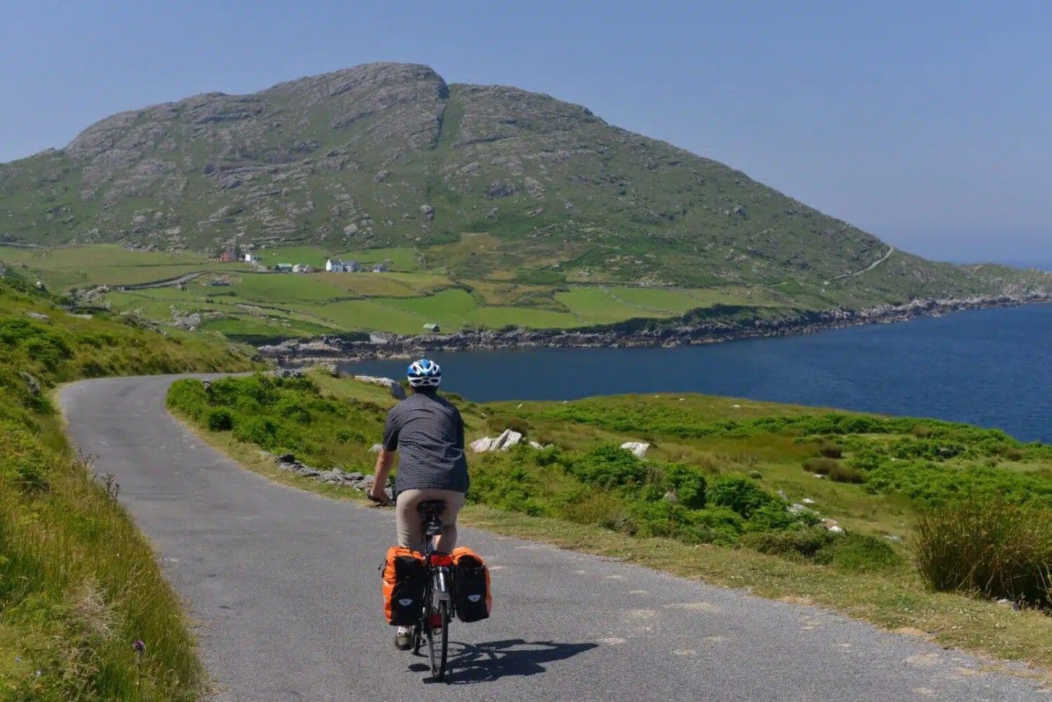
The Wild Atlantic Way stretches along the entire western coastline of Ireland, from Kinsale in County Cork to Malin Head on the Inishowen Peninsula in County Donegal. Along the way it passes through Kerry, Clare, Galway, Mayo, Sligo, Leitrim, and Limerick, nine counties in total, each with its own accent, its own local history, and its own particular way of dealing with Atlantic weather. Ireland itself measures only around 486 kms (302 mi) from top to bottom as the crow flies, so the sheer length of this coastal route says everything about how deeply indented and peninsula-strewn the west coast actually is.
Fáilte Ireland, the national tourism board, developed the Wild Atlantic Way as a single branded touring route in 2014, stitching together roads that had existed for generations into one continuous, signposted corridor. The goal was straightforward, to draw visitors away from the busier east coast and into small Atlantic communities that had watched younger generations leave for Dublin, London, or Boston for the better part of a century. For a region shaped by the Great Famine of the 1840s and by waves of emigration that followed, tourism built around the coastline's own geography has given many of these towns a fresh economic reason to keep their pubs, shops, and guesthouses open year round. Cycling the Wild Atlantic Way puts a visitor directly inside that story, moving slowly enough to notice the difference between a thriving harbor village and a quiet one.
Unlike a single iconic climb or a single stage race route, the Wild Atlantic Way is best understood as a framework rather than one fixed itinerary. Riders can pick a county and spend a week getting to know it properly, string together three or four counties for a proper touring holiday, or attempt the entire coastline as a personal challenge. Signage stays consistent throughout, a blue road marker with a white wave, making navigation straightforward even for a first-time visitor with no local knowledge.
Every junction and turn along the official route carries the same discovery point marker, a stylized wave on a dark blue background, developed specifically for the Wild Atlantic Way brand. Discovery points, numbered viewpoints and landmarks along the way, give riders a built-in set of waypoints to plan a day around, whether that means stopping for photographs at a headland or simply confirming the next junction is close. The consistency of this signage is one reason first-time visitors find the route far easier to navigate than its overall length might suggest.
Explore our amazing bike tours in the Wild Atlantic Way now !
Terrain along the Wild Atlantic Way changes dramatically from county to county, and understanding those shifts matters more for route planning than any single statistic about total distance. Riders should expect short, sharp climbs rather than sustained mountain passes, strong coastal winds that can help or hinder in equal measure, and road surfaces that range from smooth regional routes to narrow, patched boreens barely wide enough for a car. Anyone building a Wild Atlantic Way cycling itinerary should plan around these regional shifts rather than a single average pace, since a day rated moderate in Clare can feel considerably harder in Donegal purely because of wind and road surface.
The southern counties open the route with the Beara Peninsula, the Ring of Kerry, and the Dingle Peninsula, three fingers of land separated by deep sea inlets. The Caha Pass climbs to around 334 m (1,096 ft) through a series of dramatic rock tunnels, while the Conor Pass on the Dingle Peninsula reaches 456 m (1,496 ft), among the highest paved mountain passes in Ireland. Expect steep, short ramps rather than long grinds, with descents that open onto Atlantic views almost without warning. Between the peninsulas, sheltered inlets like Bantry Bay and Kenmare Bay offer flatter, calmer riding for anyone wanting a rest from the exposed headlands on either side.
County Clare flattens out compared to Kerry, but trades elevation for exposure. The coastal road past the Cliffs of Moher runs close enough to the cliff edge that riders feel the wind pushing them sideways on a blustery day. Inland, the Burren rises in low limestone terraces rather than true summits, its karst pavement stripped bare by glaciers and grazing animals over thousands of years. Roads through the Burren are quiet, narrow, and occasionally rough, rewarding riders willing to slow down and look closely at what grows in the cracks underfoot. A short detour inland from the coast road, away from the crowds gathering at the main Cliffs of Moher car park, usually delivers a quieter version of the same view.
North of Galway city, Connemara introduces proper mountain scenery in miniature, with the Twelve Bens rising sharply from blanket bog and lake. Roads here wind rather than climb, tracing the shorelines of Lough Inagh and Killary Harbour, Ireland's only true fjord. County Mayo continues the pattern into Achill Island and the base of Croagh Patrick, the pilgrimage mountain that dominates views around Westport at 764 m (2,507 ft). The Sheeffry Pass, connecting Killary Harbour to Westport, is regularly cited by regular Wild Atlantic Way cyclists as one of the toughest short climbs on the whole route, steep enough to force most riders out of the saddle.
The northern stretch through Sligo, Leitrim, and Donegal is the least crowded and, for many returning cyclists, the most rewarding. Benbulben's flat-topped limestone silhouette dominates County Sligo, while County Donegal delivers the toughest riding on the entire route, with Slieve League's sea cliffs and the Glengesh Pass climbing through switchbacks that would not look out of place in an Alpine stage. This is where the Wild Atlantic Way earns its name most literally, exposed, remote, and shaped entirely by the ocean beside it. Leitrim, Ireland's least populated county, adds a brief, gentler inland interlude around Lough Allen before the route swings back to the coast for its final push north.
Riding the entire Wild Atlantic Way by bicycle, from Kinsale to Malin Head, covers roughly 2,343 kms (1,455 mi) of continuously cyclable road, since a handful of sections on the official signposted route are built for cars only and get skipped by anyone on two wheels. Total elevation gain across the full distance comes to approximately 23,000 m (75,459 ft), nearly three times the height of Mount Everest measured from sea level. This is the single biggest cycling challenge on the island of Ireland, and one of the longest continuous coastal cycling routes anywhere on earth, drawing a small but growing community of riders who treat it the way distance runners treat a marathon.
Most riders complete the full Wild Atlantic Way in two to four weeks. Covering 180 kms (112 mi) a day, a strong, fit cyclist can finish in around 13 days, though that pace leaves little room for rest days, bad weather, or lingering over a pub lunch. A more relaxed schedule of 100 kms (62 mi) a day stretches the trip closer to a month, which suits riders who want time to detour inland, visit the Cliffs of Moher properly, or spend an extra night in Galway or Westport. Many cyclists split the difference and treat the Wild Atlantic Way as three separate trips, Cork to Galway, Galway to Sligo, and Sligo to Derry, tackled over consecutive summers rather than one continuous effort.
For cyclists who want the spirit of the full crossing without a month away from home, the Mizen Head to Malin Head route, nicknamed MizMal, trims the distance to between 925 kms (575 mi) and 1,040 kms (646 mi) depending on the exact course chosen, and can be ridden in seven to twelve days. MizMal was developed as Ireland's answer to Britain's Land's End to John O'Groats challenge, taking in many of the Wild Atlantic Way's best sections, the Black Valley, the Gap of Dunloe, the Sheeffry Pass, and Donegal's Glenveagh National Park, while trimming some of the flatter connecting roads.
South to north is the accepted wisdom for good reason. Prevailing winds on Ireland's west coast blow from the southwest for most of the cycling season, so starting in Cork or Kinsale and finishing at Malin Head means a tailwind more often than not. Riders who go north to south occasionally get lucky with an easterly spell, but should not count on it.
The full route has attracted a small but dedicated community of endurance cyclists chasing official records. The current benchmark for a solo, unsupported crossing of the entire 2,343 km (1,455 mi) route stands at under six days, an effort that involves riding through the night with only brief stops for sleep. The Wild Atlantic Way also lends its name and much of its road surface to the Trans Atlantic Way, an annual self-supported ultra-endurance race between Dublin and Cork that uses long stretches of the coast road. None of this is required reading for anyone planning a normal holiday, but it says something about how seriously the wider cycling world has come to take this stretch of coastline.
Beyond the full end to end challenge, several shorter routes along the Wild Atlantic Way stand on their own as complete cycling trips, each with a distinct character and a manageable time commitment. Riders short on time often find that one or two of these routes, combined with a single flagship stretch, delivers a more satisfying week than trying to rush a longer, less focused itinerary.
Distance 42 kms (26 mi) | Terrain Flat, traffic-free rail trail | Duration Half day | Difficulty Easy
Ireland's longest off-road greenway runs from Westport to Achill Island along a former railway line, entirely traffic-free and flat enough for families or anyone taking a rest day from hillier riding elsewhere on the coast. Views stretch across Clew Bay and its scattering of small islands, with Croagh Patrick visible for most of the ride.
Distance 88 kms (55 mi) | Terrain Narrow coastal roads, rolling hills | Duration 1 day | Difficulty Moderate
This lesser-known peninsula loop in West Cork stays quiet even in high summer, when the neighboring Ring of Kerry fills with tour coaches. Narrow roads trace the shoreline past the Sheep's Head lighthouse, with Bantry Bay opening up on one side and open Atlantic on the other.
Distance 137 kms (85 mi) | Terrain Coastal roads with the Healy Pass climb | Duration 1 to 2 days | Difficulty Moderate to hard
The Beara Peninsula combines quiet fishing villages with the Healy Pass, a climb of 334 m (1,096 ft) through the Caha Mountains connecting County Cork to County Kerry. The pass rewards the effort with views back down both sides of the peninsula at once from its summit.
Distance 35 kms (22 mi) | Terrain Coastal, one causeway crossing | Duration Half day | Difficulty Easy to moderate
This short ride on the Ring of Kerry links the golf links town of Waterville with Valentia Island by way of a bridge crossing, taking in the transatlantic cable station where the first successful transatlantic telegraph message was sent in 1866. The island's quiet lanes offer a welcome break from the busier Ring of Kerry road.
Distance 95 kms (59 mi) | Terrain Rolling hills, exposed headlands | Duration 1 day | Difficulty Moderate
Circling Donegal Bay from Donegal Town to Mullaghmore takes in Slieve League's sea cliffs at a distance and Mullaghmore Head, a big-wave surfing spot that regularly draws professional surfers chasing Atlantic swells. This stretch captures the northern Wild Atlantic Way's rawer character without committing to a full county crossing.
Distance 16 kms (10 mi) | Terrain Short, steep coastal loop | Duration 1 to 2 hours | Difficulty Moderate
A short, punchy loop out of Clifden in Connemara, the Sky Road climbs above the town before tracing a narrow cliff-edge circuit with views back across Clifden Bay to the Twelve Bens. It is short enough to ride as a warm-up or a sunset spin, but the final climb back into town has caught out plenty of riders who underestimated it.
Distance 75 kms (47 mi) | Terrain Rolling coastal roads | Duration 1 day | Difficulty Moderate
This Donegal peninsula loop circles out to Fanad Head Lighthouse, regularly named among the most photogenic lighthouses in the country, before returning past Ballymastocker Bay, a beach often compared favorably to tropical coastlines despite the distinctly Atlantic water temperature. Traffic here is minimal even in high summer, making it one of the quieter full-day rides on the entire route.
Distance 62 kms (39 mi) | Terrain Fjord-side roads with one significant climb | Duration 1 day | Difficulty Moderate
Circling Killary Harbour takes riders along both shores of Ireland's only true fjord, with mussel farms visible in the water below and the Mweelrea mountains rising steeply on the Mayo side. The climb out of Leenaun toward Delphi rewards the effort with one of the most photographed viewpoints in Connemara, looking back down the length of the fjord toward the Atlantic.
Choosing a home base matters as much as choosing a route. Each region along the Wild Atlantic Way suits a different kind of rider and a different length of stay, and most visitors do better picking two or three regions to explore properly rather than trying to sample all nine counties in a single trip.
Kinsale, the official southern start of the Wild Atlantic Way, makes an easy first or last base, with a working harbor, a strong food scene, and gentle roads heading west toward Clonakilty and the Beara Peninsula. Suitable for riders who want a soft introduction before the terrain steepens further west. Allow at least one extra rest day here, since Kinsale's restaurant scene is genuinely worth lingering over.
The Ring of Kerry and Dingle Peninsula give Kerry the greatest concentration of dramatic coastal riding on the entire route, along with the country's highest paved climbs. Suitable for confident, fitter riders prepared for busier roads in peak season and genuine elevation gain. Killarney makes the most practical base, with good rail links and a wide range of accommodation within easy reach of both peninsulas.
County Clare works well as a shorter, self-contained base, combining the Cliffs of Moher, the Burren, and traditional music towns like Doolin and Ennis within a compact area. Suitable for riders with limited time who still want cliffs, karst landscape, and evening music sessions in one trip. A week here, without ever needing to travel further afield, still leaves plenty unexplored.
Connemara's mountain and bog scenery, combined with Galway city's restaurants and nightlife close by, make this region popular with riders who want culture and countryside in equal measure. Suitable for intermediate riders comfortable with rolling terrain and occasional wind exposure. Clifden, the region's unofficial capital, makes a comfortable base with enough restaurants and bike shops to cover most needs.
Mayo pairs the traffic-free Great Western Greenway with the wilder roads of Achill Island, Ireland's largest island, connected to the mainland by bridge. Suitable for families and less experienced riders thanks to the greenway, with tougher optional routes available for those who want them. Westport itself is compact, walkable, and well stocked with places to eat after a day on the bike.
Yeats country, named for the poet who wrote extensively about this landscape, offers quieter roads and fewer tourists than the counties further south. Suitable for riders who prioritize solitude and literary history over headline attractions. Sligo town itself has a compact, lively center that rewards an evening spent wandering after a long day in the saddle.
Ireland's northwesternmost county delivers the toughest and most rewarding riding on the Wild Atlantic Way, from Slieve League to Glenveagh National Park and the Inishowen Peninsula's final approach to Malin Head. Suitable for experienced, well-prepared cyclists ready for genuine remoteness. Services thin out considerably here compared to the southern counties, so planning fuel and accommodation stops in advance matters more in Donegal than almost anywhere else on the route.
The cycling season along the Wild Atlantic Way runs roughly from May through September, though the shoulder months carry their own trade-offs worth understanding before booking flights.
Late spring brings the year's most reliable stretch of dry weather, with daytime temperatures around 13 to 17 degrees C (55 to 63 degrees F) and daylight lasting until nearly 10pm by late June. Hedgerows fill with wildflowers, and traffic on tourist routes like the Ring of Kerry has not yet reached its August peak. This is widely considered the best window for cycling in the Wild Atlantic Way.
High summer offers the warmest temperatures, typically 16 to 20 degrees C (61 to 68 degrees F), and the longest days, but also the heaviest traffic from campervans and tour coaches on popular stretches through Kerry and Clare. Accommodation books up months ahead in towns like Killarney, Galway, and Doolin.
Early autumn matches May and June for reliability while bringing noticeably thinner crowds once schools return and the campervan season winds down. Temperatures hold around 14 to 17 degrees C (57 to 63 degrees F), and many riders rate September as the single best month for Wild Atlantic Way cycling.
April and October bring unpredictable conditions, mixing genuine sunshine with sudden rain and stronger winds, and require proper layering to enjoy. November through March is considered off season, with shorter daylight, wetter roads, and many rural guesthouses closed for the winter. Riders determined to cycle outside the main season should stick to lower, more sheltered stretches of the route rather than exposed headlands in Donegal or Kerry.
The Wild Atlantic Way passes through several distinct habitats, and paying attention while riding rewards cyclists with sightings that a car window usually misses.
Puffins, guillemots, and razorbills nest on cliff ledges from the Cliffs of Moher to the Skellig Islands between April and July, best spotted early morning before crowds arrive at viewing points. Choughs, a red-billed relative of the crow, are a particular specialty of the Kerry and Clare coastline, and their distinctive call often carries clearly over the sound of wind and waves.
Grey seals haul out on rocks and small beaches all along the coast and are visible from the road at low tide in quiet coves. Basking sharks, the second largest fish in the world, feed in Irish coastal waters between May and July, occasionally visible from headlands in Kerry and Donegal, though sightings from the saddle remain rare and lucky. Dolphins are also regularly reported in Shannon Estuary and around the Dingle Peninsula, home to Fungie's successors among a small resident pod.
Clare's Burren region supports an unusual mix of Arctic alpine and Mediterranean plant species growing side by side, a botanical quirk caused by the limestone's mineral makeup and mild coastal climate. Spring brings orchids, gentians, and mountain avens flowering in the same square meter of rock, a combination botanists still travel from overseas specifically to study.
Red deer roam Killarney National Park's oak woodland, one of the last wild herds in Ireland with an unbroken lineage stretching back centuries. Golden eagles, reintroduced to Donegal after a long absence, are occasionally seen riding thermals above Glenveagh National Park, a genuine conservation success story worth watching for on a clear day in the northern counties.
Dive into our curated the Wild Atlantic Way cycling adventures today!
Cycling the Wild Atlantic Way moves slowly enough to notice the layers of history built into this coastline, much of it shaped by hardship as often as by beauty.
The Great Famine of the 1840s hit the west of Ireland hardest, and the population of the nine counties along this route has never fully recovered. Plough marks are still visible on hillsides too steep to walk comfortably, evidence of desperate attempts to cultivate new ground during the crisis. Understanding this history changes how a rider sees the scattered ruins of stone cottages that appear along quiet backroads throughout Clare, Mayo, and Donegal. Ireland's population stood at more than eight million before the famine and fell to around three million by the 1920s, a demographic collapse that still shapes how empty these roads can feel compared with the coastlines of mainland Europe.
Large stretches of Galway, Mayo, and Donegal fall within the Gaeltacht, regions where Irish remains the primary spoken language in daily life. Road signs switch to Irish first in these areas, and riders passing through Connemara in particular will hear the language spoken in shops, at petrol stations, and in schoolyards. A handful of Irish words picked up in advance, a simple greeting or a thank you, tend to go a long way with local shopkeepers and B&B hosts.
Traditional Irish music is not staged for visitors here so much as simply present, with informal sessions breaking out most nights in pubs across Doolin, Galway, Westport, and Dingle. A fiddle, a bodhrán, and a few pints of Guinness are usually all it takes to start one. Musicians drift in and out through the evening, and a session that starts with two players can easily grow to six or seven by closing time.
Ireland has a genuine cycling culture beyond tourism, with road racing and time trialing well established across rural clubs, and the country was an early adopter of a legal 1.5 m passing distance rule requiring drivers to give cyclists that much space when overtaking. This cycling culture is one reason drivers along the Wild Atlantic Way are generally considered courteous toward cyclists compared with many other countries, though patience is still occasionally required behind a tractor, a flock of sheep, or a horse and cart on the narrower back roads.
Gaelic football and hurling, organized locally through the Gaelic Athletic Association, remain the dominant sports across rural Ireland, and a summer weekend spent cycling through the west coast will likely coincide with a county match somewhere nearby. Small-town pubs fill quickly on match days, and a rider who happens to arrive during a big local game will find the atmosphere as memorable as any scheduled festival.
Get started with your Cycling adventure now!
Ireland's west coast feeds cyclists well, and the food here says as much about the culture as any monument along the route.
A proper Full Irish, fried eggs, rashers, sausages, black and white pudding, grilled tomato, and soda bread, is the standard fuel for a big riding day and comes included with almost every guesthouse stay along the route. Save it for genuine riding days rather than rest days, since it sits heavy for a few hours afterward. Most guesthouses will happily swap in a lighter continental option on request for anyone not planning big mileage that day.
Nearly every coastal town serves its own version of seafood chowder, a thick, cream-based soup packed with whatever the local boats brought in that morning, usually salmon, cod, and mussels. It pairs naturally with a slice of brown soda bread and makes an ideal lunch stop on a wet day. Kilkee and Kinvara are both known for particularly good versions, though quality along this coast rarely disappoints.
The stout genuinely tastes different in Ireland than abroad, partly due to freshness and partly due to serving technique, poured in two stages with a settling pause in between. Post-ride pints have become such a fixture of Wild Atlantic Way cycling trips that several tour operators joke about capping consumption at ten pints a day. A proper pour takes close to two minutes, which suits the unhurried pace of most evenings along this coast.
A quick bread made with buttermilk and bicarbonate of soda rather than yeast, found on breakfast tables and alongside soup at nearly every stop. Recipes vary slightly from county to county, with some bakers adding treacle for a darker, sweeter loaf. It requires no proving time, which explains why nearly every kitchen along the route seems to have a fresh loaf ready within the hour.
Sheep graze freely across Connemara's hills and bog, producing lamb with a distinctive flavor attributed to the wild heather and grasses in their diet. Restaurants in Clifden and along the Connemara loop serve it simply, usually roasted with rosemary and little else, letting the meat itself carry the dish.
Galway Bay and the harbor at Kinvara produce some of the country's best oysters, traditionally eaten with brown bread, a squeeze of lemon, and a pint of stout on the side. The Galway International Oyster Festival each September draws crowds right as the cycling season winds toward its best month, giving riders passing through a good excuse to build in an extra rest day.
Ireland's roadside petrol stations punch well above their weight for food quality, typically stocking a proper deli counter with fresh soup, sandwiches, and decent coffee. On long stretches between towns, particularly in Donegal and West Cork, these stops often provide the only food option for many kilometers, and riders quickly learn to treat them as a genuine part of the day's planning rather than a last resort.
The Wild Atlantic Way rewards general fitness and time in the saddle more than any specific training regimen. Riders planning long days should build up gradually in the months beforehand, extending weekend rides rather than attempting sudden long distances, and should not underestimate how much a headwind can add to effort on exposed coastal stretches.
A road bike with tires in the 28c to 32c range suits most of the paved Wild Atlantic Way route comfortably, since the entire signposted road route stays on tarmac. Riders planning detours onto quieter, rougher lanes, particularly in the Burren or parts of Donegal, may prefer a gravel bike or hybrid with wider tires for extra comfort and puncture resistance. Frame material matters less than fit and a saddle already broken in before departure.
A well-developed network of bike shops and rental outlets serves the main towns along the route, particularly around Galway, Killarney, Westport, and Clonakilty, and self-supported riders can generally find mechanical help within a reasonable ride of most overnight stops. Rural stretches carry fewer services, so it is worth carrying basic puncture repair kits and knowing the location of the nearest bike-friendly town before setting off each morning.
Long coastal days with wind exposure burn through energy faster than the distance alone suggests, and riders should eat and drink steadily rather than waiting for a scheduled lunch stop. Petrol station delis and small-town bakeries make reliable refueling points throughout the day, and it is worth carrying a little extra water on the more remote stretches of Donegal and the Beara Peninsula where services can be genuinely far apart. A Full Irish breakfast goes a long way toward covering a big day's calorie needs on its own.
Cork Airport sits about 20 kms (12 mi) from Kinsale, the route's southern start, and is well connected to UK and European cities. At the northern end, Derry has its own regional airport, with the larger Belfast International and Belfast City airports a short train or bus ride further east. Shannon Airport, roughly in the middle of the route near County Clare, offers a convenient third option for anyone starting or finishing a shorter section rather than the full crossing.
Irish Rail connects Dublin to Cork, Killarney, Tralee, Limerick, Ennis, Galway, Westport, Ballina, and Sligo, giving cyclists useful bail-out points along much of the southern and central route. Bus Éireann and private coach operators fill gaps in more remote stretches, and most permit bikes on board with advance notice, though space is often limited to one or two bikes per service.
Ireland drives on the left, and the country enforces a legal minimum passing distance of 1.5 m when a vehicle overtakes a cyclist. Riding two abreast is legal and generally accepted except on narrow or blind sections, though single file is safer through the busiest stretches of the Ring of Kerry and the Burren coast road during peak summer traffic. Tour coaches on the Ring of Kerry travel in one direction only during peak season, which is worth knowing when planning which way to ride that particular loop.
Visitors from the United States, Canada, the United Kingdom, Australia, and most EU countries do not need a visa for short tourist stays in Ireland, though passport validity and specific entry requirements should always be confirmed with official government travel advice before departure.
The Republic of Ireland uses the euro, while Northern Ireland, relevant only for the very northern tip of the route near Derry, uses the British pound. Credit cards are widely accepted, though small rural pubs and shops still favor cash, so carrying some on hand is worthwhile, particularly in the smaller villages of Donegal and West Cork.
English is spoken universally, with Irish spoken as a first language across Gaeltacht regions in Galway, Mayo, and Donegal. Road signs in these areas appear in Irish first, though English translations are standard on Wild Atlantic Way route signage throughout.
Mobile coverage is generally reliable along the route, though it drops out on some exposed headlands and mountain passes, particularly in Donegal and West Cork. Offline map apps are worth downloading in advance for exactly these gaps, and a small portable battery pack is a sensible addition for anyone relying on a phone for navigation over a full riding day.
Ireland runs on Greenwich Mean Time in winter and Irish Standard Time, one hour ahead, during summer. June daylight stretches from roughly 5am to nearly 10pm, giving cyclists a generous window for long riding days during the peak season.
Ireland's emergency number is 112 or 999, both connecting to police, ambulance, and fire services. Healthcare quality is high throughout the country, though rural stretches of Donegal, Mayo, and West Cork can mean a longer wait for an ambulance than in a city, so riders with existing medical conditions should carry appropriate documentation and medication with them rather than relying on quick access to a pharmacy.
Accommodation along the Wild Atlantic Way ranges from basic hostels to boutique hotels, with family-run bed and breakfasts forming the backbone of the experience in most small towns.
Irish B&Bs are typically run out of private homes, offering a personal welcome, a hearty breakfast, and usually a proprietor happy to chat about local routes, weather, and the best pub in town. Booking ahead during June through August is strongly advised, since the best-known guesthouses in towns like Doolin and Kinvara fill up months in advance. A quick phone call rather than an online form often turns up a room even when a website shows nothing available.
Larger towns including Galway, Westport, Killarney, and Ennis offer a full range of hotels, from simple two-star options to boutique four-star properties with spas and strong restaurants attached. These make sensible overnight stops on longer trips where a proper rest matters more than rustic charm, particularly after a long climbing day through Kerry or Donegal.
Hostels cluster mainly around Galway and Cork, with fewer options in smaller towns further along the coast. Budget travelers should expect B&Bs to be the realistic lower-cost option outside the two main cities, and should budget accordingly for the smaller villages in between.
Most accommodation catering to cyclists offers secure indoor storage, though smaller guesthouses without a dedicated space will usually allow bikes into the guest room overnight rather than leaving them outside. It is always worth asking about storage when booking rather than assuming it will be available on arrival.
Tim Robinson's "Stones of Aran" offers a meticulous, almost obsessive account of the Aran Islands' landscape and history, essential reading for anyone drawn to the Burren and Connemara coastline. "Wild Camping the Wild Atlantic Way" documents one cycle tourer's firsthand ride down much of the route's southern half, useful for anyone planning a similar self-supported trip. Both make far better pre-trip reading than a standard guidebook for anyone who wants a genuine feel for the place before arriving.
"The Guard", a dark comedy set on the Galway coast, captures the region's dry sense of humor better than most tourist material ever could. Documentary footage of the annual MizMal end-to-end rides, widely available online, gives a useful preview of terrain and pace for anyone considering the full crossing, and is worth watching purely for the scenery even without any plans to attempt the route.
Beyond the staples covered earlier, seek out a proper pint of stout and a plate of oysters in Kinvara's harborside pubs, or a bowl of chowder in Kilkee looking straight out over the Atlantic. Doolin's pubs pair music with food in a way that turns dinner into a three-hour event without anyone planning it that way, and the same is often true in Westport and Dingle on a good night.
The Galway International Oyster Festival each September lands right at the tail end of the best cycling month. The Lisdoonvarna Matchmaking Festival, also in September, fills the Burren's small towns with music and unexpected company. Malin Head's status as Ireland's most northerly point makes sunset there, after finishing a long ride, worth timing deliberately rather than leaving to chance, since clear evenings here can deliver some of the best light anywhere on the entire coast.
Get started with your cycling adventure now!
Art of Bicycle Trips runs a self-guided Wild Atlantic Way and Burren Bike Tour that covers 323 kms (201 mi) across six riding days, starting in Ennis and finishing in Galway by way of Kilkee, Doolin, the Cliffs of Moher, and the Burren's limestone interior. It is built for riders who want the character of the Wild Atlantic Way, the cliffs, the music towns, the ancient stone landscape, without the logistics of planning a multi-week end-to-end crossing themselves. Handpicked accommodation, daily luggage transfers, and a fully mapped route mean the only real decision each morning is what to have for breakfast. Full details are available at artofbicycletrips.com/tours/self-guided-wild-atlantic-way-burren-bike-tour.
The tour suits a moderate fitness level, with daily distances between 38 kms (24 mi) and 68 kms (42 mi), and includes rest days built into the Kilkee and Doolin stops for anyone who wants to explore further on foot or simply enjoy an extra evening of music before moving on. Riders looking for a longer or more customized itinerary, perhaps combining this route with a few extra days in Kerry or Donegal, can also work directly with Art of Bicycle Trips to design a private trip around their own timeline and fitness level.
For anyone ready to experience Wild Atlantic Way cycling firsthand, whether that means this exact route or a custom itinerary built around a different stretch of coast, reach out to Art of Bicycle Trips to start planning. Nine counties of Atlantic coastline are waiting, and there is no better way to get to know them than from a bicycle saddle.
Dive into our curated Ireland cycling adventures today!
Create a private trip or join a small-group departure.